Directions to Sunoco (Queens) with public transportation
The following transit lines have routes that pass near Sunoco
 Bus: Q85, Q86, Q87, Q89, QM63.
- Train: FAR ROCKAWAY BRANCH, LONG BEACH BRANCH, BABYLON BRANCH.
How to get to Sunoco by bus?
Click on the bus route to see step by step directions with maps, line arrival times and updated time schedules.
From 144-06 94 ave, Queens
51 minFrom LIRR - Jamaica Station, Queens
47 minFrom OZONE PARK, Queens
75 minFrom Queens Criminal Court, Queens
63 minFrom Northwell - Long Island Jewish Medical Center, Queens
84 minFrom Long Island Jewish Hospital, Queens
85 minFrom 163-03 Horace Harding Expressway, Queens
67 minFrom North Shore Towers, Queens
91 minFrom Queens Hospital Center, Queens
56 minFrom 80-02 Kew Gardens Rd., Queens
66 min
How to get to Sunoco by train?
Click on the train route to see step by step directions with maps, line arrival times and updated time schedules.
Bus stops near Sunoco in Queens
Train station near Sunoco in Queens
- Laurelton, 36 min walk,VIEW
Bus lines to Sunoco in Queens
What are the closest stations to Sunoco?
The closest stations to Sunoco are:
- Francis Lweis Blvd/Caney Ln is 192 yards away, 3 min walk.
- South Conduit Av/Hook Creek Blvd is 277 yards away, 4 min walk.
- Sunrise Hwy/Francis Lewis Blvd is 346 yards away, 5 min walk.
- Francis Lewis Bl/Sunrise Hy is 349 yards away, 5 min walk.
- Laurelton is 3061 yards away, 36 min walk.
Which bus lines stop near Sunoco?
These bus lines stop near Sunoco: Q85, Q86, Q87, Q89.
Which train lines stop near Sunoco?
These train lines stop near Sunoco: FAR ROCKAWAY BRANCH, LONG BEACH BRANCH.
What’s the nearest bus station to Sunoco in Queens?
The nearest bus station to Sunoco in Queens is Francis Lweis Blvd/Caney Ln. It’s a 3 min walk away.
What time is the first train to Sunoco in Queens?
The FAR ROCKAWAY BRANCH is the first train that goes to Sunoco in Queens. It stops nearby at 3:02 AM.
What time is the last train to Sunoco in Queens?
The FAR ROCKAWAY BRANCH is the last train that goes to Sunoco in Queens. It stops nearby at 3:02 AM.
What time is the first bus to Sunoco in Queens?
The Q85 is the first bus that goes to Sunoco in Queens. It stops nearby at 3:15 AM.
What time is the last bus to Sunoco in Queens?
The Q85 is the last bus that goes to Sunoco in Queens. It stops nearby at 3:15 AM.
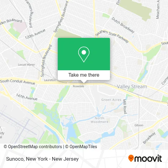
See Sunoco, Queens, on the map
Public Transit to Sunoco in Queens
Wondering how to get to Sunoco in Queens? Moovit helps you find the best way to get to Sunoco with step-by-step directions from the nearest public transit station.
Moovit provides free maps and live directions to help you navigate through your city. View schedules, routes, timetables, and find out how long does it take to get to Sunoco in real time.
Looking for the nearest stop or station to Sunoco? Check out this list of stops closest to your destination: Francis Lweis Blvd/Caney Ln; South Conduit Av/Hook Creek Blvd; Sunrise Hwy/Francis Lewis Blvd; Francis Lewis Bl/Sunrise Hy; Laurelton.
Bus: Q85, Q86, Q87, Q89, QM63, Q5.Train: FAR ROCKAWAY BRANCH, LONG BEACH BRANCH, BABYLON BRANCH.
Want to see if there’s another route that gets you there at an earlier time? Moovit helps you find alternative routes or times. Get directions from and directions to Sunoco easily from the Moovit App or Website.
We make riding to Sunoco easy, which is why over 1.5 million users, including users in Queens, trust Moovit as the best app for public transit. You don’t need to download an individual bus app or train app, Moovit is your all-in-one transit app that helps you find the best bus time or train time available.
For information on prices of bus and train, costs and ride fares to Sunoco, please check the Moovit app.
Use the app to navigate to popular places including to the airport, hospital, stadium, grocery store, mall, coffee shop, school, college, and university.
Sunoco Address: 246-02 S Conduit Ave street in Queens
- Conoco,
- Diabеtic Nеuropathy Trеatment,
- Schiano Fence,
- Nypd 116th Police Precinct,
- Eco Atm,
- Western Union,
- Secrets Nyc,
- Secrets Bar & Lounge,
- Naughton & Brothers Funeral Home,
- Navy Federal Credit Union,
- Green Beauty Atelier,
- MTA Police District 3,
- Popeyes,
- Autosoundnyc,
- Darbar's Chicken & Ribs,
- Urban Renaissance Early Childhood A,
- Halal In-N-Out,
- Cpr Cell Phone Repair Rosedale,
- Diamond Renaissance Banquet Hall,
- 244 138
Places Near Sunoco (Queens)
- Times Square, Manhattan,
- Hudson Yards, Manhattan,
- 1 Police Plaza, Manhattan,
- Rockefeller Center, Manhattan,
- SoHo, Manhattan,
- qqqq, Manhattan,
- Wall Street, Manhattan,
- Queens Center Mall, Queens,
- Katz's Deli, Manhattan,
- 3 Stone St, Manhattan,
- 26 Federal Plaza, Manhattan,
- 376 Hudson Street, Manhattan,
- Pier 83, Manhattan,
- Mountainside Hospital, Glen Ridge,
- Chinatown, Manhattan,
- 911 Memorial, Manhattan,
- 111 Centre New York City Supreme Court, Manhattan,
- San Gennaro Feast, Manhattan,
- Bellevue Hospital, Manhattan,
- 66 John Street, Manhattan
How to get to popular places in New York - New Jersey with public transit
Get around Queens by public transit!
Traveling around Queens has never been so easy. See step by step directions as you travel to any attraction, street or major public transit station. View bus and train schedules, arrival times, service alerts and detailed routes on a map, so you know exactly how to get to anywhere in Queens.
When traveling to any destination around Queens use Moovit's Live Directions with Get Off Notifications to know exactly where and how far to walk, how long to wait for your line, and how many stops are left. Moovit will alert you when it's time to get off — no need to constantly re-check whether yours is the next stop.
Wondering how to use public transit in Queens or how to pay for public transit in Queens? Moovit public transit app can help you navigate your way with public transit easily, and at minimum cost. It includes public transit fees, ticket prices, and costs. Looking for a map of Queens public transit lines? Moovit public transit app shows all public transit maps in Queens with all Bus, Train, Subway, Light Rail, Ferry and Cable Car routes and stops on an interactive map.
New York - New Jersey has 6 transit type(s), including: Bus, Train, Subway, Light Rail, Ferry and Cable Car, operated by several transit agencies, including MTA Subway, Metro-North Railroad, LIRR, PATH, MTA New York City Transit - Express routes, MTA Bus, NJ Transit, NYC Ferry, NICE bus, Bee-Line Bus, NJ Transit Rail, Norwalk Transit District, Hartford Line, River Valley Transit and HART