How to get to Sunplex Insurance by bus?
Click on the bus route to see step by step directions with maps, line arrival times and updated time schedules.
From 79th street and nw 17th ave., Miami
49 minFrom US1, Miami
86 minFrom Virginia Key Beach Park, Key Biscayne
87 minFrom Stephen P. Clark Government Center, Miami
39 minFrom Little Haiti, Miami
63 minFrom Fire Cutz Lounge, Miami
83 minFrom Intercontinental Miami, an Ihg Hotel, Miami
46 minFrom Le Jeune Rd / E 49th St, Hialeah
52 minFrom Maurice Gibb Memorial Park, Miami Beach
76 minFrom Wynwood, Miami
45 min
How to get to Sunplex Insurance by train?
Click on the train route to see step by step directions with maps, line arrival times and updated time schedules.
Bus stops near Sunplex Insurance in Miami
Train station near Sunplex Insurance in Miami
- Santa Clara, 7 min walk,VIEW
Light Rail stations near Sunplex Insurance in Miami
- Mia@Lower Level Ramp, 36 min walk,VIEW
Bus lines to Sunplex Insurance in Miami
What are the closest stations to Sunplex Insurance?
The closest stations to Sunplex Insurance are:
- Nw 7 St & Nw 32 Av is 78 yards away, 2 min walk.
- Santa Clara is 511 yards away, 7 min walk.
- Nw 27 Av@nw 7 St is 843 yards away, 11 min walk.
- W Flagler St & Nw 31 Av is 963 yards away, 12 min walk.
- Mia@Lower Level Ramp is 3064 yards away, 36 min walk.
Which bus lines stop near Sunplex Insurance?
These bus lines stop near Sunplex Insurance: 7, MIAHAVA.
Which train line stops near Sunplex Insurance?
ORANGE (Dadeland South Stat.rail Northbound→MIA Northbound)
What’s the nearest train station to Sunplex Insurance in Miami?
The nearest train station to Sunplex Insurance in Miami is Santa Clara. It’s a 7 min walk away.
What’s the nearest bus station to Sunplex Insurance in Miami?
The nearest bus station to Sunplex Insurance in Miami is Nw 7 St & Nw 32 Av. It’s a 2 min walk away.
What time is the first light rail to Sunplex Insurance in Miami?
The MIA is the first light rail that goes to Sunplex Insurance in Miami. It stops nearby at 3:03 AM.
What time is the last light rail to Sunplex Insurance in Miami?
The MIA is the last light rail that goes to Sunplex Insurance in Miami. It stops nearby at 2:59 AM.
What time is the first train to Sunplex Insurance in Miami?
The ORANGE is the first train that goes to Sunplex Insurance in Miami. It stops nearby at 5:12 AM.
What time is the last train to Sunplex Insurance in Miami?
The GREEN is the last train that goes to Sunplex Insurance in Miami. It stops nearby at 12:33 AM.
What time is the first bus to Sunplex Insurance in Miami?
The 11 is the first bus that goes to Sunplex Insurance in Miami. It stops nearby at 3:14 AM.
What time is the last bus to Sunplex Insurance in Miami?
The 27 is the last bus that goes to Sunplex Insurance in Miami. It stops nearby at 3:32 AM.
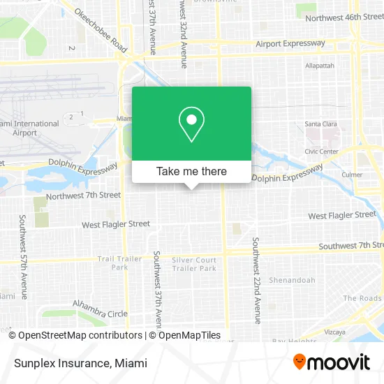
See Sunplex Insurance, Miami, on the map
Public Transit to Sunplex Insurance in Miami
Wondering how to get to Sunplex Insurance in Miami? Moovit helps you find the best way to get to Sunplex Insurance with step-by-step directions from the nearest public transit station.
Moovit provides free maps and live directions to help you navigate through your city. View schedules, routes, timetables, and find out how long does it take to get to Sunplex Insurance in real time.
Looking for the nearest stop or station to Sunplex Insurance? Check out this list of stops closest to your destination: Nw 7 St & Nw 32 Av; Santa Clara; Nw 27 Av@nw 7 St; W Flagler St & Nw 31 Av; Mia@Lower Level Ramp.
Bus: 7, MIAHAVA, 27, 11.Train: ORANGE, GREEN.
Want to see if there’s another route that gets you there at an earlier time? Moovit helps you find alternative routes or times. Get directions from and directions to Sunplex Insurance easily from the Moovit App or Website.
We make riding to Sunplex Insurance easy, which is why over 1.5 million users, including users in Miami, trust Moovit as the best app for public transit. You don’t need to download an individual bus app or train app, Moovit is your all-in-one transit app that helps you find the best bus time or train time available.
For information on prices of bus, train and light rail, costs and ride fares to Sunplex Insurance, please check the Moovit app.
Use the app to navigate to popular places including to the airport, hospital, stadium, grocery store, mall, coffee shop, school, college, and university.
Sunplex Insurance Address: 3152 NW 7th St Miami, FL 33125 street in Miami
- Palacio Tipico Caribeno & Fritanga,
- Bright Scaffolding LLC,
- Sandy Estetica,
- NW 32nd Ave / NW 7th St,
- Miami Blue Wireless,
- Proud US Marine Corps and Police Veteran,
- Ascmiami,
- Peter Davila,
- Pinar del Rio Shopping Center,
- Dr. Rodolfo Ferretti,
- Hoss Hernandez PA,
- 3 Design,
- Jel Transport,
- La Vaquita,
- Accu Construction Services,
- NW 7th St / NW 30th Ave,
- De Leon Primary Care & Dental,
- Southern Clinical Research,
- Vacuba,
- Solidaridad Sin Fronteras
Places Near Sunplex Insurance (Miami)
- Dolphin Mall Bus, Miami,
- Marlins Park, Miami,
- Keiser University Flagship Campus, West Palm Beach,
- Aventura Mall, Miami Beach,
- Sawgrass Mall, Miami,
- Miami-Dade County Courthouse, Miami,
- Richard E. Gerstein Justice Building, Miami,
- Little Havana, Miami,
- Miami Design District, Miami,
- Port of Miami Cruise Terminal, Miami,
- Miami Freedom Park, Miami,
- Brickell City Centre, Miami,
- Dolphin Mall, Miami,
- Wynwood, Miami,
- Zoo Miami, Miami,
- Miami VA Hospital, Miami,
- Bayside Marketplace, Miami,
- Sawgrass mall ( FL ), Miami Beach,
- Hard Rock Stadium, Miami Gardens,
- Aventura Mall, Miami
How to get to popular places in Miami with public transit
Get around Miami by public transit!
Traveling around Miami has never been so easy. See step by step directions as you travel to any attraction, street or major public transit station. View bus and train schedules, arrival times, service alerts and detailed routes on a map, so you know exactly how to get to anywhere in Miami.
When traveling to any destination around Miami use Moovit's Live Directions with Get Off Notifications to know exactly where and how far to walk, how long to wait for your line, and how many stops are left. Moovit will alert you when it's time to get off — no need to constantly re-check whether yours is the next stop.
Wondering how to use public transit in Miami or how to pay for public transit in Miami? Moovit public transit app can help you navigate your way with public transit easily, and at minimum cost. It includes public transit fees, ticket prices, and costs. Looking for a map of Miami public transit lines? Moovit public transit app shows all public transit maps in Miami with all Bus, Train, Light Rail and Ferry routes and stops on an interactive map.
Miami has 4 transit type(s), including: Bus, Train, Light Rail and Ferry, operated by several transit agencies, including Broward County Transit, Miami-Dade Transit, Metrorail, Palm Tran, Tri-Rail, Brightline, MARTY, City of Homestead Trolley, Key West Transit, Treasure Coast Connector, GoLine IRT, Amtrak, Greyhound-us, FlixBus-us and Aventura Express Shuttle Bus