How to get to Sunrays Window Tinting by bus?
Click on the bus route to see step by step directions with maps, line arrival times and updated time schedules.
From Parsippany, NJ, Parsippany-Troy Hills
133 minFrom Community Coach 77 Bus Stop, Livingston
170 minFrom Mountain Creek Waterpark, West Milford
278 minFrom Lakeland Bus Stop, Parsippany-Troy Hills
119 minFrom Dover, NJ, Dover
57 minFrom MMNJ, Parsippany-Troy Hills
131 minFrom Saint Barnabas Medical Center, Livingston
188 min
Train station near Sunrays Window Tinting in Roxbury
- Mount Arlington, 59 min walk,VIEW
What are the closest stations to Sunrays Window Tinting?
The closest stations to Sunrays Window Tinting are:
- Mount Arlington is 5010 yards away, 59 min walk.
Which bus lines stop near Sunrays Window Tinting?
These bus lines stop near Sunrays Window Tinting: 875, 880.
What time is the first train to Sunrays Window Tinting in Roxbury?
The ML is the first train that goes to Sunrays Window Tinting in Roxbury. It stops nearby at 5:27 AM.
What time is the last train to Sunrays Window Tinting in Roxbury?
The ML is the last train that goes to Sunrays Window Tinting in Roxbury. It stops nearby at 11:42 PM.
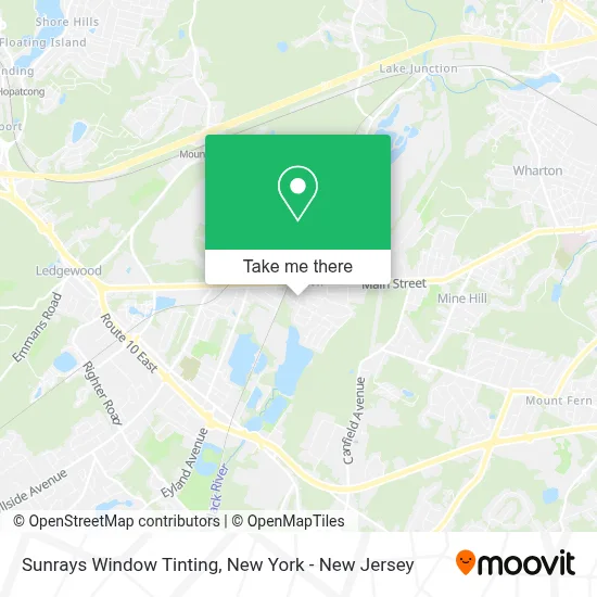
See Sunrays Window Tinting, Roxbury, on the map
Public Transit to Sunrays Window Tinting in Roxbury
Wondering how to get to Sunrays Window Tinting in Roxbury? Moovit helps you find the best way to get to Sunrays Window Tinting with step-by-step directions from the nearest public transit station.
Moovit provides free maps and live directions to help you navigate through your city. View schedules, routes, timetables, and find out how long does it take to get to Sunrays Window Tinting in real time.
Looking for the nearest stop or station to Sunrays Window Tinting? Check out this list of stops closest to your destination: Mount Arlington.
Bus: 875, 880.Train: MEL, ML.
Want to see if there’s another route that gets you there at an earlier time? Moovit helps you find alternative routes or times. Get directions from and directions to Sunrays Window Tinting easily from the Moovit App or Website.
We make riding to Sunrays Window Tinting easy, which is why over 1.5 million users, including users in Roxbury, trust Moovit as the best app for public transit. You don’t need to download an individual bus app or train app, Moovit is your all-in-one transit app that helps you find the best bus time or train time available.
For information on prices of bus and train, costs and ride fares to Sunrays Window Tinting, please check the Moovit app.
Use the app to navigate to popular places including to the airport, hospital, stadium, grocery store, mall, coffee shop, school, college, and university.
Sunrays Window Tinting Address: 68 N Dell Ave street in Roxbury
- M and M Fuel Oil and Trucking,
- Njacmobiledetailing,
- Diesel Diagnosis,
- Edwin's Towing,
- Towing Service and Steven Truck Repair,
- Eastern Auto Trading,
- 524 Service and Auto Repair,
- A-1 Peck Driving School,
- Rustic Roost,
- Twice Is Nice Thrift Shoppe,
- Gaby's Cleaning Services Company Llc,
- Cruise America Rv Rental,
- Otd Detailing,
- Puffcity Smoke Shop | Kenvil, NJ,
- Martins Automotive Group,
- Puff City,
- Nail'D It Beauty Lounge,
- Sigma Carpet Cleaning,
- Lsk Automotive,
- Flip Flops Tiki Bar
Places Near Sunrays Window Tinting (Roxbury)
- Katz's Deli, Manhattan,
- Rockefeller Center, Manhattan,
- Mountainside Hospital, Glen Ridge,
- Bellevue Hospital, Manhattan,
- qqqq, Manhattan,
- 111 Centre New York City Supreme Court, Manhattan,
- San Gennaro Feast, Manhattan,
- Pier 83, Manhattan,
- Hudson Yards, Manhattan,
- Wall Street, Manhattan,
- 911 Memorial, Manhattan,
- Queens Center Mall, Queens,
- Times Square, Manhattan,
- SoHo, Manhattan,
- 376 Hudson Street, Manhattan,
- Chinatown, Manhattan,
- 66 John Street, Manhattan,
- 26 Federal Plaza, Manhattan,
- 3 Stone St, Manhattan,
- 1 Police Plaza, Manhattan
How to get to popular places in New York - New Jersey with public transit
Get around Roxbury by public transit!
Traveling around Roxbury has never been so easy. See step by step directions as you travel to any attraction, street or major public transit station. View bus and train schedules, arrival times, service alerts and detailed routes on a map, so you know exactly how to get to anywhere in Roxbury.
When traveling to any destination around Roxbury use Moovit's Live Directions with Get Off Notifications to know exactly where and how far to walk, how long to wait for your line, and how many stops are left. Moovit will alert you when it's time to get off — no need to constantly re-check whether yours is the next stop.
Wondering how to use public transit in Roxbury or how to pay for public transit in Roxbury? Moovit public transit app can help you navigate your way with public transit easily, and at minimum cost. It includes public transit fees, ticket prices, and costs. Looking for a map of Roxbury public transit lines? Moovit public transit app shows all public transit maps in Roxbury with all Bus, Train, Subway, Light Rail, Ferry and Cable Car routes and stops on an interactive map.
New York - New Jersey has 6 transit type(s), including: Bus, Train, Subway, Light Rail, Ferry and Cable Car, operated by several transit agencies, including MTA Subway, Metro-North Railroad, LIRR, PATH, MTA New York City Transit - Express routes, MTA Bus, NJ Transit, NYC Ferry, NICE bus, Bee-Line Bus, NJ Transit Rail, Norwalk Transit District, Hartford Line, River Valley Transit and HART