How to get to Super Chapa by Colectivo?
Click on the Colectivo route to see step by step directions with maps, line arrival times and updated time schedules.
From José C. Paz, Moreno
124 minFrom Capilla del Señor, Exaltación De La Cruz
142 minFrom Hospital Universitario Austral, Pilar
94 minFrom Parque industrial pilar, Pilar
98 minFrom Francisco Alvarez, Moreno
65 minFrom Pilar, Pilar
66 minFrom Las Palmas Del Pilar, Pilar
86 minFrom Estacion Pilar, Pilar
93 minFrom Cuartel V, Moreno
89 minFrom General Rodríguez, General Rodríguez
38 min
How to get to Super Chapa by train?
Click on the train route to see step by step directions with maps, line arrival times and updated time schedules.
Colectivo stops near Super Chapa in Luján
Train station near Super Chapa in Luján
- Lujan, 36 min walk,VIEW
Colectivo lines to Super Chapa in Luján
- 57 MBJ, Mercedes,VIEW
- 57 NA, Navarro - Lujan,VIEW
- 203, Luján - Moreno (Por Gaona),VIEW
- 276, C. Areco - Autopista y Ruta 28,VIEW
- 350, Pilar – Open Door – Luján,VIEW
- 365, K: Luján,VIEW
- 410, Moreno - Lujan (X Ruta 7),VIEW
- 500, Pueblo Nuevo - Jauregui - Luján X Ruta 7,VIEW
- 502, Lujan - Torres (x Hospital Cabred),VIEW
- 503, A: Villa Ruiz - Luján,VIEW
- 57 Q0, Once X Metrobus,VIEW
- 57 B1, Moreno,VIEW
- 57 B2, Lujan,VIEW
- 57 B3, Lujan (X Autopista),VIEW
- 203, Moreno,VIEW
- 322, G: Las Heras - Luján (Terminal),VIEW
- 355, Cap. Del Señor - Luján,VIEW
- 501, E: Estación Luján x Mendoza,VIEW
What are the closest stations to Super Chapa?
The closest stations to Super Chapa are:
- Avenida Humberto Primo Y Avenida Pellegrini is 155 meters away, 3 min walk.
- Av.Humberto Primo Y Av. Pellegrini is 155 meters away, 3 min walk.
- Avenida Pellegrini Y Avenida Humberto Primo is 173 meters away, 3 min walk.
- Lujan is 2808 meters away, 36 min walk.
Which Colectivo lines stop near Super Chapa?
These Colectivo lines stop near Super Chapa: 203, 350, 355, 57 MBJ.
Which train line stops near Super Chapa?
SARMIENTO (Moreno→Luján)
What’s the nearest Colectivo station to Super Chapa in Luján?
The nearest Colectivo stations to Super Chapa in Luján are Avenida Humberto Primo Y Avenida Pellegrini, Av.Humberto Primo Y Av. Pellegrini and Avenida Pellegrini Y Avenida Humberto Primo. The closest one is a 3 min walk away.
What time is the first train to Super Chapa in Luján?
The SARMIENTO is the first train that goes to Super Chapa in Luján. It stops nearby at 3:39 AM.
What time is the last train to Super Chapa in Luján?
The SARMIENTO is the last train that goes to Super Chapa in Luján. It stops nearby at 3:43 AM.
What time is the first Colectivo to Super Chapa in Luján?
The 410 is the first Colectivo that goes to Super Chapa in Luján. It stops nearby at 3:08 AM.
What time is the last Colectivo to Super Chapa in Luján?
The 57 B2 is the last Colectivo that goes to Super Chapa in Luján. It stops nearby at 3:52 AM.
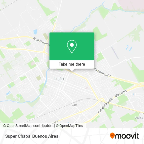
See Super Chapa, Luján, on the map
Public Transit to Super Chapa in Luján
Wondering how to get to Super Chapa in Luján? Moovit helps you find the best way to get to Super Chapa with step-by-step directions from the nearest public transit station.
Moovit provides free maps and live directions to help you navigate through your city. View schedules, routes, timetables, and find out how long does it take to get to Super Chapa in real time.
Looking for the nearest stop or station to Super Chapa? Check out this list of stops closest to your destination: Avenida Humberto Primo Y Avenida Pellegrini; Av.Humberto Primo Y Av. Pellegrini; Avenida Pellegrini Y Avenida Humberto Primo; Lujan.
Colectivo: 203, 350, 355, 57 MBJ, 57 NA, 276, 322, 501.Train: SARMIENTO.
Want to see if there’s another route that gets you there at an earlier time? Moovit helps you find alternative routes or times. Get directions from and directions to Super Chapa easily from the Moovit App or Website.
We make riding to Super Chapa easy, which is why over 1.5 million users, including users in Luján, trust Moovit as the best app for public transit. You don’t need to download an individual bus app or train app, Moovit is your all-in-one transit app that helps you find the best bus time or train time available.
For information on prices of Colectivo and train, costs and ride fares to Super Chapa, please check the Moovit app.
Use the app to navigate to popular places including to the airport, hospital, stadium, grocery store, mall, coffee shop, school, college, and university.
Super Chapa Address: Super Chapa, Avenida Carlos Pellegrini 870, 6700 Luján street in Luján
- Avenida Carlos Pellegrini / Doctor Alem,
- Franco Real - Productor Asesor De Seguros,
- Ferretería El Jardinero,
- Lekip,
- Humberto Primero / Avenida Carlos Pellegrini,
- Humberto Primo / Calle 1000,
- Kinesiologos-Propedo Bruno,
- Kinesiologos-Aime Lucas Nicolas,
- Kinesis,
- Gas Natural Fenosa,
- Vajillas y Puntadas,
- Sarmiento 385,
- La Centenaria,
- Calle 1000 / Domingo Faustino Sarmiento,
- Restaurante Los Abuelos Carlos Keen,
- La Cholula,
- Diagnostico por Imagen-Sosa Sergio Ruben,
- Ginecologo-Cruz Hugo Edmundo,
- Asociación Argentina De Agentes De Propaganda Médica,
- Rodizio Campo
Places Near Super Chapa (Luján)
- Unicenter Shopping, San Isidro,
- Once, Distrito Federal,
- Parque de la Ciudad, Distrito Federal,
- Flores, Distrito Federal,
- La Plata, La Plata,
- Tecnópolis, Vicente López,
- La Plata, La Plata,
- Movistar Arena, Distrito Federal,
- Aeroparque Jorge Newbery,
- Barrio Chino, Distrito Federal,
- CABA, Distrito Federal,
- Abasto Shopping, Distrito Federal,
- Estadio Monumental (River Plate), Distrito Federal,
- Dot Baires Shopping, Vicente López,
- Aeropuerto Ezeiza, Distrito Federal,
- Jardín Japonés, Distrito Federal,
- Avellaneda, Avellaneda,
- Buenos Aires, Distrito Federal,
- Facultad de Odontología (UBA), Distrito Federal,
- Hospital Santa Lucia, Distrito Federal
How to get to popular places in Buenos Aires with public transit
Get around Luján by public transit!
Traveling around Luján has never been so easy. See step by step directions as you travel to any attraction, street or major public transit station. View bus and train schedules, arrival times, service alerts and detailed routes on a map, so you know exactly how to get to anywhere in Luján.
When traveling to any destination around Luján use Moovit's Live Directions with Get Off Notifications to know exactly where and how far to walk, how long to wait for your line, and how many stops are left. Moovit will alert you when it's time to get off — no need to constantly re-check whether yours is the next stop.
Wondering how to use public transit in Luján or how to pay for public transit in Luján? Moovit public transit app can help you navigate your way with public transit easily, and at minimum cost. It includes public transit fees, ticket prices, and costs. Looking for a map of Luján public transit lines? Moovit public transit app shows all public transit maps in Luján with all Colectivo, Train, Subte, Light Rail and Ferry routes and stops on an interactive map.
Buenos Aires has 5 transit type(s), including: Colectivo, Train, Subte, Light Rail and Ferry, operated by several transit agencies, including Municipalidad Carmen de Areco, Trenes Argentinos, Ferrovías, Metrovías, Subte de Buenos Aires, Doscientos Ocho Transporte Automotor S.A., Empresa del Oeste, Empresa de Transportes Tratado del PIlar S.R.L., Transportes Veintidos de Septiembre, Sargento Cabral, Transportes Sesenta y Ocho, Transportes Quirno Costa, Transportes Santa Fe, Transportes Automotores Riachuelo and Transportes Atlantida