How to get to Super Limpio by bus?
Click on the bus route to see step by step directions with maps, line arrival times and updated time schedules.
From Sam's Club Santa Monica, Aguascalientes
56 minFrom Plaza Canteras, Aguascalientes
49 minFrom Fraccionamiento Los Bosques, Aguascalientes
36 minFrom Fracc Cartagena 1947, Aguascalientes
38 minFrom SEDESOL, Aguascalientes
36 minFrom Templo de San Benito Abad, Aguascalientes
61 minFrom Primo Verdad, Aguascalientes
34 minFrom Linea Verde, Aguascalientes
33 minFrom Residencial Punta Del Cielo, Aguascalientes
75 minFrom Imss Jesus Maria Clinica#6, Aguascalientes
35 min
Bus stops near Super Limpio in Aguascalientes
Bus lines to Super Limpio in Aguascalientes
What are the closest stations to Super Limpio?
The closest stations to Super Limpio are:
- Avenida Siglo Xxi, Sn(D) is 145 meters away, 2 min walk.
- Bulevar Guadalupano, 1808 is 338 meters away, 5 min walk.
- Avenida Siglo Xxi, Ct is 352 meters away, 5 min walk.
Which bus lines stop near Super Limpio?
These bus lines stop near Super Limpio: RUTA 09, RUTA 23, RUTA 37, RUTA 42, RUTA 45, RUTA 50.
What’s the nearest bus station to Super Limpio in Aguascalientes?
The nearest bus station to Super Limpio in Aguascalientes is Avenida Siglo Xxi, Sn(D). It’s a 2 min walk away.
What time is the first bus to Super Limpio in Aguascalientes?
The RUTA 42 is the first bus that goes to Super Limpio in Aguascalientes. It stops nearby at 5:57 AM.
What time is the last bus to Super Limpio in Aguascalientes?
The RUTA 50 is the last bus that goes to Super Limpio in Aguascalientes. It stops nearby at 10:30 PM.
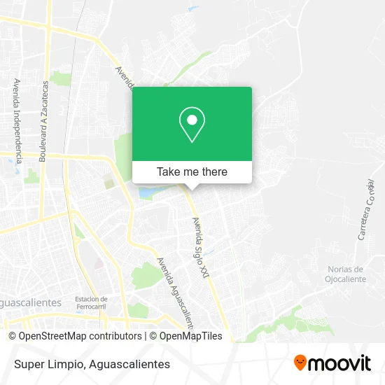
See Super Limpio, Aguascalientes, on the map
Public Transit to Super Limpio in Aguascalientes
Wondering how to get to Super Limpio in Aguascalientes? Moovit helps you find the best way to get to Super Limpio with step-by-step directions from the nearest public transit station.
Moovit provides free maps and live directions to help you navigate through your city. View schedules, routes, timetables, and find out how long does it take to get to Super Limpio in real time.
Looking for the nearest stop or station to Super Limpio? Check out this list of stops closest to your destination: Avenida Siglo Xxi; Bulevar Guadalupano; Avenida Siglo Xxi.
Bus: RUTA 09, RUTA 23, RUTA 37, RUTA 42, RUTA 45, RUTA 50.
Want to see if there’s another route that gets you there at an earlier time? Moovit helps you find alternative routes or times. Get directions from and directions to Super Limpio easily from the Moovit App or Website.
We make riding to Super Limpio easy, which is why over 1.5 million users, including users in Aguascalientes, trust Moovit as the best app for public transit. You don’t need to download an individual bus app or train app, Moovit is your all-in-one transit app that helps you find the best bus time or train time available.
For information on prices of bus, costs and ride fares to Super Limpio, please check the Moovit app.
Use the app to navigate to popular places including to the airport, hospital, stadium, grocery store, mall, coffee shop, school, college, and university.
Super Limpio Address: Calle Mártires de Río Blanco 110, Fraccionamiento Nazario Ortiz Garza, 20170 Aguascalientes, Aguasc street in Aguascalientes
- Venta de Cerámica,
- Paso del Estudiante,
- Óptica Preciso,
- Abarrotes-Calle Las Cumbres,
- Abarrotes Diana,
- Maqueta Estadio Victoria - Necaxa,
- Veterinaria El Establo,
- Six en Blvd. Guadalupano,
- Little Caesars Pizza,
- Papeleria Richard,
- Vianney,
- Tiendita de Dulces,
- Farmacias Guadalajara,
- Moto Zone Garage,
- Boulevard Guadalupano,
- Cooperativa Cuauhtemoc,
- Gorditas,
- Roy Products,
- Servicios Integrales Carrillo Ags,
- Comex
Places Near Super Limpio (Aguascalientes)
- ESPACIOS, Aguascalientes,
- Hospital Imss No. 3, Aguascalientes,
- Imss Clinica 1, Aguascalientes,
- clinica 3 uaa, Aguascalientes,
- Centro, Aguascalientes,
- Parque Las Tres Centurias, Aguascalientes,
- Villas de Nuestra Señora de la Asunción, Aguascalientes,
- La Isla San Marcos, Aguascalientes,
- Blvd. Luis Donaldo Colosio, Aguascalientes,
- Terminal De Combis, Aguascalientes,
- Central De Autobuses, Aguascalientes,
- Centro Comercial Altaria, Aguascalientes,
- Universidad Autónoma de Aguascalientes, Aguascalientes,
- Jesús María, Aguascalientes,
- Agropecuario, Aguascalientes,
- Aeropuerto de Aguascalientes S.A. de C.V., Aguascalientes,
- Nuevo Hospital Hidalgo, Aguascalientes,
- Isla San Marcos, Aguascalientes,
- Villasuncion, Aguascalientes,
- Ciudad industrial, Aguascalientes
How to get to popular places in Aguascalientes with public transit
Get around Aguascalientes by public transit!
Traveling around Aguascalientes has never been so easy. See step by step directions as you travel to any attraction, street or major public transit station. View bus and train schedules, arrival times, service alerts and detailed routes on a map, so you know exactly how to get to anywhere in Aguascalientes.
When traveling to any destination around Aguascalientes use Moovit's Live Directions with Get Off Notifications to know exactly where and how far to walk, how long to wait for your line, and how many stops are left. Moovit will alert you when it's time to get off — no need to constantly re-check whether yours is the next stop.
Wondering how to use public transit in Aguascalientes or how to pay for public transit in Aguascalientes? Moovit public transit app can help you navigate your way with public transit easily, and at minimum cost. It includes public transit fees, ticket prices, and costs. Looking for a map of Aguascalientes public transit lines? Moovit public transit app shows all public transit maps in Aguascalientes with all bus routes and stops on an interactive map.
Aguascalientes has 1 transit type(s), including: bus, operated by several transit agencies, including Coordinación General de Movilidad