How to get to Supercor Stop&Go by bus?
Click on the bus route to see step by step directions with maps, line arrival times and updated time schedules.
From Urbanización El Carmelo, Ogíjares
58 minFrom El Fargue, Granada
38 minFrom Cenes De La Vega, Cenes De La Vega
51 minFrom Babilonia Summer Club, Las Gabias
77 minFrom Pabellón Municial De Deportes La Libertad, Huétor Vega
63 minFrom Caja Rural Granada Sede Central, Granada
42 minFrom Polígono Tecnológico Ogijares, Ogíjares
55 minFrom Barcelo Carmen, Granada
31 minFrom Generalife, Granada
47 minFrom Plaza De Campo Verde, Granada
36 min
How to get to Supercor Stop&Go by metro?
Click on the metro route to see step by step directions with maps, line arrival times and updated time schedules.
Bus stops near Supercor Stop&Go in Peligros
Metro station near Supercor Stop&Go in Peligros
- Jaén, 11 min walk,VIEW
Bus lines to Supercor Stop&Go in Peligros
What are the closest stations to Supercor Stop&Go?
The closest stations to Supercor Stop&Go are:
- Cruce Pol. Ind. Asegra is 148 meters away, 2 min walk.
- Ctra.Jaén.N12-C.Emp.Olinda is 148 meters away, 2 min walk.
- P.Asegra. Av Asegra. Seur is 492 meters away, 7 min walk.
- Avda. De Andalucía 1 V is 492 meters away, 7 min walk.
- Jaén is 801 meters away, 11 min walk.
Which bus lines stop near Supercor Stop&Go?
These bus lines stop near Supercor Stop&Go: 110, CI2, L-0110 IDA.
Which metro line stops near Supercor Stop&Go?
1 (Armilla→Albolote)
What’s the nearest metro station to Supercor Stop&Go in Peligros?
The nearest metro station to Supercor Stop&Go in Peligros is Jaén. It’s a 11 min walk away.
What’s the nearest bus station to Supercor Stop&Go in Peligros?
The nearest bus stations to Supercor Stop&Go in Peligros are Cruce Pol. Ind. Asegra and Ctra.Jaén.N12-C.Emp.Olinda. The closest one is a 2 min walk away.
What time is the first metro to Supercor Stop&Go in Peligros?
The 1 is the first metro that goes to Supercor Stop&Go in Peligros. It stops nearby at 6:32 AM.
What time is the last metro to Supercor Stop&Go in Peligros?
The 1 is the last metro that goes to Supercor Stop&Go in Peligros. It stops nearby at 11:49 PM.
What time is the first bus to Supercor Stop&Go in Peligros?
The L-0110 VTA is the first bus that goes to Supercor Stop&Go in Peligros. It stops nearby at 7:05 AM.
What time is the last bus to Supercor Stop&Go in Peligros?
The 110 is the last bus that goes to Supercor Stop&Go in Peligros. It stops nearby at 2:42 AM.
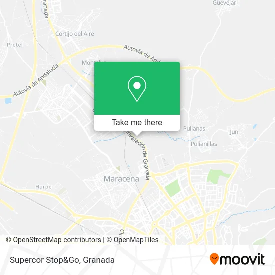
See Supercor Stop&Go, Peligros, on the map
Public Transit to Supercor Stop&Go in Peligros
Wondering how to get to Supercor Stop&Go in Peligros? Moovit helps you find the best way to get to Supercor Stop&Go with step-by-step directions from the nearest public transit station.
Moovit provides free maps and live directions to help you navigate through your city. View schedules, routes, timetables, and find out how long does it take to get to Supercor Stop&Go in real time.
Looking for the nearest stop or station to Supercor Stop&Go? Check out this list of stops closest to your destination: Cruce Pol. Ind. Asegra; Ctra.Jaén.N12-C.Emp.Olinda; P.Asegra. Av Asegra. Seur; Avda. De Andalucía 1 V; Jaén.
Bus: 110, CI2, L-0110 IDA, 117, 123, L-0110 VTA, L-0111VTA, 111.Metro: 1.
Want to see if there’s another route that gets you there at an earlier time? Moovit helps you find alternative routes or times. Get directions from and directions to Supercor Stop&Go easily from the Moovit App or Website.
We make riding to Supercor Stop&Go easy, which is why over 1.5 million users, including users in Peligros, trust Moovit as the best app for public transit. You don’t need to download an individual bus app or train app, Moovit is your all-in-one transit app that helps you find the best bus time or train time available.
For information on prices of bus and metro, costs and ride fares to Supercor Stop&Go, please check the Moovit app.
Use the app to navigate to popular places including to the airport, hospital, stadium, grocery store, mall, coffee shop, school, college, and university.
Supercor Stop&Go Address: 18210 Peligros street in Peligros
- Minioil,
- Moveon Granada,
- Carretera de Madrid km. 426,
- Concesionario Mercedes,
- VV Motors,
- SEUR,
- Antonio Capilla de Haro,
- Seur,
- Luminosos Alhambra,
- Pedro Romero Ramos,
- Entornos de Salud y Deporte Sociedad Limitada.,
- Carpinteria Ebanisteria Guidet,
- Party Jump,
- Taller Venta Vehic Gen,
- Hermanos Rodríguez Megias,
- La Casa del Metacrilat,
- Asegra,
- Parque Infantil La Joya,
- Hormigones Juncaril 312,
- Fábrica de Muebles de Cocina Rubimar
Places Near Supercor Stop&Go (Peligros)
- Palacio De Congresos, Granada,
- PTS, Granada,
- Plaza de Toros, Granada,
- Hospital Hla Inmaculada, Granada,
- Centro Comercial Kinépolis, Pulianas,
- La Chana, Granada,
- Centro Comercial Nevada Shopping, Armilla,
- Estadio Nuevo Los Carmenes, Granada,
- Jefatura Provincial De Tráfico, Granada,
- Estación De Autobuses De Granada, Granada,
- Palacio de Congresos de Granada, Granada,
- Auditorio Manuel de Falla, Granada,
- Albaicín, Granada,
- Renfe Estación de Tren, Granada,
- La Zubia, La Zubia,
- Hospital de trauma, Granada,
- Carmen De Los Mártires, Granada,
- Nevada Shopping, Armilla,
- Hospital Vithas, Granada,
- Serrallo Plaza, Granada
How to get to popular places in Granada with public transit
Get around Peligros by public transit!
Traveling around Peligros has never been so easy. See step by step directions as you travel to any attraction, street or major public transit station. View bus and train schedules, arrival times, service alerts and detailed routes on a map, so you know exactly how to get to anywhere in Peligros.
When traveling to any destination around Peligros use Moovit's Live Directions with Get Off Notifications to know exactly where and how far to walk, how long to wait for your line, and how many stops are left. Moovit will alert you when it's time to get off — no need to constantly re-check whether yours is the next stop.
Wondering how to use public transit in Peligros or how to pay for public transit in Peligros? Moovit public transit app can help you navigate your way with public transit easily, and at minimum cost. It includes public transit fees, ticket prices, and costs. Looking for a map of Peligros public transit lines? Moovit public transit app shows all public transit maps in Peligros with all Bus, Train and Metro routes and stops on an interactive map.
Granada has 3 transit type(s), including: Bus, Train and Metro, operated by several transit agencies, including Metro de Granada, Bus urbano Granada, TranspRober, Consorcio de Transporte Metropolitano de Granada, ALSA, Grupo Fajardo - Motril, Grupo Fajardo - Almuñécar, Grupo Fajardo - Salobreña, Paco Campos and Renfe