Directions to Support Offices (Hartford) with public transportation
The following transit lines have routes that pass near Support Offices
How to get to Support Offices by bus?
Click on the bus route to see step by step directions with maps, line arrival times and updated time schedules.
How to get to Support Offices by train?
Click on the train route to see step by step directions with maps, line arrival times and updated time schedules.
Bus stops near Support Offices in Hartford
Train station near Support Offices in Hartford
- Hartford Union Station, 63 min walk,VIEW
Bus lines to Support Offices in Hartford
- 72, 72a - Asylum Av-Bishops Corner-Cigna-Metlife,VIEW
- 74, 74 - Granby St-St Francis Hosp-Copaco-Wedgewood Dr,VIEW
- 161, 161 - Hartford Hosp-Sigourney St Sta Via Capitol Ave,VIEW
- 901, 901 - Avon-Canton Express,VIEW
- 912, 912 - Hartford Express,VIEW
- 926, 926 - Avon-Canton-Winsted Express,VIEW
- 927, 927 - Hartford Express,VIEW
- 926/927, 926/927 - Hartford Express,VIEW
- 60, 60 - Farmington Av-West Hartford Ctr,VIEW
- 62, 62 - Farmington Av-North Main St-Bishops Corner,VIEW
- 64, 64w - Farmington Av-South Main St-Westfarms Mall,VIEW
- 66, 66 - Farmington Av-Westgate,VIEW
What are the closest stations to Support Offices?
The closest stations to Support Offices are:
- Asylum Ave @ Opp Atwood St is 68 yards away, 2 min walk.
- Asylum Ave @ Opp Gillett St is 77 yards away, 2 min walk.
- Asylum Ave @ Woodland St is 218 yards away, 3 min walk.
- Farmington Ave @ Laurel St is 779 yards away, 10 min walk.
- Hartford Union Station is 5372 yards away, 63 min walk.
Which bus lines stop near Support Offices?
These bus lines stop near Support Offices: 72, 928, FLIXBUS 2610, GREYHOUND US0230, GREYHOUND US0235, GREYHOUND US0255S.
Which train lines stop near Support Offices?
These train lines stop near Support Offices: AMTRAK HARTFORD LINE, HARTFORD LINE, VALLEY FLYER, VERMONTER.
What’s the nearest bus station to Support Offices in Hartford?
The nearest bus stations to Support Offices in Hartford are Asylum Ave @ Opp Atwood St and Asylum Ave @ Opp Gillett St. The closest one is a 2 min walk away.
What time is the first train to Support Offices in Hartford?
The NORTHEAST REGIONAL is the first train that goes to Support Offices in Hartford. It stops nearby at 4:51 AM.
What time is the last train to Support Offices in Hartford?
The NORTHEAST REGIONAL is the last train that goes to Support Offices in Hartford. It stops nearby at 11:59 PM.
What time is the first bus to Support Offices in Hartford?
The 161 is the first bus that goes to Support Offices in Hartford. It stops nearby at 4:55 AM.
What time is the last bus to Support Offices in Hartford?
The 60 is the last bus that goes to Support Offices in Hartford. It stops nearby at 12:50 AM.
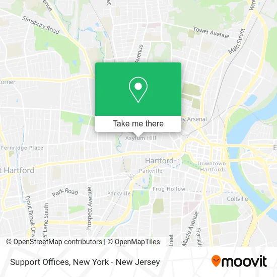
See Support Offices, Hartford, on the map
Public Transit to Support Offices in Hartford
Wondering how to get to Support Offices in Hartford? Moovit helps you find the best way to get to Support Offices with step-by-step directions from the nearest public transit station.
Moovit provides free maps and live directions to help you navigate through your city. View schedules, routes, timetables, and find out how long does it take to get to Support Offices in real time.
Looking for the nearest stop or station to Support Offices? Check out this list of stops closest to your destination: Asylum Ave @ Opp Atwood St; Asylum Ave @ Opp Gillett St; Asylum Ave @ Woodland St; Farmington Ave @ Laurel St; Hartford Union Station.
Bus: 72, 928, FLIXBUS 2610, GREYHOUND US0230, GREYHOUND US0235, GREYHOUND US0255S, 74, 161, 901, 912, 926, 927, 926/927, 60, 62, 64, 66.Train: AMTRAK HARTFORD LINE, HARTFORD LINE, VALLEY FLYER, VERMONTER, NORTHEAST REGIONAL.
Want to see if there’s another route that gets you there at an earlier time? Moovit helps you find alternative routes or times. Get directions from and directions to Support Offices easily from the Moovit App or Website.
We make riding to Support Offices easy, which is why over 1.5 million users, including users in Hartford, trust Moovit as the best app for public transit. You don’t need to download an individual bus app or train app, Moovit is your all-in-one transit app that helps you find the best bus time or train time available.
For information on prices of train and bus, costs and ride fares to Support Offices, please check the Moovit app.
Use the app to navigate to popular places including to the airport, hospital, stadium, grocery store, mall, coffee shop, school, college, and university.
Support Offices Address: 999 Asylum Ave street in Hartford
- Human Rights Commission,
- Sabia Taiman Llc,
- Child Advocate Office,
- FedEx,
- Haymond Law Firm - Car & Motorcycle Accident Attorneys,
- Orthopedic Associates,
- Elios 967,
- Ingenuity and Solutions,
- Asylum Ave and Opp Atwood St,
- Hartford Federal Credit Union,
- No Labels,
- A1 Door Repair & Installation,
- Professional Image,
- Champion Chinese Language Institute,
- State of Ct Legislature House of Representatives Management,
- Kokutz,
- Hartford City Ballet,
- T Properties,
- Gladys Kagaoan, Md,
- Scott Fecteau, Md
Places Near Support Offices (Hartford)
- 376 Hudson Street, Manhattan,
- Chinatown, Manhattan,
- Pier 83, Manhattan,
- 3 Stone St, Manhattan,
- San Gennaro Feast, Manhattan,
- 111 Centre New York City Supreme Court, Manhattan,
- Mountainside Hospital, Glen Ridge,
- Katz's Deli, Manhattan,
- 911 Memorial, Manhattan,
- 66 John Street, Manhattan,
- SoHo, Manhattan,
- Times Square, Manhattan,
- Bellevue Hospital, Manhattan,
- Queens Center Mall, Queens,
- Rockefeller Center, Manhattan,
- 1 Police Plaza, Manhattan,
- 26 Federal Plaza, Manhattan,
- Hudson Yards, Manhattan,
- Wall Street, Manhattan,
- qqqq, Manhattan
How to get to popular places in New York - New Jersey with public transit
Get around Hartford by public transit!
Traveling around Hartford has never been so easy. See step by step directions as you travel to any attraction, street or major public transit station. View bus and train schedules, arrival times, service alerts and detailed routes on a map, so you know exactly how to get to anywhere in Hartford.
When traveling to any destination around Hartford use Moovit's Live Directions with Get Off Notifications to know exactly where and how far to walk, how long to wait for your line, and how many stops are left. Moovit will alert you when it's time to get off — no need to constantly re-check whether yours is the next stop.
Wondering how to use public transit in Hartford or how to pay for public transit in Hartford? Moovit public transit app can help you navigate your way with public transit easily, and at minimum cost. It includes public transit fees, ticket prices, and costs. Looking for a map of Hartford public transit lines? Moovit public transit app shows all public transit maps in Hartford with all Bus, Train, Subway, Light Rail, Ferry and Cable Car routes and stops on an interactive map.
New York - New Jersey has 6 transit type(s), including: Bus, Train, Subway, Light Rail, Ferry and Cable Car, operated by several transit agencies, including MTA Subway, Metro-North Railroad, LIRR, PATH, MTA New York City Transit - Express routes, MTA Bus, NJ Transit, NYC Ferry, NICE bus, Bee-Line Bus, NJ Transit Rail, Norwalk Transit District, Hartford Line, River Valley Transit and HART