Directions to Suttner String Studio (Indianapolis City (Balance)) with public transportation
The following transit lines have routes that pass near Suttner String Studio
 Bus: 28.
How to get to Suttner String Studio by bus?
Click on the bus route to see step by step directions with maps, line arrival times and updated time schedules.
From Early Learning Indiana, Indianapolis City (Balance)
152 minFrom Eskenazi Health West 38th Street, Indianapolis
74 minFrom Harvest Nights at Newfields, Indianapolis City (Balance)
77 minFrom Shell, Indianapolis City (Balance)
51 minFrom Westend Dental, Indianapolis City (Balance)
103 minFrom Jonathan Jennings School #109, Indianapolis City (Balance)
86 minFrom Emergency Dentist Indianapolis 24/7, Indianapolis City (Balance)
31 minFrom Irium, Indianapolis City (Balance)
82 minFrom Aveda, Indianapolis City (Balance)
97 min
Bus stop near Suttner String Studio in Indianapolis City (Balance)
- Harcourt Rd & 75th Pl, 4 min walk,VIEW
Bus lines to Suttner String Studio in Indianapolis City (Balance)
- 28, Transit Center,VIEW
What are the closest stations to Suttner String Studio?
The closest stations to Suttner String Studio are:
- Harcourt Rd & 75th Pl is 329 yards away, 4 min walk.
Which bus line stops near Suttner String Studio?
28 (St. Vincent)
What’s the nearest bus station to Suttner String Studio in Indianapolis City (Balance)?
The nearest bus station to Suttner String Studio in Indianapolis City (Balance) is Harcourt Rd & 75th Pl. It’s a 4 min walk away.
What time is the first bus to Suttner String Studio in Indianapolis City (Balance)?
The 28 is the first bus that goes to Suttner String Studio in Indianapolis City (Balance). It stops nearby at 5:07 AM.
What time is the last bus to Suttner String Studio in Indianapolis City (Balance)?
The 28 is the last bus that goes to Suttner String Studio in Indianapolis City (Balance). It stops nearby at 11:00 PM.
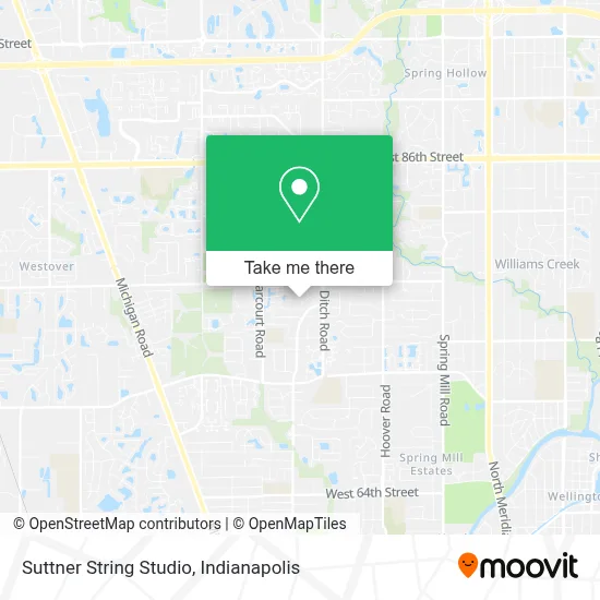
See Suttner String Studio, Indianapolis City (Balance), on the map
Public Transit to Suttner String Studio in Indianapolis City (Balance)
Wondering how to get to Suttner String Studio in Indianapolis City (Balance)? Moovit helps you find the best way to get to Suttner String Studio with step-by-step directions from the nearest public transit station.
Moovit provides free maps and live directions to help you navigate through your city. View schedules, routes, timetables, and find out how long does it take to get to Suttner String Studio in real time.
Looking for the nearest stop or station to Suttner String Studio? Check out this list of stops closest to your destination: Harcourt Rd & 75th Pl.
Bus: 28.
Want to see if there’s another route that gets you there at an earlier time? Moovit helps you find alternative routes or times. Get directions from and directions to Suttner String Studio easily from the Moovit App or Website.
We make riding to Suttner String Studio easy, which is why over 1.5 million users, including users in Indianapolis City (Balance), trust Moovit as the best app for public transit. You don’t need to download an individual bus app or train app, Moovit is your all-in-one transit app that helps you find the best bus time or train time available.
For information on prices of bus, costs and ride fares to Suttner String Studio, please check the Moovit app.
Use the app to navigate to popular places including to the airport, hospital, stadium, grocery store, mall, coffee shop, school, college, and university.
Suttner String Studio Address: 1544 McCollough Ct street in Indianapolis City (Balance)
- Tree Service Indianapolis,
- Pavlovszky, Maria,
- Mount Nebo MBC,
- Indy Best Hvac,
- Hampton Court Apartments of Indianapolis,
- Willow Lake Elementary School,
- Nexus Group,
- Private Reserve Townhomes,
- Grove at Harcourt,
- Landmark,
- Go Anywhere Anytime,
- Metro Companies,
- Watergate Roofing,
- Computer Parts,
- Peter Murphy Certified Public Acc,
- Nettoi,
- Convient Childcare,
- WFBQ-FM / WNTR-FM Indianapolis Tower Site,
- God's Grace Christian Church,
- Westlane Middle School
Places Near Suttner String Studio (Indianapolis City (Balance))
- 119 W 19th St Parking, Indianapolis City (Balance),
- St. Vincent Hospital - Indianapolis, Indianapolis City (Balance),
- I U Health Methodist Hospital, Indianapolis City (Balance),
- Indiana, Indianapolis City (Balance),
- Indianapolis Airport Zone 2, Indianapolis City (Balance),
- Lucas Oil Stadium, Indianapolis City (Balance),
- Eskenazi Hospital, Indianapolis City (Balance),
- Plainfield, IN, Plainfield,
- Jersey Barn, Indianapolis City (Balance),
- Lilly Corporate Center (Eli Lilly & Co), Indianapolis City (Balance),
- I-465 / I-65 Interchange, Indianapolis City (Balance),
- THE BALT, Indianapolis City (Balance),
- Indiana Convention Center, Indianapolis City (Balance),
- Indianapolis Motor Speedway, Speedway,
- St. Vincent entrance #1, Indianapolis City (Balance),
- Castleton Square Mall, Indianapolis,
- Train Ride At Castleton Mall, Indianapolis City (Balance),
- Methodist Hospital of Indianapolis, Indianapolis City (Balance),
- Cotter's Massage Parlor With Happy Endings, Indianapolis City (Balance),
- Gainbridge Fieldhouse, Indianapolis City (Balance)
How to get to popular places in Indianapolis with public transit
Get around Indianapolis City (Balance) by public transit!
Traveling around Indianapolis City (Balance) has never been so easy. See step by step directions as you travel to any attraction, street or major public transit station. View bus and train schedules, arrival times, service alerts and detailed routes on a map, so you know exactly how to get to anywhere in Indianapolis City (Balance).
When traveling to any destination around Indianapolis City (Balance) use Moovit's Live Directions with Get Off Notifications to know exactly where and how far to walk, how long to wait for your line, and how many stops are left. Moovit will alert you when it's time to get off — no need to constantly re-check whether yours is the next stop.
Wondering how to use public transit in Indianapolis City (Balance) or how to pay for public transit in Indianapolis City (Balance)? Moovit public transit app can help you navigate your way with public transit easily, and at minimum cost. It includes public transit fees, ticket prices, and costs. Looking for a map of Indianapolis City (Balance) public transit lines? Moovit public transit app shows all public transit maps in Indianapolis City (Balance) with all bus routes and stops on an interactive map.
Indianapolis has 1 transit type(s), including: bus, operated by several transit agencies, including IndyGo, FlixBus-us and Greyhound-us