Directions to Sweet & Co (Santa Cândida) with public transportation
The following transit lines have routes that pass near Sweet & Co
How to get to Sweet & Co by bus?
Click on the bus route to see step by step directions with maps, line arrival times and updated time schedules.
From Rua Alferes Poli, Rebouças
45 minFrom Colônia Faria, Colombo
49 minFrom Av. Manoel Ribas, Santa Felicidade
58 minFrom Auditorio Mario Lobo, Centro Cívico
37 minFrom Universidade Tuiuti, Santo Inácio
69 minFrom Praça Do Japão, Água Verde
41 minFrom Rua Bento Viana 1200, Batel
44 minFrom Copel Agencia Colombo, Colombo
44 minFrom Rua Imaculada Conceicao, Prado Velho
70 minFrom Universidade Tuiuti do Paraná (UTP), Santo Inácio
69 min
Bus stops near Sweet & Co in Santa Cândida
Bus lines to Sweet & Co in Santa Cândida
What are the closest stations to Sweet & Co?
The closest stations to Sweet & Co are:
- Rua Theodoro Makiolka, 2230 is 115 meters away, 2 min walk.
- Abaetê - R. Amadeu Natal, 300 is 589 meters away, 8 min walk.
- Rua Padre Paulo Canelles, 906 is 629 meters away, 9 min walk.
Which bus lines stop near Sweet & Co?
These bus lines stop near Sweet & Co: 272 PAINEIRAS, 924 SANTA FELICIDADE / SANTA CÂNDIDA.
What’s the nearest bus station to Sweet & Co in Santa Cândida?
The nearest bus station to Sweet & Co in Santa Cândida is Rua Theodoro Makiolka, 2230. It’s a 2 min walk away.
What time is the first bus to Sweet & Co in Santa Cândida?
The 226 ABAETÉ is the first bus that goes to Sweet & Co in Santa Cândida. It stops nearby at 5:00 AM.
What time is the last bus to Sweet & Co in Santa Cândida?
The 924 SANTA FELICIDADE / SANTA CÂNDIDA is the last bus that goes to Sweet & Co in Santa Cândida. It stops nearby at 12:54 AM.
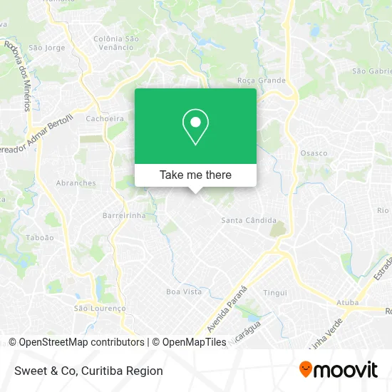
See Sweet & Co, Santa Cândida, on the map
Public Transit to Sweet & Co in Santa Cândida
Wondering how to get to Sweet & Co in Santa Cândida? Moovit helps you find the best way to get to Sweet & Co with step-by-step directions from the nearest public transit station.
Moovit provides free maps and live directions to help you navigate through your city. View schedules, routes, timetables, and find out how long does it take to get to Sweet & Co in real time.
Looking for the nearest stop or station to Sweet & Co? Check out this list of stops closest to your destination: Rua Theodoro Makiolka; Abaetê - R. Amadeu Natal; Rua Padre Paulo Canelles.
Bus: 272 PAINEIRAS, 924 SANTA FELICIDADE / SANTA CÂNDIDA, 226 ABAETÉ, 236 SÃO BENEDITO, 244 JARDIM DO ARROIO.
Want to see if there’s another route that gets you there at an earlier time? Moovit helps you find alternative routes or times. Get directions from and directions to Sweet & Co easily from the Moovit App or Website.
We make riding to Sweet & Co easy, which is why over 1.5 million users, including users in Santa Cândida, trust Moovit as the best app for public transit. You don’t need to download an individual bus app or train app, Moovit is your all-in-one transit app that helps you find the best bus time or train time available.
For information on prices of bus, costs and ride fares to Sweet & Co, please check the Moovit app.
Use the app to navigate to popular places including to the airport, hospital, stadium, grocery store, mall, coffee shop, school, college, and university.
Sweet & Co Address: Rua Izidoro Wosch, 839 Santa Cândida Curitiba-PR 82650-500 street in Santa Cândida
- Lataria e Pintura Ca,
- Casa Kamylla e Wagner,
- Wall Shop - Materiais Para Drywall e Steel Frame,
- Permaneser Psicologia,
- Moran Consultoria,
- Straube,
- Bc Mais Manutencao Predial,
- Rua Lídia Wosch 155,
- Condominio Recanto das Araucarias,
- Trettin Imóveis,
- Food Land Administracao Participacoes e Hotelaria,
- Carbo Sul PR,
- A.L Pinturas,
- Buum de Ofertas,
- Condomínio Residencial Vila Real,
- Cravaterra,
- Mmw Lataria,
- Objetiva Comercio e Manutencao de Compressores,
- Rua Theodoro Makiolka 2567,
- Du'Leo Gourmet
Places Near Sweet & Co (Santa Cândida)
- Arena Da Baixada - Curitiba,
- Parque Barigui, Mercês,
- Hospital Erasto Gaertner, Jardim Das Américas,
- Rua General Mário Tourinho, Campina Do Siqueira,
- Hospital Nossa Senhora Das Graças, Mercês,
- Campo Largo, Campo,
- Rua Martim Afonso 558, Mercês,
- Hospital Universitário Evangélico de Curitiba, Bigorrilho,
- Shopping Palladium, Portão,
- Jardim Botânico de Curitiba PR, Centro,
- Hospital Da Cruz Vermelha, Batel,
- Hospital de Clínicas (HC - UFPR), Centro,
- Jockey Plaza Shopping Center, Tarumã,
- Shopping Estação, Rebouças,
- Hospital Angelina Caron, Campina Grande Do Sul,
- Park Shopping Barigüi, Mossunguê,
- Hospital Madalena Sofia, Bairro Alto,
- Hhhhh, Fazendinha,
- Hospital do Rocio, Campo,
- Pontifícia Universidade Católica do Paraná (PUCPR), Prado Velho
How to get to popular places in Curitiba Region with public transit
Get around Santa Cândida by public transit!
Traveling around Santa Cândida has never been so easy. See step by step directions as you travel to any attraction, street or major public transit station. View bus and train schedules, arrival times, service alerts and detailed routes on a map, so you know exactly how to get to anywhere in Santa Cândida.
When traveling to any destination around Santa Cândida use Moovit's Live Directions with Get Off Notifications to know exactly where and how far to walk, how long to wait for your line, and how many stops are left. Moovit will alert you when it's time to get off — no need to constantly re-check whether yours is the next stop.
Wondering how to use public transit in Santa Cândida or how to pay for public transit in Santa Cândida? Moovit public transit app can help you navigate your way with public transit easily, and at minimum cost. It includes public transit fees, ticket prices, and costs. Looking for a map of Santa Cândida public transit lines? Moovit public transit app shows all public transit maps in Santa Cândida with all Bus and Cable Car routes and stops on an interactive map.
Curitiba Region has 2 transit type(s), including: Bus and Cable Car, operated by several transit agencies, including Sistema Integrado de Mobilidade (URBS), Sistema Integrado de Mobilidade (AMEP), URBS (Cartões bancários e Dinheiro), URBS (Cartões bancários / Cartão URBS), AMEP (Cartões bancários / Cartão MetroCard), AMEP (Cartões bancários / Cartão MetroCard / Dinheiro), Viação Colombo (Dinheiro), TRIAR (Cartão TRIAR / Dinheiro), Empresa Curitiba Cerro Azul (Dinheiro), Expresso Nossa Senhora da Penha (Dinheiro), Empresa Campo Alto Tijucas (Dinheiro), Auto Viação São José (Cartão VEM / Dinheiro), BRT S/A (Cartão VEM / Dinheiro), TransPiedade (Cartão Cidadão / Dinheiro) and Oceânica Sul (Cartão Transporte / Dinheiro)