Directions to Sweet Cream (Rishon LeZion) with public transportation
The following transit lines have routes that pass near Sweet Cream
 Bus: 15, 3, 83, 138, 151.
- Israel Railways: Herzliya - Ashkelon, Herzliya - Be'er Sheva Center, Ashdod Ad Halom - Herzliya, Ashkelon - Herzliya, Beer Sheva Center - Bnei Brak.
How to get to Sweet Cream by bus?
Click on the bus route to see step by step directions with maps, line arrival times and updated time schedules.
From Azrieli Center, Tel Aviv-Yafo
53 minFrom Hatikva Neighborhood, Tel Aviv-Yafo
35 minFrom Crown Plaza Hotel, Tel Aviv-Yafo
49 minFrom Tel Aviv Museum, Tel Aviv-Yafo
63 minFrom Azrieli Round Tower, Floor 23, 132 Menachem Begin, Tel Aviv-Yafo
52 minFrom Dead Sea Transportation - Zivit Transport, Rishon LeZion
38 minFrom Yefet, Tel Aviv-Yafo
34 minFrom Carmel Market, Tel Aviv-Yafo
45 minFrom Azrieli Towers, Tel Aviv-Yafo
52 minFrom Azrieli Peace Center, Tel Aviv-Yafo
53 min
How to get to Sweet Cream by Israel Railways?
Click on the Israel Railways route to see step by step directions with maps, line arrival times and updated time schedules.
From Azrieli Center, Tel Aviv-Yafo
63 minFrom Hatikva Neighborhood, Tel Aviv-Yafo
65 minFrom Tel Aviv Museum, Tel Aviv-Yafo
69 minFrom Azrieli Round Tower, Floor 23, 132 Menachem Begin, Tel Aviv-Yafo
64 minFrom Dead Sea Transportation - Zivit Transport, Rishon LeZion
118 minFrom Azrieli Towers, Tel Aviv-Yafo
62 minFrom Azrieli Peace Center, Tel Aviv-Yafo
62 min
Bus stops near Sweet Cream in Rishon LeZion
Light Rail stations near Sweet Cream in Rishon LeZion
- Komemiyut Light Rail Station, 22 min walk,VIEW
Israel Railways station near Sweet Cream in Rishon LeZion
- Bat Yam-Komemiyut Railway, 38 min walk,VIEW
Bus lines to Sweet Cream in Rishon LeZion
- 3, Rishon LeZion,VIEW
- 138, Yehud,VIEW
- 151, Rishon LeZion,VIEW
- 162, Rishon LeZion,VIEW
- 220, Rishon LeZion Beach,VIEW
- 221, HaRishonim Railway Station,VIEW
- 336, Beit Ezis,VIEW
- 425, Rishon LeZion,VIEW
- 15, Rishon LeZion,VIEW
- 16, Holon,VIEW
- 17, Rishon LeZion,VIEW
- 24, Rishon LeZion,VIEW
- 83, Tel Aviv-Yafo,VIEW
- 70, Golda Meir/HaSachlav,VIEW
- 70A, Artillery Corps/Armor Corps,VIEW
What are the closest stations to Sweet Cream?
The closest stations to Sweet Cream are:
- Rehavam Zeevi Boulevard is 331 meters away, 5 min walk.
- Zalman Shazar/Artillery Corps is 460 meters away, 7 min walk.
- Zalman Shazar/Navy is 556 meters away, 8 min walk.
- Komemiyut Light Rail Station is 1677 meters away, 22 min walk.
- Bat Yam-Komemiyut Railway is 2975 meters away, 38 min walk.
Which bus lines stop near Sweet Cream?
These bus lines stop near Sweet Cream: 15, 3, 83.
Which Israel Railways lines stop near Sweet Cream?
These Israel Railways lines stop near Sweet Cream: Herzliya - Ashkelon, Herzliya - Be'er Sheva Center.
What’s the nearest light rail station to Sweet Cream in Rishon LeZion?
The nearest light rail station to Sweet Cream in Rishon LeZion is Komemiyut Light Rail Station. It’s a 22 min walk away.
What’s the nearest bus station to Sweet Cream in Rishon LeZion?
The nearest bus station to Sweet Cream in Rishon LeZion is Rehavam Zeevi Boulevard. It’s a 5 min walk away.
What time is the first light rail to Sweet Cream in Rishon LeZion?
The R1 is the first light rail that goes to Sweet Cream in Rishon LeZion. It stops nearby at 5:30 AM.
What time is the last light rail to Sweet Cream in Rishon LeZion?
The R1 is the last light rail that goes to Sweet Cream in Rishon LeZion. It stops nearby at 1:10 AM.
What time is the first Israel Railways to Sweet Cream in Rishon LeZion?
The Be'er Sheva Center - Herzliya is the first Israel Railways that goes to Sweet Cream in Rishon LeZion. It stops nearby at 5:59 AM.
What time is the last Israel Railways to Sweet Cream in Rishon LeZion?
The Beer Sheva Center - Tel Aviv Center is the last Israel Railways that goes to Sweet Cream in Rishon LeZion. It stops nearby at 12:42 AM.
What time is the first bus to Sweet Cream in Rishon LeZion?
The 83 is the first bus that goes to Sweet Cream in Rishon LeZion. It stops nearby at 5:20 AM.
What time is the last bus to Sweet Cream in Rishon LeZion?
The 15 is the last bus that goes to Sweet Cream in Rishon LeZion. It stops nearby at 12:58 AM.
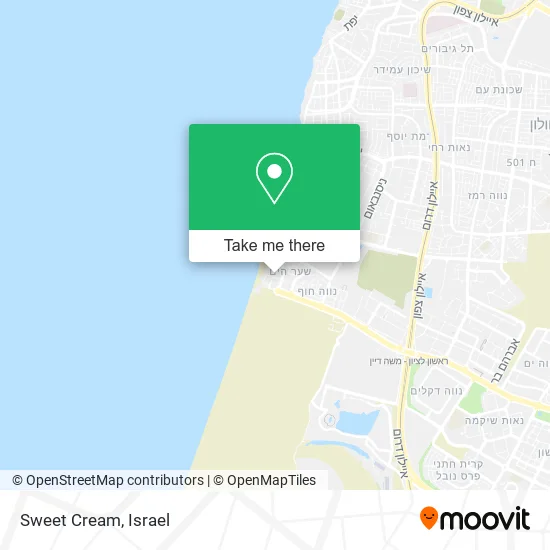
See Sweet Cream, Rishon LeZion, on the map
Public Transit to Sweet Cream in Rishon LeZion
Wondering how to get to Sweet Cream in Rishon LeZion? Moovit helps you find the best way to get to Sweet Cream with step-by-step directions from the nearest public transit station.
Moovit provides free maps and live directions to help you navigate through your city. View schedules, routes, timetables, and find out how long does it take to get to Sweet Cream in real time.
Looking for the nearest stop or station to Sweet Cream? Check out this list of stops closest to your destination: Rehavam Zeevi Boulevard; Zalman Shazar/Artillery Corps; Zalman Shazar/Navy; Komemiyut Light Rail Station; Bat Yam-Komemiyut Railway.
Bus: 15, 3, 83, 138, 151, 162, 220, 16, 17, 24, 70, 70A.Israel Railways: Herzliya - Ashkelon, Herzliya - Be'er Sheva Center, Ashdod Ad Halom - Herzliya, Ashkelon - Herzliya, Beer Sheva Center - Bnei Brak, Be'er Sheva Center - Herzliya, Beer Sheva Center - Tel Aviv Center.
Want to see if there’s another route that gets you there at an earlier time? Moovit helps you find alternative routes or times. Get directions from and directions to Sweet Cream easily from the Moovit App or Website.
We make riding to Sweet Cream easy, which is why over 1.5 million users, including users in Rishon LeZion, trust Moovit as the best app for public transit. You don’t need to download an individual bus app or train app, Moovit is your all-in-one transit app that helps you find the best bus time or train time available.
For information on prices of bus and Israel Railways, costs and ride fares to Sweet Cream, please check the Moovit app.
Use the app to navigate to popular places including to the airport, hospital, stadium, grocery store, mall, coffee shop, school, college, and university.
Sweet Cream Address: אח"י דקר שער הים, 75000 ראשון לציון street in Rishon LeZion
- Glico,
- The Shark Pizza and Bar,
- Drink Stop,
- Drink Stop,
- Four on Four Meeting,
- INS Dakar,
- Real Estate in Israel. Iska Tova - Real Estate Sales 2001,
- Playa,
- Kibbutz on the Beach - Rishon LeZion,
- HaKibbutz - Sea Coast Rishon LeZion,
- Mizu Sushi Bar,
- Golda Ice Cream - Rishon LeZion,
- Beach 4,
- 38765 - Rehavam Ze'evi Boulevard,
- Sea Gate,
- Tel Yona Beach,
- Benny the Fisherman,
- Artillery Corps,
- 4x4 Beach,
- Rishon LeZion Beach
Places Near Sweet Cream (Rishon LeZion)
- Azrieli, Tel Aviv-Yafo,
- Beilinson Hospital, Petah Tikva,
- Ichilov Hospital, Tel Aviv-Yafo,
- Menora Mivtachim Arena, Tel Aviv-Yafo,
- Yarkon Park, Tel Aviv-Yafo,
- Assuta Hospital - Ramat HaHayal, Tel Aviv-Yafo,
- Expo Tel Aviv, Tel Aviv-Yafo,
- Bislach 17, Ramat Negev Regional Council,
- Gideon Camp - Military Base 7, Emek Lod Regional Council,
- Ramat Gan Stadium, Ramat Gan,
- Southern Medical Center, Ramat Negev Regional Council,
- Carmel Market, Tel Aviv-Yafo,
- Tel Hashomer Base, Ramat Gan,
- Kashcafe, Kiryat Ata,
- Dizengoff Center, Tel Aviv-Yafo,
- Tel HaShomer North Gate, Ramat Gan,
- Bloomfield Stadium, Tel Aviv-Yafo,
- HaKotel, Jerusalem,
- Glilot Complex, Hof HaSharon Regional Council,
- Moovit Office, Nes Ziona
How to get to popular places in Israel with public transit
Get around Rishon LeZion by public transit!
Traveling around Rishon LeZion has never been so easy. See step by step directions as you travel to any attraction, street or major public transit station. View bus and train schedules, arrival times, service alerts and detailed routes on a map, so you know exactly how to get to anywhere in Rishon LeZion.
When traveling to any destination around Rishon LeZion use Moovit's Live Directions with Get Off Notifications to know exactly where and how far to walk, how long to wait for your line, and how many stops are left. Moovit will alert you when it's time to get off — no need to constantly re-check whether yours is the next stop.
Wondering how to use public transit in Rishon LeZion or how to pay for public transit in Rishon LeZion? Moovit public transit app can help you navigate your way with public transit easily, and at minimum cost. It includes public transit fees, ticket prices, and costs. Looking for a map of Rishon LeZion public transit lines? Moovit public transit app shows all public transit maps in Rishon LeZion with all Bus, Israel Railways, Light Rail, Carmelit / Rachbalit and Shuttle routes and stops on an interactive map.
Israel has 5 transit type(s), including: Bus, Israel Railways, Light Rail, Carmelit / Rachbalit and Shuttle, operated by several transit agencies, including Dan, Tel Aviv Light Rail - Tevel - Red Line, Israel Railways, Egged, Metropoline, Kavim, Electra Afikim, Nateev Express, Extra, Extra Jerusalem, Jerusalem Light Rail - Kfir, Egged Jerusalem Envelope Route, Dan Badarom, Dan Beer-Sheva and Electra Afikim Transport
