How to get to Sweet Peas Learning Center by bus?
Click on the bus route to see step by step directions with maps, line arrival times and updated time schedules.
From Clifton, NJ, Clifton
61 minFrom Bloomfield, NJ, Bloomfield
68 minFrom Paterson, NJ, Paterson
67 minFrom Bergen Community College, Paramus
109 minFrom Nutley, NJ, Nutley
115 minFrom West Orange, NJ, West Orange
152 minFrom Mountainside Hospital, Glen Ridge
55 minFrom BAPS Shri Swaminarayan Mandir, Clifton
58 minFrom Lodi, NJ, Lodi
115 minFrom Passaic, NJ, Passaic
69 min
How to get to Sweet Peas Learning Center by train?
Click on the train route to see step by step directions with maps, line arrival times and updated time schedules.
Bus stops near Sweet Peas Learning Center in Totowa
Train station near Sweet Peas Learning Center in Totowa
- Little Falls, 12 min walk,VIEW
Bus lines to Sweet Peas Learning Center in Totowa
What are the closest stations to Sweet Peas Learning Center?
The closest stations to Sweet Peas Learning Center are:
- Riverview Dr at Commerce Way is 340 yards away, 5 min walk.
- Jackson Rd at Madison Rd is 770 yards away, 10 min walk.
- Little Falls is 963 yards away, 12 min walk.
- Edison Dr at Riverview Dr is 978 yards away, 12 min walk.
Which bus lines stop near Sweet Peas Learning Center?
These bus lines stop near Sweet Peas Learning Center: 197, 712.
Which train line stops near Sweet Peas Learning Center?
ML (Dover)
What’s the nearest train station to Sweet Peas Learning Center in Totowa?
The nearest train station to Sweet Peas Learning Center in Totowa is Little Falls. It’s a 12 min walk away.
What’s the nearest bus station to Sweet Peas Learning Center in Totowa?
The nearest bus station to Sweet Peas Learning Center in Totowa is Riverview Dr at Commerce Way. It’s a 5 min walk away.
What time is the first train to Sweet Peas Learning Center in Totowa?
The ML is the first train that goes to Sweet Peas Learning Center in Totowa. It stops nearby at 6:06 AM.
What time is the last train to Sweet Peas Learning Center in Totowa?
The ML is the last train that goes to Sweet Peas Learning Center in Totowa. It stops nearby at 11:05 PM.
What time is the first bus to Sweet Peas Learning Center in Totowa?
The 197 is the first bus that goes to Sweet Peas Learning Center in Totowa. It stops nearby at 5:28 AM.
What time is the last bus to Sweet Peas Learning Center in Totowa?
The 197 is the last bus that goes to Sweet Peas Learning Center in Totowa. It stops nearby at 1:03 AM.
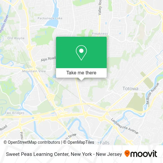
See Sweet Peas Learning Center, Totowa, on the map
Public Transit to Sweet Peas Learning Center in Totowa
Wondering how to get to Sweet Peas Learning Center in Totowa? Moovit helps you find the best way to get to Sweet Peas Learning Center with step-by-step directions from the nearest public transit station.
Moovit provides free maps and live directions to help you navigate through your city. View schedules, routes, timetables, and find out how long does it take to get to Sweet Peas Learning Center in real time.
Looking for the nearest stop or station to Sweet Peas Learning Center? Check out this list of stops closest to your destination: Riverview Dr at Commerce Way; Jackson Rd at Madison Rd; Little Falls; Edison Dr at Riverview Dr.
Bus: 197, 712, 198.Train: ML.
Want to see if there’s another route that gets you there at an earlier time? Moovit helps you find alternative routes or times. Get directions from and directions to Sweet Peas Learning Center easily from the Moovit App or Website.
We make riding to Sweet Peas Learning Center easy, which is why over 1.5 million users, including users in Totowa, trust Moovit as the best app for public transit. You don’t need to download an individual bus app or train app, Moovit is your all-in-one transit app that helps you find the best bus time or train time available.
For information on prices of bus and train, costs and ride fares to Sweet Peas Learning Center, please check the Moovit app.
Use the app to navigate to popular places including to the airport, hospital, stadium, grocery store, mall, coffee shop, school, college, and university.
Sweet Peas Learning Center Address: 80 Commerce Way street in Totowa
- Green Eastern,
- Advocating For Dreams,
- Speedpro Imaging Services Group,
- Avs Technology,
- Xentry Garage Door Repair,
- Speedpro Services Group,
- Terrasense Llc,
- Stack Assist Chimney Repair,
- Alphagraphics,
- Omni Printing Llc,
- Arab American Radio,
- Wheatley Law Firm,
- Lost Car Keys,
- Ibs,
- The John Arthur Group,
- Legend Fusions,
- Good Credit Is Better,
- Anne Mary Lfang Dds Inc,
- Paul E. Forsythe III Cpa,
- Mvp Valet Group
Places Near Sweet Peas Learning Center (Totowa)
- Pier 83, Manhattan,
- Chinatown, Manhattan,
- Hudson Yards, Manhattan,
- Rockefeller Center, Manhattan,
- 911 Memorial, Manhattan,
- 3 Stone St, Manhattan,
- Katz's Deli, Manhattan,
- SoHo, Manhattan,
- San Gennaro Feast, Manhattan,
- Mountainside Hospital, Glen Ridge,
- 111 Centre New York City Supreme Court, Manhattan,
- 66 John Street, Manhattan,
- 376 Hudson Street, Manhattan,
- Wall Street, Manhattan,
- 26 Federal Plaza, Manhattan,
- Queens Center Mall, Queens,
- qqqq, Manhattan,
- Bellevue Hospital, Manhattan,
- 1 Police Plaza, Manhattan,
- Times Square, Manhattan
How to get to popular places in New York - New Jersey with public transit
Get around Totowa by public transit!
Traveling around Totowa has never been so easy. See step by step directions as you travel to any attraction, street or major public transit station. View bus and train schedules, arrival times, service alerts and detailed routes on a map, so you know exactly how to get to anywhere in Totowa.
When traveling to any destination around Totowa use Moovit's Live Directions with Get Off Notifications to know exactly where and how far to walk, how long to wait for your line, and how many stops are left. Moovit will alert you when it's time to get off — no need to constantly re-check whether yours is the next stop.
Wondering how to use public transit in Totowa or how to pay for public transit in Totowa? Moovit public transit app can help you navigate your way with public transit easily, and at minimum cost. It includes public transit fees, ticket prices, and costs. Looking for a map of Totowa public transit lines? Moovit public transit app shows all public transit maps in Totowa with all Bus, Train, Subway, Light Rail, Ferry and Cable Car routes and stops on an interactive map.
New York - New Jersey has 6 transit type(s), including: Bus, Train, Subway, Light Rail, Ferry and Cable Car, operated by several transit agencies, including MTA Subway, Metro-North Railroad, LIRR, PATH, MTA New York City Transit - Express routes, MTA Bus, NJ Transit, NYC Ferry, NICE bus, Bee-Line Bus, NJ Transit Rail, Norwalk Transit District, Hartford Line, River Valley Transit and HART