How to get to Sweet Science Coffee by bus?
Click on the bus route to see step by step directions with maps, line arrival times and updated time schedules.
From Renaissance Arlington Capital View Hotel, Arlington County
31 minFrom Saint Elizabeth's West Campus (DHS/USCG), Washington
101 minFrom I-295 Exit 1 - Naval Research Lab, Washington
121 minFrom Uspto, Alexandria
65 minFrom Rfk Stadium, Washington
84 minFrom Ruth's Chris Steak House, Washington
48 minFrom United States Patent & Trademark Office (USPTO), Alexandria
63 minFrom U.S. Department of Health and Human Services (HHS), Washington
54 minFrom Tenleytown, Washington
44 minFrom Malcolm X Park, Washington
97 min
How to get to Sweet Science Coffee by metro?
Click on the metro route to see step by step directions with maps, line arrival times and updated time schedules.
From Renaissance Arlington Capital View Hotel, Arlington County
42 minFrom Saint Elizabeth's West Campus (DHS/USCG), Washington
54 minFrom Uspto, Alexandria
41 minFrom Rfk Stadium, Washington
54 minFrom Ruth's Chris Steak House, Washington
25 minFrom United States Patent & Trademark Office (USPTO), Alexandria
39 minFrom U.S. Department of Health and Human Services (HHS), Washington
27 minFrom Tenleytown, Washington
35 minFrom Malcolm X Park, Washington
54 min
Bus stops near Sweet Science Coffee in Arlington County
Metro station near Sweet Science Coffee in Arlington County
- Rosslyn Metro Station, 36 min walk,VIEW
Bus lines to Sweet Science Coffee in Arlington County
- 41, Court House,VIEW
- 56, Madison Community Center,VIEW
- 77, Shirlington,VIEW
- A58, East To Farragut Sq,VIEW
- 45, Arlington Mill,VIEW
- F62, West To Dunn Loring,VIEW
- 622, Haymarket,VIEW
- 932, Rosslyn Ballston / Xfer at Pentagon To 981 For State Department,VIEW
- 972-R, Pentagon / Horner / Telegraph / Dale City Lots Via Minnieville,VIEW
- 43, Crystal City,VIEW
What are the closest stations to Sweet Science Coffee?
The closest stations to Sweet Science Coffee are:
- Wilson Blvd, Wb @ N Barton Street, Ns is 80 yards away, 2 min walk.
- N Barton St, Sb @ Clarendon Blvd, Ns is 129 yards away, 2 min walk.
- Clarendon Blvd, Eb @ N Wayne Street, Ns is 327 yards away, 4 min walk.
- Wilson Blvd, Wb @ N Veitch Street, Ns is 367 yards away, 5 min walk.
- Rosslyn Metro Station is 3011 yards away, 36 min walk.
Which bus lines stop near Sweet Science Coffee?
These bus lines stop near Sweet Science Coffee: 43, 77, A58, F62.
Which metro lines stop near Sweet Science Coffee?
These metro lines stop near Sweet Science Coffee: ORANGE, SILVER.
What’s the nearest bus station to Sweet Science Coffee in Arlington County?
The nearest bus stations to Sweet Science Coffee in Arlington County are Wilson Blvd, Wb @ N Barton Street, Ns and N Barton St, Sb @ Clarendon Blvd, Ns. The closest one is a 2 min walk away.
What time is the first metro to Sweet Science Coffee in Arlington County?
The ORANGE is the first metro that goes to Sweet Science Coffee in Arlington County. It stops nearby at 5:14 AM.
What time is the last metro to Sweet Science Coffee in Arlington County?
The ORANGE is the last metro that goes to Sweet Science Coffee in Arlington County. It stops nearby at 12:18 AM.
What time is the first bus to Sweet Science Coffee in Arlington County?
The 972-R is the first bus that goes to Sweet Science Coffee in Arlington County. It stops nearby at 5:34 AM.
What time is the last bus to Sweet Science Coffee in Arlington County?
The A58 is the last bus that goes to Sweet Science Coffee in Arlington County. It stops nearby at 2:11 AM.
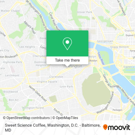
See Sweet Science Coffee, Arlington County, on the map
Public Transit to Sweet Science Coffee in Arlington County
Wondering how to get to Sweet Science Coffee in Arlington County? Moovit helps you find the best way to get to Sweet Science Coffee with step-by-step directions from the nearest public transit station.
Moovit provides free maps and live directions to help you navigate through your city. View schedules, routes, timetables, and find out how long does it take to get to Sweet Science Coffee in real time.
Looking for the nearest stop or station to Sweet Science Coffee? Check out this list of stops closest to your destination: Wilson Blvd; N Barton St; Clarendon Blvd; Wilson Blvd; Rosslyn Metro Station.
Bus: 43, 77, A58, F62, 41, 56, 45, 622, 932, 972-R.Metro: ORANGE, SILVER, BLUE.
Want to see if there’s another route that gets you there at an earlier time? Moovit helps you find alternative routes or times. Get directions from and directions to Sweet Science Coffee easily from the Moovit App or Website.
We make riding to Sweet Science Coffee easy, which is why over 1.5 million users, including users in Arlington County, trust Moovit as the best app for public transit. You don’t need to download an individual bus app or train app, Moovit is your all-in-one transit app that helps you find the best bus time or train time available.
For information on prices of metro and bus, costs and ride fares to Sweet Science Coffee, please check the Moovit app.
Use the app to navigate to popular places including to the airport, hospital, stadium, grocery store, mall, coffee shop, school, college, and university.
Sweet Science Coffee Address: 2507 N Franklin Rd Arlington, VA 22201 street in Arlington County
- DMV Renovation,
- Bliss Nail Lounge (Nail Salon),
- Azure Dream Spa,
- Arlington Rooftop Bar & Grill,
- Hyatt Place-Arlington Courthouse Plaza ,
- Fedex Office,
- Wilson Blvd,
- Whole Foods,
- Arlington, Virginia,
- AMC Theatres-Courthouse Plaza 8,
- 2201 Wilson Blvd Loading Dock,
- Totem Pole Pencil Dickden,
- DMJM,
- Arlington County Government,
- Strayer University Arlington Campus,
- Amc Courthouse Plaza 8,
- Colonial Village, District of Columbia,
- Apple Clarendon,
- Courthouse, Virginia,
- Arlington, VA
Places Near Sweet Science Coffee (Arlington County)
- National Theatre, Washington,
- Basilica of the National Shrine, Washington,
- Capital One Arena, Washington,
- Marriott Marquis Washington, DC, Washington,
- National Museum of African American History and Culture, Washington,
- PG Mall, Prince George's County,
- Amazon Hq2, Arlington County,
- Museum Of The Bible, Washington,
- Georgetown, Washington,
- Pennsylvania Ave NW (3rd st and pennsylvania), Washington,
- The Anthem, Washington,
- Washington National Cathedral, Washington,
- Rock Creek Tennis Center, Washington,
- M&T Bank Stadium, Baltimore,
- Warner Theatre, Washington,
- Washington DC VA Medical Center, Washington,
- National Zoo, Washington,
- Camden Yards, Baltimore,
- Westfield Montgomery Mall, Montgomery County,
- Sibley Memorial Hospital, Washington
How to get to popular places in Washington, D.C. - Baltimore, MD with public transit
Get around Arlington County by public transit!
Traveling around Arlington County has never been so easy. See step by step directions as you travel to any attraction, street or major public transit station. View bus and train schedules, arrival times, service alerts and detailed routes on a map, so you know exactly how to get to anywhere in Arlington County.
When traveling to any destination around Arlington County use Moovit's Live Directions with Get Off Notifications to know exactly where and how far to walk, how long to wait for your line, and how many stops are left. Moovit will alert you when it's time to get off — no need to constantly re-check whether yours is the next stop.
Wondering how to use public transit in Arlington County or how to pay for public transit in Arlington County? Moovit public transit app can help you navigate your way with public transit easily, and at minimum cost. It includes public transit fees, ticket prices, and costs. Looking for a map of Arlington County public transit lines? Moovit public transit app shows all public transit maps in Arlington County with all Bus, Train, Metro, Light Rail and Ferry routes and stops on an interactive map.
Washington, D.C. - Baltimore, MD has 5 transit type(s), including: Bus, Train, Metro, Light Rail and Ferry, operated by several transit agencies, including WMATA, Montgomery County Ride On, Fairfax Connector, TheBus, PRTC, DASH - Alexandria, Arlington Transit (ART), RTA of Central Maryland, MDOT MTA, MDOT MTA Light RailLink, MDOT MTA Commuter Bus, MDOT MTA Local Bus, FXBGO!, Virginia Railway Express (VRE) and MARC