Directions to Sweet Soul Kitchen (Baltimore) with public transportation
The following transit lines have routes that pass near Sweet Soul Kitchen
 Bus: 154, 40, 73, 94, CITYLINK NAVY.
- Train: MARC.
- Metro: METRO.
- Light Rail: LIGHT RAILLINK.
How to get to Sweet Soul Kitchen by bus?
Click on the bus route to see step by step directions with maps, line arrival times and updated time schedules.
From Guinness Open Gate Brewery & Barrel House, Baltimore County
56 minFrom Western High School, Baltimore
34 minFrom Walmart, Baltimore County
47 minFrom NSA Friendship Annex (FANX), Anne Arundel County
75 minFrom Harford Road, Baltimore
23 minFrom Reisterstown Road Plaza, Baltimore
60 minFrom Sinai Hospital, Baltimore
54 minFrom I-695 @ Exit 17 (Security Blvd/MD 122), Baltimore County
33 minFrom Walmart Supercenter, Baltimore County
37 minFrom MVA Glen Burnie, Anne Arundel County
39 min
How to get to Sweet Soul Kitchen by train?
Click on the train route to see step by step directions with maps, line arrival times and updated time schedules.
How to get to Sweet Soul Kitchen by metro?
Click on the metro route to see step by step directions with maps, line arrival times and updated time schedules.
Bus stops near Sweet Soul Kitchen in Baltimore
- Baltimore St & Eutaw St FS Eb, 1 min walk,VIEW
- Eutaw St & Redwood St Sb, 2 min walk,VIEW
- Howard St & Balt & Fairmount Mis Nb, 2 min walk,VIEW
- Paca St & Baltimore Nb, 2 min walk,VIEW
- Baltimore Arena Bay 1, 3 min walk,VIEW
- Baltimore & Howard Mid Eb, 3 min walk,VIEW
- Howard St & Fayette St Nb, 4 min walk,VIEW
Metro station near Sweet Soul Kitchen in Baltimore
- Charles Center Metro, 4 min walk,VIEW
Light Rail stations near Sweet Soul Kitchen in Baltimore
- Baltimore Arena (University Center), 15 min walk,VIEW
Bus lines to Sweet Soul Kitchen in Baltimore
- CITYLINK ORANGE, Essex - West Baltimore Marc,VIEW
- CITYLINK PURPLE, City Hall - Paradise/catonsville,VIEW
- CITYLINK RED, Downtown - Towson/lutherville,VIEW
- 40, Cms - Essex,VIEW
- 71, Downtown - Patapsco Station,VIEW
- 78, Downtown - Cms,VIEW
- 105, Cedonia - Downtown,VIEW
- 150, Columbia - Downtown/harbor East,VIEW
- 310, 310/4 Johns Hopkins,VIEW
- 54, Clifton Park,VIEW
- 94, Fort Mchenry,VIEW
- 154, Hillendale,VIEW
- 320, 320/7 Johns Hopkins,VIEW
- 73, State Center,VIEW
- CITYLINK NAVY, Baltimore Arena,VIEW
- 160, Johns Hopkins Hospital,VIEW
- 210, 210/3 Annapolis/Baltimore,VIEW
- 215, 215/6 Baltimore,VIEW
- 120, Hopkins Hospital,VIEW
What are the closest stations to Sweet Soul Kitchen?
The closest stations to Sweet Soul Kitchen are:
- Baltimore St & Eutaw St FS Eb is 32 yards away, 1 min walk.
- Eutaw St & Redwood St Sb is 104 yards away, 2 min walk.
- Howard St & Balt & Fairmount Mis Nb is 144 yards away, 2 min walk.
- Paca St & Baltimore Nb is 157 yards away, 2 min walk.
- Baltimore Arena Bay 1 is 165 yards away, 3 min walk.
- Baltimore & Howard Mid Eb is 174 yards away, 3 min walk.
- Howard St & Fayette St Nb is 236 yards away, 4 min walk.
- Charles Center Metro is 282 yards away, 4 min walk.
- Baltimore Arena (University Center) is 1217 yards away, 15 min walk.
Which bus lines stop near Sweet Soul Kitchen?
These bus lines stop near Sweet Soul Kitchen: 154, 40, 73, 94, CITYLINK NAVY, CITYLINK PURPLE, CITYLINK SILVER, CITYLINK YELLOW.
Which train line stops near Sweet Soul Kitchen?
MARC (Inbound - Penn)
Which metro line stops near Sweet Soul Kitchen?
METRO (Towards John Hopkins)
Which light rail line stops near Sweet Soul Kitchen?
LIGHT RAILLINK (Northbound)
What’s the nearest light rail station to Sweet Soul Kitchen in Baltimore?
The nearest light rail station to Sweet Soul Kitchen in Baltimore is Baltimore Arena (University Center). It’s a 15 min walk away.
What’s the nearest metro station to Sweet Soul Kitchen in Baltimore?
The nearest metro station to Sweet Soul Kitchen in Baltimore is Charles Center Metro. It’s a 4 min walk away.
What’s the nearest bus station to Sweet Soul Kitchen in Baltimore?
The nearest bus station to Sweet Soul Kitchen in Baltimore is Baltimore St & Eutaw St FS Eb. It’s a 1 min walk away.
What time is the first light rail to Sweet Soul Kitchen in Baltimore?
The LIGHT RAILLINK is the first light rail that goes to Sweet Soul Kitchen in Baltimore. It stops nearby at 3:56 AM.
What time is the last light rail to Sweet Soul Kitchen in Baltimore?
The LIGHT RAILLINK is the last light rail that goes to Sweet Soul Kitchen in Baltimore. It stops nearby at 1:20 AM.
What time is the first metro to Sweet Soul Kitchen in Baltimore?
The METRO is the first metro that goes to Sweet Soul Kitchen in Baltimore. It stops nearby at 5:08 AM.
What time is the last metro to Sweet Soul Kitchen in Baltimore?
The METRO is the last metro that goes to Sweet Soul Kitchen in Baltimore. It stops nearby at 12:25 AM.
What time is the first bus to Sweet Soul Kitchen in Baltimore?
The CITYLINK RED is the first bus that goes to Sweet Soul Kitchen in Baltimore. It stops nearby at 3:25 AM.
What time is the last bus to Sweet Soul Kitchen in Baltimore?
The 73 is the last bus that goes to Sweet Soul Kitchen in Baltimore. It stops nearby at 3:14 AM.
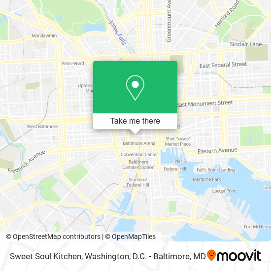
See Sweet Soul Kitchen, Baltimore, on the map
Public Transit to Sweet Soul Kitchen in Baltimore
Wondering how to get to Sweet Soul Kitchen in Baltimore? Moovit helps you find the best way to get to Sweet Soul Kitchen with step-by-step directions from the nearest public transit station.
Moovit provides free maps and live directions to help you navigate through your city. View schedules, routes, timetables, and find out how long does it take to get to Sweet Soul Kitchen in real time.
Looking for the nearest stop or station to Sweet Soul Kitchen? Check out this list of stops closest to your destination: Baltimore St & Eutaw St FS Eb; Eutaw St & Redwood St Sb; Howard St & Balt & Fairmount Mis Nb; Paca St & Baltimore Nb; Baltimore Arena Bay 1; Baltimore & Howard Mid Eb; Howard St & Fayette St Nb; Charles Center Metro; Baltimore Arena (University Center).
Bus: 154, 40, 73, 94, CITYLINK NAVY, CITYLINK PURPLE, CITYLINK SILVER, CITYLINK YELLOW, CITYLINK ORANGE, CITYLINK RED, 71, 310, 54, 320.Train: MARC.Metro: METRO.Light Rail: LIGHT RAILLINK.
Want to see if there’s another route that gets you there at an earlier time? Moovit helps you find alternative routes or times. Get directions from and directions to Sweet Soul Kitchen easily from the Moovit App or Website.
We make riding to Sweet Soul Kitchen easy, which is why over 1.5 million users, including users in Baltimore, trust Moovit as the best app for public transit. You don’t need to download an individual bus app or train app, Moovit is your all-in-one transit app that helps you find the best bus time or train time available.
For information on prices of bus, light rail, metro and train, costs and ride fares to Sweet Soul Kitchen, please check the Moovit app.
Use the app to navigate to popular places including to the airport, hospital, stadium, grocery store, mall, coffee shop, school, college, and university.
Sweet Soul Kitchen Address: 3 N Eutaw St Baltimore, MD 21201 street in Baltimore
- Ziza Kabob,
- The Hipp Cafe @ The Hippodrome,
- Lexus Lounge @ The Hippodrome,
- France-Merrick Performing Arts,
- Hippodrome Theatre,
- The Hippodrome Theatre at the France-Merrick Performing Arts Center,
- TMG Hippodrome,
- LEXUS Lounge at the Hippodrome Theater,
- Upholstery Cleaning Carpet Cleaning,
- N Howard St (baltimore and howard),
- M&T Bank Exchange at the France-Merrick Performing Arts Center,
- Rita's Italian Ice & Frozen Custard,
- N Eutaw St (eutaw and fayette),
- University of ob Gyn Associate,
- Royal Farms Arena Parking Garage,
- PNC Mortgage,
- STARBUCKS,
- UPS,
- Baltimore Grand Garage,
- Springhill Suites-Baltimore
Places Near Sweet Soul Kitchen (Baltimore)
- PG Mall, Prince George's County,
- Rock Creek Tennis Center, Washington,
- Museum Of The Bible, Washington,
- Washington DC VA Medical Center, Washington,
- National Zoo, Washington,
- Sibley Memorial Hospital, Washington,
- The Anthem, Washington,
- Basilica of the National Shrine, Washington,
- Washington National Cathedral, Washington,
- National Museum of African American History and Culture, Washington,
- Amazon Hq2, Arlington County,
- M&T Bank Stadium, Baltimore,
- Marriott Marquis Washington, DC, Washington,
- National Mall, Washington,
- Georgetown, Washington,
- Pennsylvania Ave NW (3rd st and pennsylvania), Washington,
- Westfield Montgomery Mall, Montgomery County,
- Capital One Arena, Washington,
- Warner Theatre, Washington,
- Camden Yards, Baltimore
How to get to popular places in Washington, D.C. - Baltimore, MD with public transit
Get around Baltimore by public transit!
Traveling around Baltimore has never been so easy. See step by step directions as you travel to any attraction, street or major public transit station. View bus and train schedules, arrival times, service alerts and detailed routes on a map, so you know exactly how to get to anywhere in Baltimore.
When traveling to any destination around Baltimore use Moovit's Live Directions with Get Off Notifications to know exactly where and how far to walk, how long to wait for your line, and how many stops are left. Moovit will alert you when it's time to get off — no need to constantly re-check whether yours is the next stop.
Wondering how to use public transit in Baltimore or how to pay for public transit in Baltimore? Moovit public transit app can help you navigate your way with public transit easily, and at minimum cost. It includes public transit fees, ticket prices, and costs. Looking for a map of Baltimore public transit lines? Moovit public transit app shows all public transit maps in Baltimore with all Bus, Train, Metro, Light Rail and Ferry routes and stops on an interactive map.
Washington, D.C. - Baltimore, MD has 5 transit type(s), including: Bus, Train, Metro, Light Rail and Ferry, operated by several transit agencies, including WMATA, Montgomery County Ride On, Fairfax Connector, TheBus, PRTC, DASH - Alexandria, Arlington Transit (ART), RTA of Central Maryland, MDOT MTA, MDOT MTA Light RailLink, MDOT MTA Commuter Bus, MDOT MTA Local Bus, FXBGO!, Virginia Railway Express (VRE) and MARC