Train station near Sweets by Homade in Fairfax County
- Manassas Park Station, 0 min walk,VIEW
- Main Clif,
- Clifton Presbyterian Church,
- Health Systems Technology,
- Choo Choo Hill,
- Trummer's,
- Cba Community Garden Plots,
- Acacia Lodge No. 16,
- Simplicity Kitchen,
- Belle Jar Design,
- Senator George Barker And Delegate Dan Helmer,
- Caboose Plaza,
- McNamara Enterprises,
- Clifton Store (The General Store),
- The Wine Attic,
- Clifton Café,
- Trattoria Villagio,
- Little Villagio Pizzeria E Mercato,
- Ayre Square,
- Peterson's Ice Cream Depot,
- Main St at Chapel Rd
Places Near Sweets by Homade (Fairfax County)
- Rock Creek Tennis Center, Washington,
- M&T Bank Stadium, Baltimore,
- Westfield Montgomery Mall, Montgomery County,
- Capital One Arena, Washington,
- The Anthem, Washington,
- Pennsylvania Ave NW (3rd st and pennsylvania), Washington,
- PG Mall, Prince George's County,
- Camden Yards, Baltimore,
- Sibley Memorial Hospital, Washington,
- National Museum of African American History and Culture, Washington,
- Georgetown, Washington,
- Washington DC VA Medical Center, Washington,
- National Zoo, Washington,
- Museum Of The Bible, Washington,
- Marriott Marquis Washington, DC, Washington,
- Basilica of the National Shrine, Washington,
- Washington National Cathedral, Washington,
- National Mall, Washington,
- Warner Theatre, Washington,
- Amazon Hq2, Arlington County
How to get to popular places in Washington, D.C. - Baltimore, MD with public transit
What are the closest stations to Sweets by Homade?
The closest stations to Sweets by Homade are:
- Manassas Park Station is 0 yards away, 0 min walk.
What’s the nearest train station to Sweets by Homade in Fairfax County?
The nearest train station to Sweets by Homade in Fairfax County is Manassas Park Station. It’s a 0 min walk away.
What time is the first train to Sweets by Homade in Fairfax County?
The MANASSAS LINE is the first train that goes to Sweets by Homade in Fairfax County. It stops nearby at 5:15 AM.
What time is the last train to Sweets by Homade in Fairfax County?
The MANASSAS LINE is the last train that goes to Sweets by Homade in Fairfax County. It stops nearby at 8:02 PM.
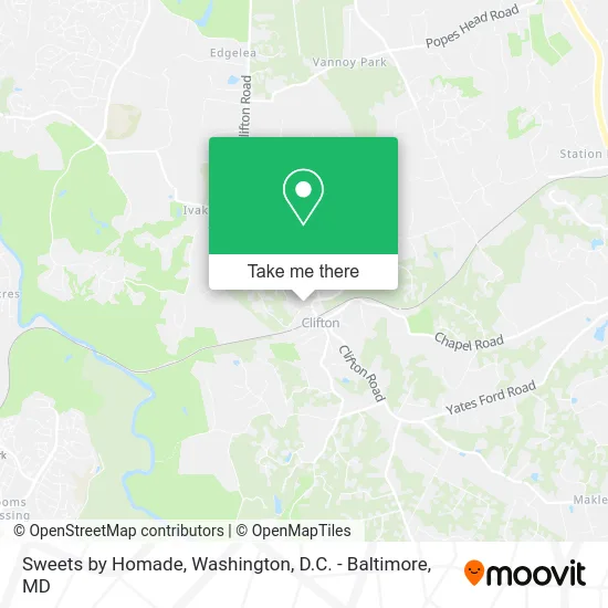
See Sweets by Homade, Fairfax County, on the map
Public Transit to Sweets by Homade in Fairfax County
Wondering how to get to Sweets by Homade in Fairfax County? Moovit helps you find the best way to get to Sweets by Homade with step-by-step directions from the nearest public transit station.
Moovit provides free maps and live directions to help you navigate through your city. View schedules, routes, timetables, and find out how long does it take to get to Sweets by Homade in real time.
Looking for the nearest stop or station to Sweets by Homade? Check out this list of stops closest to your destination: Manassas Park Station.
Want to see if there’s another route that gets you there at an earlier time? Moovit helps you find alternative routes or times. Get directions from and directions to Sweets by Homade easily from the Moovit App or Website.
We make riding to Sweets by Homade easy, which is why over 1.5 million users, including users in Fairfax County, trust Moovit as the best app for public transit. You don’t need to download an individual bus app or train app, Moovit is your all-in-one transit app that helps you find the best bus time or train time available.
Use the app to navigate to popular places including to the airport, hospital, stadium, grocery store, mall, coffee shop, school, college, and university.
Sweets by Homade Address: Clifton Creek Dr street in Fairfax County
Get around Fairfax County by public transit!
Traveling around Fairfax County has never been so easy. See step by step directions as you travel to any attraction, street or major public transit station. View bus and train schedules, arrival times, service alerts and detailed routes on a map, so you know exactly how to get to anywhere in Fairfax County.
When traveling to any destination around Fairfax County use Moovit's Live Directions with Get Off Notifications to know exactly where and how far to walk, how long to wait for your line, and how many stops are left. Moovit will alert you when it's time to get off — no need to constantly re-check whether yours is the next stop.
Wondering how to use public transit in Fairfax County or how to pay for public transit in Fairfax County? Moovit public transit app can help you navigate your way with public transit easily, and at minimum cost. It includes public transit fees, ticket prices, and costs. Looking for a map of Fairfax County public transit lines? Moovit public transit app shows all public transit maps in Fairfax County with all Bus, Train, Metro, Light Rail and Ferry routes and stops on an interactive map.
Washington, D.C. - Baltimore, MD has 5 transit type(s), including: Bus, Train, Metro, Light Rail and Ferry, operated by several transit agencies, including WMATA, Montgomery County Ride On, Fairfax Connector, TheBus, PRTC, DASH - Alexandria, Arlington Transit (ART), RTA of Central Maryland, MDOT MTA, MDOT MTA Light RailLink, MDOT MTA Commuter Bus, MDOT MTA Local Bus, FXBGO!, Virginia Railway Express (VRE) and MARC