How to get to Sycamore Building by bus?
Click on the bus route to see step by step directions with maps, line arrival times and updated time schedules.
From Rose Gaming Resort, Prince William County
232 minFrom Potomac Mills Mall, Prince William County
207 minFrom Busch Gardens Williamsburg (Employee Parking Lot), James City County
166 minFrom Lorton, VA - Amtrak Auto Train Station (LOR), Fairfax County
222 minFrom Lorton, VA, Fairfax County
216 minFrom Amazon Fulfillment Center-Ric3, Richmond
80 minFrom UVA Hospital Medical Center, Charlottesville
296 minFrom Woodbridge, VA, Prince William County
151 min
Bus stops near Sycamore Building in Richmond
Train station near Sycamore Building in Richmond
- Pathrichmond Main Street Amtrak Station, 34 min walk,VIEW
Bus lines to Sycamore Building in Richmond
What are the closest stations to Sycamore Building?
The closest stations to Sycamore Building are:
- Cary + Boulevard is 102 yards away, 2 min walk.
- Robinson + Main is 354 yards away, 5 min walk.
- Pathrichmond Main Street Amtrak Station is 2857 yards away, 34 min walk.
Which bus lines stop near Sycamore Building?
These bus lines stop near Sycamore Building: 20, 5, BRT.
What’s the nearest bus station to Sycamore Building in Richmond?
The nearest bus station to Sycamore Building in Richmond is Cary + Boulevard. It’s a 2 min walk away.
What time is the first train to Sycamore Building in Richmond?
The NORTHEAST REGIONAL is the first train that goes to Sycamore Building in Richmond. It stops nearby at 5:19 AM.
What time is the last train to Sycamore Building in Richmond?
The NORTHEAST REGIONAL is the last train that goes to Sycamore Building in Richmond. It stops nearby at 6:52 PM.
What time is the first bus to Sycamore Building in Richmond?
The 5 is the first bus that goes to Sycamore Building in Richmond. It stops nearby at 4:57 AM.
What time is the last bus to Sycamore Building in Richmond?
The 5 is the last bus that goes to Sycamore Building in Richmond. It stops nearby at 12:09 AM.
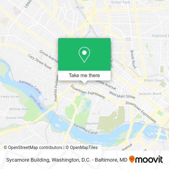
See Sycamore Building, Richmond, on the map
Public Transit to Sycamore Building in Richmond
Wondering how to get to Sycamore Building in Richmond? Moovit helps you find the best way to get to Sycamore Building with step-by-step directions from the nearest public transit station.
Moovit provides free maps and live directions to help you navigate through your city. View schedules, routes, timetables, and find out how long does it take to get to Sycamore Building in real time.
Looking for the nearest stop or station to Sycamore Building? Check out this list of stops closest to your destination: Cary + Boulevard; Robinson + Main; Pathrichmond Main Street Amtrak Station.
Bus: 20, 5, BRT, 78, 77.Train: NORTHEAST REGIONAL.
Want to see if there’s another route that gets you there at an earlier time? Moovit helps you find alternative routes or times. Get directions from and directions to Sycamore Building easily from the Moovit App or Website.
We make riding to Sycamore Building easy, which is why over 1.5 million users, including users in Richmond, trust Moovit as the best app for public transit. You don’t need to download an individual bus app or train app, Moovit is your all-in-one transit app that helps you find the best bus time or train time available.
For information on prices of bus and train, costs and ride fares to Sycamore Building, please check the Moovit app.
Use the app to navigate to popular places including to the airport, hospital, stadium, grocery store, mall, coffee shop, school, college, and university.
Sycamore Building Address: 2707 W Cary St Richmond, VA 23220 street in Richmond
- Richmond Massage Therapy,
- Dramby Environmental Consulting,
- Richmond Young Writers,
- Campus Apartments,
- Pierce Arrow,
- Roastology,
- William Ivey Fine Furniture,
- Sunny Market,
- Richmond Italian Car Brands Transponder Key,
- Libertyx Bitcoin ATM,
- Cary Street Cafe,
- Uptown Neon,
- Fan Auto Repair,
- Clothes Rack,
- Alliance Insurance Group,
- Dalton's Hair Chateau,
- The Clothes Rack,
- Recycles Bicycle Shop,
- Tequila & Deadlifts,
- Kreggers at Hand
Places Near Sycamore Building (Richmond)
- Georgetown, Washington,
- Warner Theatre, Washington,
- Museum Of The Bible, Washington,
- Amazon Hq2, Arlington County,
- Basilica of the National Shrine, Washington,
- PG Mall, Prince George's County,
- National Mall, Washington,
- Westfield Montgomery Mall, Montgomery County,
- Rock Creek Tennis Center, Washington,
- Washington National Cathedral, Washington,
- Sibley Memorial Hospital, Washington,
- Camden Yards, Baltimore,
- M&T Bank Stadium, Baltimore,
- The Anthem, Washington,
- Capital One Arena, Washington,
- Washington DC VA Medical Center, Washington,
- National Zoo, Washington,
- National Museum of African American History and Culture, Washington,
- Pennsylvania Ave NW (3rd st and pennsylvania), Washington,
- Marriott Marquis Washington, DC, Washington
How to get to popular places in Washington, D.C. - Baltimore, MD with public transit
Get around Richmond by public transit!
Traveling around Richmond has never been so easy. See step by step directions as you travel to any attraction, street or major public transit station. View bus and train schedules, arrival times, service alerts and detailed routes on a map, so you know exactly how to get to anywhere in Richmond.
When traveling to any destination around Richmond use Moovit's Live Directions with Get Off Notifications to know exactly where and how far to walk, how long to wait for your line, and how many stops are left. Moovit will alert you when it's time to get off — no need to constantly re-check whether yours is the next stop.
Wondering how to use public transit in Richmond or how to pay for public transit in Richmond? Moovit public transit app can help you navigate your way with public transit easily, and at minimum cost. It includes public transit fees, ticket prices, and costs. Looking for a map of Richmond public transit lines? Moovit public transit app shows all public transit maps in Richmond with all Bus, Train, Metro, Light Rail and Ferry routes and stops on an interactive map.
Washington, D.C. - Baltimore, MD has 5 transit type(s), including: Bus, Train, Metro, Light Rail and Ferry, operated by several transit agencies, including WMATA, Montgomery County Ride On, Fairfax Connector, TheBus, PRTC, DASH - Alexandria, Arlington Transit (ART), RTA of Central Maryland, MDOT MTA, MDOT MTA Light RailLink, MDOT MTA Commuter Bus, MDOT MTA Local Bus, FXBGO!, Virginia Railway Express (VRE) and MARC