How to get to Sylvan Learning by bus?
Click on the bus route to see step by step directions with maps, line arrival times and updated time schedules.
From Louis Armstrong Stadium, Queens
45 minFrom Walmart, Queens
81 minFrom Belmont Park, Elmont
88 minFrom Queens Center Mall, Queens
65 minFrom Albert Einstein College of Medicine, Bronx
92 minFrom Bronx Zoo, Bronx
88 minFrom Prospect Avenue, Bronx
78 minFrom Morris Park, Bronx
90 minFrom Co-op City, Bronx
61 minFrom St. John's University, Queens
49 min
How to get to Sylvan Learning by train?
Click on the train route to see step by step directions with maps, line arrival times and updated time schedules.
Bus stops near Sylvan Learning in Queens
Train station near Sylvan Learning in Queens
- Broadway, 12 min walk,VIEW
Subway station near Sylvan Learning in Queens
- Flushing-Main St, 39 min walk,VIEW
Bus lines to Sylvan Learning in Queens
What are the closest stations to Sylvan Learning?
The closest stations to Sylvan Learning are:
- Utopia Pkwy/16 Av is 86 yards away, 2 min walk.
- Cross Island Pkwy/Utopia Pkwy is 467 yards away, 6 min walk.
- Broadway is 1009 yards away, 12 min walk.
- Flushing-Main St is 3234 yards away, 39 min walk.
Which bus lines stop near Sylvan Learning?
These bus lines stop near Sylvan Learning: Q16, Q76.
Which train line stops near Sylvan Learning?
PORT WASHINGTON BRANCH (Port Washington)
What’s the nearest train station to Sylvan Learning in Queens?
The nearest train station to Sylvan Learning in Queens is Broadway. It’s a 12 min walk away.
What’s the nearest bus station to Sylvan Learning in Queens?
The nearest bus station to Sylvan Learning in Queens is Utopia Pkwy/16 Av. It’s a 2 min walk away.
What time is the first subway to Sylvan Learning in Queens?
The 7 is the first subway that goes to Sylvan Learning in Queens. It stops nearby at 3:00 AM.
What time is the last subway to Sylvan Learning in Queens?
The 7 is the last subway that goes to Sylvan Learning in Queens. It stops nearby at 3:31 AM.
What time is the first train to Sylvan Learning in Queens?
The PORT WASHINGTON BRANCH is the first train that goes to Sylvan Learning in Queens. It stops nearby at 3:39 AM.
What time is the last train to Sylvan Learning in Queens?
The PORT WASHINGTON BRANCH is the last train that goes to Sylvan Learning in Queens. It stops nearby at 2:35 AM.
What time is the first bus to Sylvan Learning in Queens?
The Q16 is the first bus that goes to Sylvan Learning in Queens. It stops nearby at 4:44 AM.
What time is the last bus to Sylvan Learning in Queens?
The Q16 is the last bus that goes to Sylvan Learning in Queens. It stops nearby at 1:16 AM.
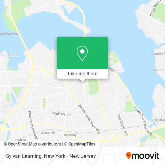
See Sylvan Learning, Queens, on the map
Public Transit to Sylvan Learning in Queens
Wondering how to get to Sylvan Learning in Queens? Moovit helps you find the best way to get to Sylvan Learning with step-by-step directions from the nearest public transit station.
Moovit provides free maps and live directions to help you navigate through your city. View schedules, routes, timetables, and find out how long does it take to get to Sylvan Learning in real time.
Looking for the nearest stop or station to Sylvan Learning? Check out this list of stops closest to your destination: Utopia Pkwy/16 Av; Cross Island Pkwy/Utopia Pkwy; Broadway; Flushing-Main St.
Bus: Q16, Q76, QM20, QM2, QM32.Train: PORT WASHINGTON BRANCH.Subway: 7, 7X.
Want to see if there’s another route that gets you there at an earlier time? Moovit helps you find alternative routes or times. Get directions from and directions to Sylvan Learning easily from the Moovit App or Website.
We make riding to Sylvan Learning easy, which is why over 1.5 million users, including users in Queens, trust Moovit as the best app for public transit. You don’t need to download an individual bus app or train app, Moovit is your all-in-one transit app that helps you find the best bus time or train time available.
For information on prices of bus and train, costs and ride fares to Sylvan Learning, please check the Moovit app.
Use the app to navigate to popular places including to the airport, hospital, stadium, grocery store, mall, coffee shop, school, college, and university.
Sylvan Learning Address: 16-50 Utopia Pkwy street in Queens
- Circle Academy,
- Pro-Tek Physical Therapy Pllc - Myofascial Release Nyc,
- G House Incorporated,
- Myofascial Release Physical Therapy and Wellness,
- Dragonfly Acupuncture,
- Color Me Nail Salon,
- Ps 209 Clearview Gardens,
- PS 209 Clearview Gardens School,
- Utopia Pkwy and 169th St,
- Vivo! Restaurant & Catering,
- Bp,
- Acorde International,
- Nicovic,
- 202nd St,
- Capital One Bank,
- The First National Bank Of Long Island Atm,
- The Parlor Pizza Kitchen Whitestone,
- Parlor Pizza Kitcken,
- Verizon and All Wireless Iphone and Smartphone Repairs,
- Utopia Bagels
Places Near Sylvan Learning (Queens)
- 26 Federal Plaza, Manhattan,
- Bellevue Hospital, Manhattan,
- Mountainside Hospital, Glen Ridge,
- SoHo, Manhattan,
- Times Square, Manhattan,
- 911 Memorial, Manhattan,
- Chinatown, Manhattan,
- San Gennaro Feast, Manhattan,
- 111 Centre New York City Supreme Court, Manhattan,
- Pier 83, Manhattan,
- 66 John Street, Manhattan,
- Wall Street, Manhattan,
- 376 Hudson Street, Manhattan,
- Rockefeller Center, Manhattan,
- 1 Police Plaza, Manhattan,
- Queens Center Mall, Queens,
- qqqq, Manhattan,
- 3 Stone St, Manhattan,
- Hudson Yards, Manhattan,
- Katz's Deli, Manhattan
How to get to popular places in New York - New Jersey with public transit
Get around Queens by public transit!
Traveling around Queens has never been so easy. See step by step directions as you travel to any attraction, street or major public transit station. View bus and train schedules, arrival times, service alerts and detailed routes on a map, so you know exactly how to get to anywhere in Queens.
When traveling to any destination around Queens use Moovit's Live Directions with Get Off Notifications to know exactly where and how far to walk, how long to wait for your line, and how many stops are left. Moovit will alert you when it's time to get off — no need to constantly re-check whether yours is the next stop.
Wondering how to use public transit in Queens or how to pay for public transit in Queens? Moovit public transit app can help you navigate your way with public transit easily, and at minimum cost. It includes public transit fees, ticket prices, and costs. Looking for a map of Queens public transit lines? Moovit public transit app shows all public transit maps in Queens with all Bus, Train, Subway, Light Rail, Ferry and Cable Car routes and stops on an interactive map.
New York - New Jersey has 6 transit type(s), including: Bus, Train, Subway, Light Rail, Ferry and Cable Car, operated by several transit agencies, including MTA Subway, Metro-North Railroad, LIRR, PATH, MTA New York City Transit - Express routes, MTA Bus, NJ Transit, NYC Ferry, NICE bus, Bee-Line Bus, NJ Transit Rail, Norwalk Transit District, Hartford Line, River Valley Transit and HART