How to get to Syncom by bus?
Click on the bus route to see step by step directions with maps, line arrival times and updated time schedules.
How to get to Syncom by train?
Click on the train route to see step by step directions with maps, line arrival times and updated time schedules.
Bus stops near Syncom in Verwaltungsgemeinschaft Höri
Train stations near Syncom in Verwaltungsgemeinschaft Höri
Ferry station near Syncom in Verwaltungsgemeinschaft Höri
- Radolfzell Hafen, 50 min walk,VIEW
Bus lines to Syncom in Verwaltungsgemeinschaft Höri
What are the closest stations to Syncom?
The closest stations to Syncom are:
- Moos (Kr. Kn) Mooswaldstraße is 308 meters away, 5 min walk.
- Moos (Kr. Kn) Bohlinger Straße is 409 meters away, 6 min walk.
- Radolfzell is 3875 meters away, 50 min walk.
- Radolfzell Hafen is 3889 meters away, 50 min walk.
- Radolfzell Bahnhof is 3904 meters away, 50 min walk.
- Böhringen-Rickelhausen Bahnhof is 4902 meters away, 63 min walk.
Which train lines stop near Syncom?
These train lines stop near Syncom: RE3, S6, S61.
Which bus lines stop near Syncom?
These bus lines stop near Syncom: 200, 402.
What’s the nearest bus station to Syncom in Verwaltungsgemeinschaft Höri?
The nearest bus station to Syncom in Verwaltungsgemeinschaft Höri is Moos (Kr. Kn) Mooswaldstraße. It’s a 5 min walk away.
What time is the first light rail to Syncom in Verwaltungsgemeinschaft Höri?
The S61 is the first light rail that goes to Syncom in Verwaltungsgemeinschaft Höri. It stops nearby at 4:52 AM.
What time is the last light rail to Syncom in Verwaltungsgemeinschaft Höri?
The S6 is the last light rail that goes to Syncom in Verwaltungsgemeinschaft Höri. It stops nearby at 1:02 AM.
What time is the first train to Syncom in Verwaltungsgemeinschaft Höri?
The RB31 is the first train that goes to Syncom in Verwaltungsgemeinschaft Höri. It stops nearby at 4:19 AM.
What time is the last train to Syncom in Verwaltungsgemeinschaft Höri?
The RB31 is the last train that goes to Syncom in Verwaltungsgemeinschaft Höri. It stops nearby at 1:21 AM.
What time is the first bus to Syncom in Verwaltungsgemeinschaft Höri?
The 200 is the first bus that goes to Syncom in Verwaltungsgemeinschaft Höri. It stops nearby at 5:00 AM.
What time is the last bus to Syncom in Verwaltungsgemeinschaft Höri?
The 200 is the last bus that goes to Syncom in Verwaltungsgemeinschaft Höri. It stops nearby at 1:08 AM.
What time is the first ferry to Syncom in Verwaltungsgemeinschaft Höri?
The BAT is the first ferry that goes to Syncom in Verwaltungsgemeinschaft Höri. It stops nearby at 1:20 PM.
What time is the last ferry to Syncom in Verwaltungsgemeinschaft Höri?
The BAT is the last ferry that goes to Syncom in Verwaltungsgemeinschaft Höri. It stops nearby at 1:20 PM.
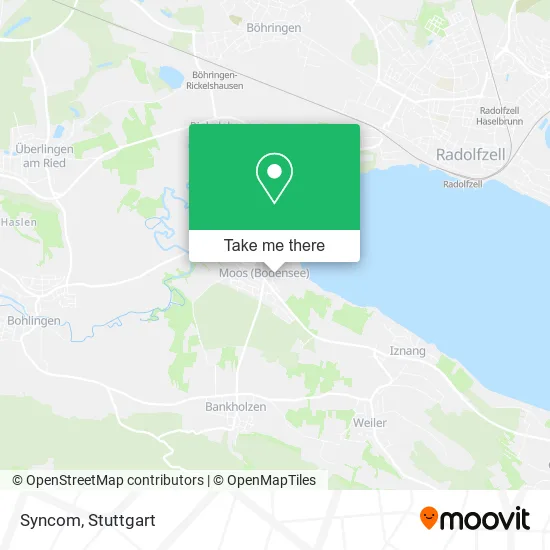
See Syncom, Verwaltungsgemeinschaft Höri, on the map
Public Transit to Syncom in Verwaltungsgemeinschaft Höri
Wondering how to get to Syncom in Verwaltungsgemeinschaft Höri? Moovit helps you find the best way to get to Syncom with step-by-step directions from the nearest public transit station.
Moovit provides free maps and live directions to help you navigate through your city. View schedules, routes, timetables, and find out how long does it take to get to Syncom in real time.
Looking for the nearest stop or station to Syncom? Check out this list of stops closest to your destination: Moos (Kr. Kn) Mooswaldstraße; Moos (Kr. Kn) Bohlinger Straße; Radolfzell; Radolfzell Hafen; Radolfzell Bahnhof; Böhringen-Rickelhausen Bahnhof.
Train: RE3, S6, S61, SVG, RE4, RE2, RE4, RE4, RE 2, RE 3, RE 4, RB 31, 7.Bus: 200, 402, 200S, 201.Ferry: BAT.
Want to see if there’s another route that gets you there at an earlier time? Moovit helps you find alternative routes or times. Get directions from and directions to Syncom easily from the Moovit App or Website.
We make riding to Syncom easy, which is why over 1.5 million users, including users in Verwaltungsgemeinschaft Höri, trust Moovit as the best app for public transit. You don’t need to download an individual bus app or train app, Moovit is your all-in-one transit app that helps you find the best bus time or train time available.
For information on prices of bus, train and light rail, costs and ride fares to Syncom, please check the Moovit app.
Use the app to navigate to popular places including to the airport, hospital, stadium, grocery store, mall, coffee shop, school, college, and university.
Syncom Address: Rütistraße 1 78345 Moos street in Verwaltungsgemeinschaft Höri
- Tennisclub Moos,
- Naturheilpraxis Veronika M. Bruttel,
- Spielplatz Im Park,
- Dlrg Gruppe Moos,
- Ulrich Nesper,
- Ilona Roth,
- Bodensee-Forderungsmanagement,
- Gebhart Svenja Gartenplanung,
- B.B.T. Bauträger,
- Moos (Bodensee),
- Uwe Koch,
- Sonnenstudio Ooase,
- Frische Automat,
- Duventäster- Maier Gemüseanbau & Bunte Vielfalt,
- Höri Gemüse,
- Gemüseanbau & Bunte Vielfalt,
- Bodensee Harbour Apartments Halbinsel Höri Moos,
- Martin und Carmen Riedmüller Fliesengeschäft,
- Fliesenlegermeister,
- Heinz Scherle
Places Near Syncom (Verwaltungsgemeinschaft Höri)
- Klinikum Stuttgart - Katharinenhospital, Stuttgart-Mitte,
- Schleyerhalle, Bad Cannstatt,
- Marmorsaal Im Weissenburgpark, Stuttgart-Süd,
- Mettingen Eros-Center Puff Laufhaus, Esslingen Am Neckar,
- SI-Centrum, Möhringen,
- Hanns-Martin-Schleyer-Halle (Stuttgart Hans-Martin-Schleyerhalle), Bad Cannstatt,
- Mercedes-Benz Museum, Bad Cannstatt,
- Geilhaus Haus 33a, Reutlingen-Betzingen,
- Mercedes-Benz Museum (Mercedes Museum Stuttgart), Bad Cannstatt,
- Im Wizemann (Halle), Bad Cannstatt,
- Hauptbahnhof Stuttgart, Stuttgart-Mitte,
- Waldfriedhof, Degerloch,
- FlixBus Haltestelle, Stuttgart,
- Porsche Museum, Zuffenhausen,
- Pariser Platz Stuttgart, Stuttgart-Mitte,
- Wilhelma (U-Bahn Wilhelma), Bad Cannstatt,
- Gleis 101/102 (tief), Stuttgart-Mitte,
- Gasometer Pforzheim, Pforzheim,
- Hanns-Martin-Schleyer-Halle, Bad Cannstatt,
- Porsche-Arena, Bad Cannstatt
How to get to popular places in Stuttgart with public transit
Get around Verwaltungsgemeinschaft Höri by public transit!
Traveling around Verwaltungsgemeinschaft Höri has never been so easy. See step by step directions as you travel to any attraction, street or major public transit station. View bus and train schedules, arrival times, service alerts and detailed routes on a map, so you know exactly how to get to anywhere in Verwaltungsgemeinschaft Höri.
When traveling to any destination around Verwaltungsgemeinschaft Höri use Moovit's Live Directions with Get Off Notifications to know exactly where and how far to walk, how long to wait for your line, and how many stops are left. Moovit will alert you when it's time to get off — no need to constantly re-check whether yours is the next stop.
Wondering how to use public transit in Verwaltungsgemeinschaft Höri or how to pay for public transit in Verwaltungsgemeinschaft Höri? Moovit public transit app can help you navigate your way with public transit easily, and at minimum cost. It includes public transit fees, ticket prices, and costs. Looking for a map of Verwaltungsgemeinschaft Höri public transit lines? Moovit public transit app shows all public transit maps in Verwaltungsgemeinschaft Höri with all Bus, Train, Subway, Light Rail, Ferry, S-Bahn and Funicular routes and stops on an interactive map.
Stuttgart has 7 transit type(s), including: Bus, Train, Subway, Light Rail, Ferry, S-Bahn and Funicular, operated by several transit agencies, including SSB - Stadtbahn, SSB, SSB - Seilbahn / Zacke, S-Bahn Stuttgart, Rhein-Neckar-Verkehr GmbH (rnv), Karlsruher Verkehrsverbund, DB AG, DB Regiobus BW, Arverio Baden-Württemberg GmbH, DB RegioNetz Verkehrs GmbH Westfrankenbahn, DB Regio AG Baden-Württemberg, Südwestdeutsche Verkehrs-AG, DB Regio AG Mitte Region Hessen, DB and Bodensee-Oberschwaben-Bahn