Directions to Syndicate Screenprint Co. (Baltimore) with public transportation
The following transit lines have routes that pass near Syndicate Screenprint Co.
 Bus: 21, 22, 94.
- Metro: METRO.
- Light Rail: LIGHT RAILLINK.
How to get to Syndicate Screenprint Co. by bus?
Click on the bus route to see step by step directions with maps, line arrival times and updated time schedules.
From Walmart, Baltimore County
59 minFrom I-695 @ Exit 18 (Liberty Rd/MD 26), Baltimore County
41 minFrom Saint Agnes Hospital, Baltimore
41 minFrom I-83 Exit 16 (Timonium Road), Baltimore County
64 minFrom Towson Town Center, Baltimore County
41 minFrom Bwi2 Employee Shuttles, Baltimore
52 minFrom Hyatt Regency Baltimore Inner Harbor, Baltimore
39 minFrom University Of Maryland Baltimore (Umbc), Baltimore County
68 minFrom Light Rail-Timonium Fairgrounds, Baltimore County
75 minFrom Baltimore VA Medical Center, Baltimore
35 min
How to get to Syndicate Screenprint Co. by metro?
Click on the metro route to see step by step directions with maps, line arrival times and updated time schedules.
Bus stops near Syndicate Screenprint Co. in Baltimore
Light Rail stations near Syndicate Screenprint Co. in Baltimore
- Cold Spring Lane, 15 min walk,VIEW
Metro station near Syndicate Screenprint Co. in Baltimore
- Mondawmin Metro, 48 min walk,VIEW
Bus lines to Syndicate Screenprint Co. in Baltimore
What are the closest stations to Syndicate Screenprint Co.?
The closest stations to Syndicate Screenprint Co. are:
- Buena Vista Ave & 41st St Nb is 8 yards away, 1 min walk.
- 41st St & Buena Vista Ave Eb is 50 yards away, 1 min walk.
- Falls Rd & 42nd St Nb is 374 yards away, 5 min walk.
- Cold Spring Lane is 1237 yards away, 15 min walk.
- Mondawmin Metro is 4053 yards away, 48 min walk.
Which bus lines stop near Syndicate Screenprint Co.?
These bus lines stop near Syndicate Screenprint Co.: 21, 22.
Which metro line stops near Syndicate Screenprint Co.?
METRO (Towards Owing Mills)
Which light rail line stops near Syndicate Screenprint Co.?
LIGHT RAILLINK (Soutbound)
What’s the nearest light rail station to Syndicate Screenprint Co. in Baltimore?
The nearest light rail station to Syndicate Screenprint Co. in Baltimore is Cold Spring Lane. It’s a 15 min walk away.
What’s the nearest bus station to Syndicate Screenprint Co. in Baltimore?
The nearest bus stations to Syndicate Screenprint Co. in Baltimore are Buena Vista Ave & 41st St Nb and 41st St & Buena Vista Ave Eb. The closest one is a 1 min walk away.
What time is the first light rail to Syndicate Screenprint Co. in Baltimore?
The LIGHT RAILLINK is the first light rail that goes to Syndicate Screenprint Co. in Baltimore. It stops nearby at 4:26 AM.
What time is the last light rail to Syndicate Screenprint Co. in Baltimore?
The LIGHT RAILLINK is the last light rail that goes to Syndicate Screenprint Co. in Baltimore. It stops nearby at 12:47 AM.
What time is the first metro to Syndicate Screenprint Co. in Baltimore?
The METRO is the first metro that goes to Syndicate Screenprint Co. in Baltimore. It stops nearby at 4:58 AM.
What time is the last metro to Syndicate Screenprint Co. in Baltimore?
The METRO is the last metro that goes to Syndicate Screenprint Co. in Baltimore. It stops nearby at 12:17 AM.
What time is the first bus to Syndicate Screenprint Co. in Baltimore?
The 22 is the first bus that goes to Syndicate Screenprint Co. in Baltimore. It stops nearby at 3:50 AM.
What time is the last bus to Syndicate Screenprint Co. in Baltimore?
The 94 is the last bus that goes to Syndicate Screenprint Co. in Baltimore. It stops nearby at 2:48 AM.
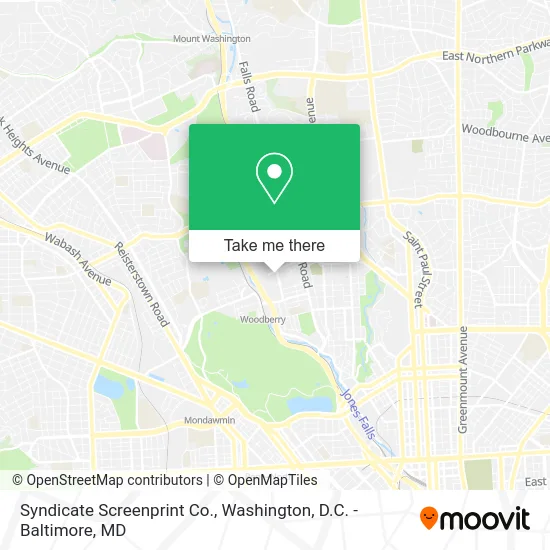
See Syndicate Screenprint Co., Baltimore, on the map
Public Transit to Syndicate Screenprint Co. in Baltimore
Wondering how to get to Syndicate Screenprint Co. in Baltimore? Moovit helps you find the best way to get to Syndicate Screenprint Co. with step-by-step directions from the nearest public transit station.
Moovit provides free maps and live directions to help you navigate through your city. View schedules, routes, timetables, and find out how long does it take to get to Syndicate Screenprint Co. in real time.
Looking for the nearest stop or station to Syndicate Screenprint Co.? Check out this list of stops closest to your destination: Buena Vista Ave & 41st St Nb; 41st St & Buena Vista Ave Eb; Falls Rd & 42nd St Nb; Cold Spring Lane; Mondawmin Metro.
Bus: 21, 22, 94.Metro: METRO.Light Rail: LIGHT RAILLINK.
Want to see if there’s another route that gets you there at an earlier time? Moovit helps you find alternative routes or times. Get directions from and directions to Syndicate Screenprint Co. easily from the Moovit App or Website.
We make riding to Syndicate Screenprint Co. easy, which is why over 1.5 million users, including users in Baltimore, trust Moovit as the best app for public transit. You don’t need to download an individual bus app or train app, Moovit is your all-in-one transit app that helps you find the best bus time or train time available.
For information on prices of bus, light rail and metro, costs and ride fares to Syndicate Screenprint Co., please check the Moovit app.
Use the app to navigate to popular places including to the airport, hospital, stadium, grocery store, mall, coffee shop, school, college, and university.
Syndicate Screenprint Co. Address: 4000 Buena Vista Ave Baltimore, MD 21211 street in Baltimore
- Je Transporte,
- Baltimore Fop3 Lounge,
- Fop Lodge,
- The Wine Collective,
- PP*Carroll & Son F,
- American Lock & Key,
- Baltimore Music Company,
- Carroll & Son Fine Food,
- Cutlass Velo,
- Hampden Auto Care,
- Jose, Alamiro,
- Airsource,
- Union Mill (Union Avenue Master Tenan),
- Orans,
- Slimtech,
- Stay Humble Tattoo Company,
- The Space Within Reiki,
- Outlast Health and Performance,
- Xavier,
- Falls Rd (41st st & falls rd)
Places Near Syndicate Screenprint Co. (Baltimore)
- Washington National Cathedral, Washington,
- Rock Creek Tennis Center, Washington,
- The Anthem, Washington,
- Basilica of the National Shrine, Washington,
- Sibley Memorial Hospital, Washington,
- M&T Bank Stadium, Baltimore,
- National Museum of African American History and Culture, Washington,
- Georgetown, Washington,
- National Mall, Washington,
- Westfield Montgomery Mall, Montgomery County,
- Camden Yards, Baltimore,
- Pennsylvania Ave NW (3rd st and pennsylvania), Washington,
- Washington DC VA Medical Center, Washington,
- Amazon Hq2, Arlington County,
- Capital One Arena, Washington,
- National Zoo, Washington,
- PG Mall, Prince George's County,
- Marriott Marquis Washington, DC, Washington,
- Warner Theatre, Washington,
- Museum Of The Bible, Washington
How to get to popular places in Washington, D.C. - Baltimore, MD with public transit
Get around Baltimore by public transit!
Traveling around Baltimore has never been so easy. See step by step directions as you travel to any attraction, street or major public transit station. View bus and train schedules, arrival times, service alerts and detailed routes on a map, so you know exactly how to get to anywhere in Baltimore.
When traveling to any destination around Baltimore use Moovit's Live Directions with Get Off Notifications to know exactly where and how far to walk, how long to wait for your line, and how many stops are left. Moovit will alert you when it's time to get off — no need to constantly re-check whether yours is the next stop.
Wondering how to use public transit in Baltimore or how to pay for public transit in Baltimore? Moovit public transit app can help you navigate your way with public transit easily, and at minimum cost. It includes public transit fees, ticket prices, and costs. Looking for a map of Baltimore public transit lines? Moovit public transit app shows all public transit maps in Baltimore with all Bus, Train, Metro, Light Rail and Ferry routes and stops on an interactive map.
Washington, D.C. - Baltimore, MD has 5 transit type(s), including: Bus, Train, Metro, Light Rail and Ferry, operated by several transit agencies, including WMATA, Montgomery County Ride On, Fairfax Connector, TheBus, PRTC, DASH - Alexandria, Arlington Transit (ART), RTA of Central Maryland, MDOT MTA, MDOT MTA Light RailLink, MDOT MTA Commuter Bus, MDOT MTA Local Bus, FXBGO!, Virginia Railway Express (VRE) and MARC