How to get to Synergy Enterprises by bus?
Click on the bus route to see step by step directions with maps, line arrival times and updated time schedules.
From The Fillmore Silver Spring, Montgomery County
44 minFrom I-270 Exit 9A/B (I-370 / Sam Eig Hwy. Interchange), Montgomery County
79 minFrom 5454 Wisconsin, Montgomery County
74 minFrom Bullis School, Montgomery County
47 minFrom Adventist HealthCare Shady Grove Medical Center, Montgomery County
52 minFrom Avalon Theatre, Washington
70 minFrom Clyde's of Chevy Chase, Montgomery County
71 minFrom National Institutes of Health (NIH), Montgomery County
35 minFrom Walter Reed National Military Medical Center, Montgomery County
35 minFrom Carderock Division of the Naval Surface Warfare Center, Montgomery County
82 min
How to get to Synergy Enterprises by metro?
Click on the metro route to see step by step directions with maps, line arrival times and updated time schedules.
From The Fillmore Silver Spring, Montgomery County
70 minFrom 5454 Wisconsin, Montgomery County
36 minFrom Avalon Theatre, Washington
44 minFrom Clyde's of Chevy Chase, Montgomery County
32 minFrom National Institutes of Health (NIH), Montgomery County
31 minFrom Walter Reed National Military Medical Center, Montgomery County
32 min
Bus stops near Synergy Enterprises in Montgomery County
Metro station near Synergy Enterprises in Montgomery County
- Twinbrook - Parklawn Dr &Amp; Wicomico Ave, 34 min walk,VIEW
Train stations near Synergy Enterprises in Montgomery County
Bus lines to Synergy Enterprises in Montgomery County
What are the closest stations to Synergy Enterprises?
The closest stations to Synergy Enterprises are:
- Executive Blvd & Old Georgetown Rd is 39 yards away, 1 min walk.
- Montrose Rd & Jefferson St is 237 yards away, 3 min walk.
- Twinbrook - Parklawn Dr &Amp; Wicomico Ave is 2884 yards away, 34 min walk.
- Garrett Park Marc Eb is 4201 yards away, 50 min walk.
- Rockville - S Stonestreet Ave &Amp; Park Rd is 4414 yards away, 52 min walk.
Which bus lines stop near Synergy Enterprises?
These bus lines stop near Synergy Enterprises: 26, 42, 5, 81.
Which metro line stops near Synergy Enterprises?
RED (Shady Grove)
What’s the nearest bus station to Synergy Enterprises in Montgomery County?
The nearest bus station to Synergy Enterprises in Montgomery County is Executive Blvd & Old Georgetown Rd. It’s a 1 min walk away.
What time is the first metro to Synergy Enterprises in Montgomery County?
The RED is the first metro that goes to Synergy Enterprises in Montgomery County. It stops nearby at 5:04 AM.
What time is the last metro to Synergy Enterprises in Montgomery County?
The RED is the last metro that goes to Synergy Enterprises in Montgomery County. It stops nearby at 12:36 AM.
What time is the first train to Synergy Enterprises in Montgomery County?
The MARC is the first train that goes to Synergy Enterprises in Montgomery County. It stops nearby at 5:39 AM.
What time is the last train to Synergy Enterprises in Montgomery County?
The MARC is the last train that goes to Synergy Enterprises in Montgomery County. It stops nearby at 7:50 PM.
What time is the first bus to Synergy Enterprises in Montgomery County?
The 26 is the first bus that goes to Synergy Enterprises in Montgomery County. It stops nearby at 4:34 AM.
What time is the last bus to Synergy Enterprises in Montgomery County?
The 5 is the last bus that goes to Synergy Enterprises in Montgomery County. It stops nearby at 1:41 AM.
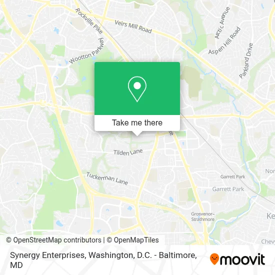
See Synergy Enterprises, Montgomery County, on the map
Public Transit to Synergy Enterprises in Montgomery County
Wondering how to get to Synergy Enterprises in Montgomery County? Moovit helps you find the best way to get to Synergy Enterprises with step-by-step directions from the nearest public transit station.
Moovit provides free maps and live directions to help you navigate through your city. View schedules, routes, timetables, and find out how long does it take to get to Synergy Enterprises in real time.
Looking for the nearest stop or station to Synergy Enterprises? Check out this list of stops closest to your destination: Executive Blvd & Old Georgetown Rd; Montrose Rd & Jefferson St; Twinbrook - Parklawn Dr &Amp; Wicomico Ave; Garrett Park Marc Eb; Rockville - S Stonestreet Ave &Amp; Park Rd.
Bus: 26, 42, 5, 81.Train: MARC, FLORIDIAN.Metro: RED.
Want to see if there’s another route that gets you there at an earlier time? Moovit helps you find alternative routes or times. Get directions from and directions to Synergy Enterprises easily from the Moovit App or Website.
We make riding to Synergy Enterprises easy, which is why over 1.7 million users, including users in Montgomery County, trust Moovit as the best app for public transit. You don’t need to download an individual bus app or train app, Moovit is your all-in-one transit app that helps you find the best bus time or train time available.
For information on prices of bus and metro, costs and ride fares to Synergy Enterprises, please check the Moovit app.
Use the app to navigate to popular places including to the airport, hospital, stadium, grocery store, mall, coffee shop, school, college, and university.
Synergy Enterprises Address: 6116 Executive Blvd street in Montgomery County
- 6110 Executive Blvd,
- Booz Allen Hamilton,
- Kaiser Permanente Regional Headquarters,
- Edward Jones - Financial Advisor: Aleksandr Udovenko,
- Luxmanor Elementary School,
- JCC Of Greater Washington,
- Pike & Rose (Pike and Rose),
- Pike & Rose Block 11 / 10 (Colonial Parking Lot #795),
- iPic Pike & Rose,
- Pike & Rose Parking,
- Pinstripes,
- Pony Power Wash,
- Ipic,
- Kyoto Matcha,
- iPic Theater,
- Fogo De Chão,
- Fogo de Chão Brazilian Steakhouse,
- Canopy-Washington DC Bethesda North,
- Kennedy Shriver Aquatic Center,
- Caruso's Grocery Pike and Rose
Places Near Synergy Enterprises (Montgomery County)
- Georgetown, Washington,
- Camden Yards, Baltimore,
- Capital One Arena, Washington,
- Pennsylvania Ave NW (3rd st and pennsylvania), Washington,
- Warner Theatre, Washington,
- M&T Bank Stadium, Baltimore,
- Westfield Montgomery Mall, Montgomery County,
- Marriott Marquis Washington, DC, Washington,
- Rock Creek Tennis Center, Washington,
- Sibley Memorial Hospital, Washington,
- Basilica of the National Shrine, Washington,
- National Museum of African American History and Culture, Washington,
- The Anthem, Washington,
- Washington National Cathedral, Washington,
- Washington DC VA Medical Center, Washington,
- PG Mall, Prince George's County,
- Amazon Hq2, Arlington County,
- Museum Of The Bible, Washington,
- National Zoo, Washington,
- National Theatre, Washington
How to get to popular places in Washington, D.C. - Baltimore, MD with public transit
Get around Montgomery County by public transit!
Traveling around Montgomery County has never been so easy. See step by step directions as you travel to any attraction, street or major public transit station. View bus and train schedules, arrival times, service alerts and detailed routes on a map, so you know exactly how to get to anywhere in Montgomery County.
When traveling to any destination around Montgomery County use Moovit's Live Directions with Get Off Notifications to know exactly where and how far to walk, how long to wait for your line, and how many stops are left. Moovit will alert you when it's time to get off — no need to constantly re-check whether yours is the next stop.
Wondering how to use public transit in Montgomery County or how to pay for public transit in Montgomery County? Moovit public transit app can help you navigate your way with public transit easily, and at minimum cost. It includes public transit fees, ticket prices, and costs. Looking for a map of Montgomery County public transit lines? Moovit public transit app shows all public transit maps in Montgomery County with all Bus, Train, Metro, Light Rail and Ferry routes and stops on an interactive map.
Washington, D.C. - Baltimore, MD has 5 transit type(s), including: Bus, Train, Metro, Light Rail and Ferry, operated by several transit agencies, including WMATA, Montgomery County Ride On, Fairfax Connector, TheBus, PRTC, DASH - Alexandria, Arlington Transit (ART), RTA of Central Maryland, MDOT MTA, MDOT MTA Light RailLink, MDOT MTA Commuter Bus, MDOT MTA Local Bus, FXBGO!, Virginia Railway Express (VRE) and MARC