How to get to Synernet by bus?
Click on the bus route to see step by step directions with maps, line arrival times and updated time schedules.
Bus stops near Synernet in Portland, ME
- St John St + 274 St John St, 3 min walk,VIEW
- St John St, 3 min walk,VIEW
- Congress + Union Square Plaza, 5 min walk,VIEW
- St John St + 325 St John St, 5 min walk,VIEW
- City Of Portland, 7 min walk,VIEW
- Congress St + Maine Med, 7 min walk,VIEW
- West St + Chadwick St, 7 min walk,VIEW
- Mercy at the Fore, 14 min walk,VIEW
Ferry station near Synernet in Portland, ME
- Casco Bay Lines Terminal, 55 min walk,VIEW
Train station near Synernet in Portland, ME
- Portland Station, 63 min walk,VIEW
Bus lines to Synernet in Portland, ME
- 1, Thompson's Point,VIEW
- 60, Saco Transportation Center,VIEW
- 7, Portland Jetport,VIEW
- 9B, Congress St + Maine Med,VIEW
- 5, Pulse,VIEW
- 9A, Cbhs Outbound,VIEW
- GREYHOUND US0265S, Boston (South Station),VIEW
- FLIXBUS N2615, New York Midtown (31st St & 8th Ave),VIEW
- BRZ, Brunswick Train Station,VIEW
- 8, Casco Bay Lines,VIEW
- 70, Forest Ave + Bedford St,VIEW
What are the closest stations to Synernet?
The closest stations to Synernet are:
- St John St + 274 St John St is 135 yards away, 3 min walk.
- St John St is 149 yards away, 3 min walk.
- Congress + Union Square Plaza is 359 yards away, 5 min walk.
- St John St + 325 St John St is 362 yards away, 5 min walk.
- City Of Portland is 483 yards away, 7 min walk.
- Congress St + Maine Med is 483 yards away, 7 min walk.
- West St + Chadwick St is 500 yards away, 7 min walk.
- Mercy at the Fore is 1158 yards away, 14 min walk.
- Casco Bay Lines Terminal is 4631 yards away, 55 min walk.
- Portland Station is 5364 yards away, 63 min walk.
Which bus lines stop near Synernet?
These bus lines stop near Synernet: 60, 7, 9A.
What’s the nearest bus station to Synernet in Portland, ME?
The nearest bus stations to Synernet in Portland, ME are St John St + 274 St John St and St John St. The closest one is a 3 min walk away.
What time is the first train to Synernet in Portland, ME?
The DOWNEASTER is the first train that goes to Synernet in Portland, ME. It stops nearby at 5:18 AM.
What time is the last train to Synernet in Portland, ME?
The DOWNEASTER is the last train that goes to Synernet in Portland, ME. It stops nearby at 1:00 AM.
What time is the first bus to Synernet in Portland, ME?
The 1 is the first bus that goes to Synernet in Portland, ME. It stops nearby at 5:05 AM.
What time is the last bus to Synernet in Portland, ME?
The FLIXBUS N2615 is the last bus that goes to Synernet in Portland, ME. It stops nearby at 7:15 AM.
What time is the first ferry to Synernet in Portland, ME?
The DB is the first ferry that goes to Synernet in Portland, ME. It stops nearby at 5:00 AM.
What time is the last ferry to Synernet in Portland, ME?
The PK is the last ferry that goes to Synernet in Portland, ME. It stops nearby at 11:10 PM.
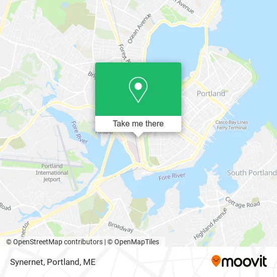
See Synernet, Portland, ME, on the map
Public Transit to Synernet in Portland, ME
Wondering how to get to Synernet in Portland, ME? Moovit helps you find the best way to get to Synernet with step-by-step directions from the nearest public transit station.
Moovit provides free maps and live directions to help you navigate through your city. View schedules, routes, timetables, and find out how long does it take to get to Synernet in real time.
Looking for the nearest stop or station to Synernet? Check out this list of stops closest to your destination: St John St + 274 St John St; St John St; Congress + Union Square Plaza; St John St + 325 St John St; City Of Portland; Congress St + Maine Med; West St + Chadwick St; Mercy at the Fore; Casco Bay Lines Terminal; Portland Station.
Bus: 60, 7, 9A, 1, 9B, 5.Train: DOWNEASTER.Ferry: DB, IB, PK.
Want to see if there’s another route that gets you there at an earlier time? Moovit helps you find alternative routes or times. Get directions from and directions to Synernet easily from the Moovit App or Website.
We make riding to Synernet easy, which is why over 1.5 million users, including users in Portland, ME, trust Moovit as the best app for public transit. You don’t need to download an individual bus app or train app, Moovit is your all-in-one transit app that helps you find the best bus time or train time available.
For information on prices of bus and ferry, costs and ride fares to Synernet, please check the Moovit app.
Use the app to navigate to popular places including to the airport, hospital, stadium, grocery store, mall, coffee shop, school, college, and university.
Synernet Address: 222 Saint John St Portland, ME 04102 street in Portland, ME
- New Leaves,
- Opportunity for Change,
- Bearded Brewfest,
- Maine Central Railroad General Office Building,
- Portland Hypnotherapy,
- Dragonfly Taijiquan,
- McChristian Christina L,
- Blais Valerie Neuromuscular Therapy,
- Stevens Reid D,
- Polished Nail Salon,
- Maine Narrow Gage Railroad & M,
- Maine Resource Development Cor,
- Rent with US,
- Ancient Pathways Massage (Craven Mary Massage Therapist),
- Ancient Pathways Massage,
- The Holy Donut,
- Thomas Stephen P,
- Mainely Property Management,
- Paulin's Tire & Auto Care,
- D & M Automotive Services
Places Near Synernet (Portland, ME)
- Walmart,
- Fort Williams Park, Cape Elizabeth,
- Portland Transportation Center,
- Walmart Scarborough Supercenter,
- The Old Port,
- Southern Maine Community College, South Portland,
- Clarion Hotel Portland,
- Cross Insurance Arena,
- L. L. Bean Outlet,
- Fort Gorges,
- Cape Elizabeth, ME, Cape Elizabeth,
- On a bus to Kennebunkport,
- House Island,
- Mercy Hospital - Fore River Campus,
- Casco Bay Ferry Terminal,
- Maine Medical Center,
- Portland International Jetport (PWM) (Portland International Jetport),
- Jewell Island,
- ZzZzZzZzZzZ, Westbrook,
- Exit 45 Park And Ride, South Portland
How to get to popular places in Portland, ME with public transit
Get around Portland, ME by public transit!
Traveling around Portland, ME has never been so easy. See step by step directions as you travel to any attraction, street or major public transit station. View bus and train schedules, arrival times, service alerts and detailed routes on a map, so you know exactly how to get to anywhere in Portland, ME.
When traveling to any destination around Portland, ME use Moovit's Live Directions with Get Off Notifications to know exactly where and how far to walk, how long to wait for your line, and how many stops are left. Moovit will alert you when it's time to get off — no need to constantly re-check whether yours is the next stop.
Wondering how to use public transit in Portland, ME or how to pay for public transit in Portland, ME? Moovit public transit app can help you navigate your way with public transit easily, and at minimum cost. It includes public transit fees, ticket prices, and costs. Looking for a map of Portland, ME public transit lines? Moovit public transit app shows all public transit maps in Portland, ME with all Bus, Train and Ferry routes and stops on an interactive map.
Portland, ME has 3 transit type(s), including: Bus, Train and Ferry, operated by several transit agencies, including Greater Portland Metro, City of South Portland, Biddeford Saco Old Orchard Beach Transit, Casco Bay Lines, Amtrak, Greyhound-us and FlixBus-us