How to get to Sysdataperu E.I.R.L by bus?
Click on the bus route to see step by step directions with maps, line arrival times and updated time schedules.
From Surco, Santiago D
69 minFrom Av. Santa Anita, Chorrillos
47 minFrom Av Defensores del Morro, Chorrillos
58 minFrom Cuartel General Del Ejercito, San Borja
52 minFrom I. E. Mercedes Indacochea, Barranco
61 minFrom LOS CEDROS DE VILLA CHORRILLOS, Chorrillos
63 minFrom Av Raul Ferrero, La Molina
73 minFrom Parque Ecológico Voces Por El Clima, Santiago D
52 min
How to get to Sysdataperu E.I.R.L by metro?
Click on the metro route to see step by step directions with maps, line arrival times and updated time schedules.
Bus stops near Sysdataperu E.I.R.L in Villa Mari
Metro station near Sysdataperu E.I.R.L in Villa Mari
- Miguel Iglesias, 30 min walk,VIEW
Bus lines to Sysdataperu E.I.R.L in Villa Mari
- 1060, Campoy (San Juan De Lurigancho) - Nueva Esperanza (Villa María Del Triunfo),VIEW
- 1100, Huaycan (Ate) - Las Palmas (Pachacamac),VIEW
- 1123, José Gálvez (Villa María Del Triunfo) - Parque Kennedy (Miraflores),VIEW
- 1127, Surquillo - Lurin,VIEW
- 1398, S.J.M - Punta Hermosa,VIEW
- 1417, Pachacamac - V.M.T.,VIEW
- 7804, V.M.T. - S.J.M.,VIEW
- 8701, Pachacamac - S.J.M,VIEW
- 8711, Lurín - Surquillo,VIEW
- 8715, Via Expresa P.Republica (Surquillo),VIEW
- NH109B, Manchay (Pachacamac),VIEW
- 8892, V.E.S. - V.M.T.,VIEW
- 7803, V.M.T - S.J.M,VIEW
What are the closest stations to Sysdataperu E.I.R.L?
The closest stations to Sysdataperu E.I.R.L are:
- Ramiro Merino is 530 meters away, 7 min walk.
- Avenida Los Eucaliptos is 942 meters away, 13 min walk.
- Pajaten is 1253 meters away, 17 min walk.
- Miguel Iglesias is 2346 meters away, 30 min walk.
Which bus lines stop near Sysdataperu E.I.R.L?
These bus lines stop near Sysdataperu E.I.R.L: 1060, 1100, 1123, 1417, 8711.
Which metro line stops near Sysdataperu E.I.R.L?
LINEA 1 (Bayóvar (San Juan De Lurigancho) - Separadora Industrial (Villa El Salvador))
What’s the nearest metro station to Sysdataperu E.I.R.L in Villa Mari?
The nearest metro station to Sysdataperu E.I.R.L in Villa Mari is Miguel Iglesias. It’s a 30 min walk away.
What’s the nearest bus station to Sysdataperu E.I.R.L in Villa Mari?
The nearest bus station to Sysdataperu E.I.R.L in Villa Mari is Ramiro Merino. It’s a 7 min walk away.
What time is the first metro to Sysdataperu E.I.R.L in Villa Mari?
The LINEA 1 is the first metro that goes to Sysdataperu E.I.R.L in Villa Mari. It stops nearby at 5:00 AM.
What time is the last metro to Sysdataperu E.I.R.L in Villa Mari?
The LINEA 1 is the last metro that goes to Sysdataperu E.I.R.L in Villa Mari. It stops nearby at 10:47 PM.
What time is the first bus to Sysdataperu E.I.R.L in Villa Mari?
The 1100 is the first bus that goes to Sysdataperu E.I.R.L in Villa Mari. It stops nearby at 3:57 AM.
What time is the last bus to Sysdataperu E.I.R.L in Villa Mari?
The 1417 is the last bus that goes to Sysdataperu E.I.R.L in Villa Mari. It stops nearby at 12:27 AM.
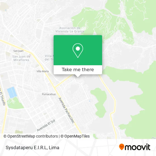
See Sysdataperu E.I.R.L, Villa Mari, on the map
Public Transit to Sysdataperu E.I.R.L in Villa Mari
Wondering how to get to Sysdataperu E.I.R.L in Villa Mari? Moovit helps you find the best way to get to Sysdataperu E.I.R.L with step-by-step directions from the nearest public transit station.
Moovit provides free maps and live directions to help you navigate through your city. View schedules, routes, timetables, and find out how long does it take to get to Sysdataperu E.I.R.L in real time.
Looking for the nearest stop or station to Sysdataperu E.I.R.L? Check out this list of stops closest to your destination: Ramiro Merino; Avenida Los Eucaliptos; Pajaten; Miguel Iglesias.
Bus: 1060, 1100, 1123, 1417, 8711, 1127, 1398, 8892, 7803.Metro: LINEA 1.
Want to see if there’s another route that gets you there at an earlier time? Moovit helps you find alternative routes or times. Get directions from and directions to Sysdataperu E.I.R.L easily from the Moovit App or Website.
We make riding to Sysdataperu E.I.R.L easy, which is why over 1.5 million users, including users in Villa Mari, trust Moovit as the best app for public transit. You don’t need to download an individual bus app or train app, Moovit is your all-in-one transit app that helps you find the best bus time or train time available.
For information on prices of bus and metro, costs and ride fares to Sysdataperu E.I.R.L, please check the Moovit app.
Use the app to navigate to popular places including to the airport, hospital, stadium, grocery store, mall, coffee shop, school, college, and university.
Sysdataperu E.I.R.L Address: Jirón 3 de Octubre Urb. Nueva Esperanza, 15818 Villa María del Triunfo street in Villa Mari
- Comité 26C,
- Casas Hogares Remar Vmt,
- Ramiro Prialé,
- Market E S Saimon,
- Arco Iris,
- Colegio 6014,
- Agencia Municipal de Nueva Esperanza,
- Centro Civico Nueva Esperanza,
- I. E. P. Santa Ana,
- Avenida 26 de Noviembre,
- Institución Educativa Inicial No. 524,
- I. E. P. Mi Pequeño Manuelito,
- 26 DE NOVIEMBRE NUEVA ESPERANZA,
- Avenida 26 de Noviembre,
- Demuna - Agencia Municipal Nueva Esperanza,
- Institución Educativa 6011 Santisima Virgen De Fatima,
- Nueva Esperanza Comité 22 A1,
- Policlínico Parroquial Nuestra Señora de la Esperanza,
- Ex-Comisaría Nueva Esperanza,
- Parque Bellavista - Nva Esperanza
Places Near Sysdataperu E.I.R.L (Villa Mari)
- Hospital Edgardo Rebagliati Martins, Jesus Mari,
- Av. La Marina, San Miguel,
- Barranco, Barranco,
- Av. Salaverry, Jesus Mari,
- Real Plaza Puruchuco, Ate,
- Jockey Plaza, Santiago D,
- Aeropuerto Internacional Jorge Chávez, Ventanilla,
- Miraflores, Miraflores,
- Pontificia Universidad Católica del Perú - PUCP, San Miguel,
- Mall Del Sur,
- Paradero Av.Brasil,
- av arequipa, Lima,
- Parque Kennedy, Miraflores,
- Centro Comercial Plaza Norte, Independen,
- Gamarra,
- Av. Abancay, Lima,
- Plaza San Miguel, San Miguel,
- Circuito Mágico Del Agua, Lima,
- Larcomar, Miraflores,
- Parque de las Leyendas, San Miguel
How to get to popular places in Lima with public transit
Get around Villa Mari by public transit!
Traveling around Villa Mari has never been so easy. See step by step directions as you travel to any attraction, street or major public transit station. View bus and train schedules, arrival times, service alerts and detailed routes on a map, so you know exactly how to get to anywhere in Villa Mari.
When traveling to any destination around Villa Mari use Moovit's Live Directions with Get Off Notifications to know exactly where and how far to walk, how long to wait for your line, and how many stops are left. Moovit will alert you when it's time to get off — no need to constantly re-check whether yours is the next stop.
Wondering how to use public transit in Villa Mari or how to pay for public transit in Villa Mari? Moovit public transit app can help you navigate your way with public transit easily, and at minimum cost. It includes public transit fees, ticket prices, and costs. Looking for a map of Villa Mari public transit lines? Moovit public transit app shows all public transit maps in Villa Mari with all Bus, Metro and Ferry routes and stops on an interactive map.
Lima has 3 transit type(s), including: Bus, Metro and Ferry, operated by several transit agencies, including Metro de Lima Línea 2 , Metro de Lima, Corredor Rojo, Metropolitano, Metropolitano - Alimentadores, Corredor Morado, Corredor Azul, Rutas Tradicionales, Transportes y Servicios La Esperanza S.A., Las Flores S.A., Virgen de la Asunción S.A., Consorcio HAM, Transportes y Service Canadá S.A., ETUL4SA and ETUCHISA