How to get to System 1 by bus?
Click on the bus route to see step by step directions with maps, line arrival times and updated time schedules.
From Ruff N Ready Crab House, Prince George's County
75 minFrom Eastern Middle School, Montgomery County
57 minFrom Thomas S Wootton High School, Montgomery County
57 minFrom IHOP, Washington
69 minFrom Fda White Oak Campus, Montgomery County
81 minFrom Mt. Pleasant, Washington
69 minFrom Nordstrom Rack Friendship Center, Washington
36 minFrom Park Potomac Place, Montgomery County
35 minFrom Mama Ayesha's, Washington
73 minFrom McLean Gardens, Washington
55 min
How to get to System 1 by metro?
Click on the metro route to see step by step directions with maps, line arrival times and updated time schedules.
Bus stops near System 1 in Montgomery County
Bus lines to System 1 in Montgomery County
What are the closest stations to System 1?
The closest stations to System 1 are:
- Rockville Pike & Cedar Ln is 67 yards away, 2 min walk.
- Rockville Pike & North Dr is 447 yards away, 6 min walk.
- Cedar Ln+Cedarcrest Dr is 459 yards away, 6 min walk.
- North Bethesda is 2374 yards away, 29 min walk.
Which bus lines stop near System 1?
These bus lines stop near System 1: 34, 46, J2.
Which metro line stops near System 1?
METRORAIL RED LINE (Towards Shady Grove)
What’s the nearest bus station to System 1 in Montgomery County?
The nearest bus station to System 1 in Montgomery County is Rockville Pike & Cedar Ln. It’s a 2 min walk away.
What time is the first metro to System 1 in Montgomery County?
The METRORAIL RED LINE is the first metro that goes to System 1 in Montgomery County. It stops nearby at 5:09 AM.
What time is the last metro to System 1 in Montgomery County?
The METRORAIL RED LINE is the last metro that goes to System 1 in Montgomery County. It stops nearby at 12:33 AM.
What time is the first train to System 1 in Montgomery County?
The MARC is the first train that goes to System 1 in Montgomery County. It stops nearby at 5:45 AM.
What time is the last train to System 1 in Montgomery County?
The MARC is the last train that goes to System 1 in Montgomery County. It stops nearby at 7:45 PM.
What time is the first bus to System 1 in Montgomery County?
The J2 is the first bus that goes to System 1 in Montgomery County. It stops nearby at 5:11 AM.
What time is the last bus to System 1 in Montgomery County?
The J2 is the last bus that goes to System 1 in Montgomery County. It stops nearby at 2:22 AM.
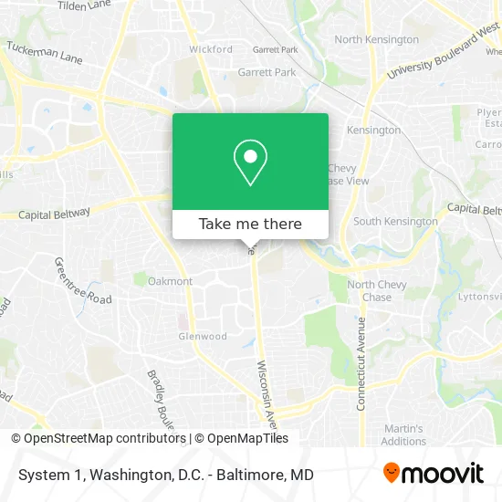
See System 1, Montgomery County, on the map
Public Transit to System 1 in Montgomery County
Wondering how to get to System 1 in Montgomery County? Moovit helps you find the best way to get to System 1 with step-by-step directions from the nearest public transit station.
Moovit provides free maps and live directions to help you navigate through your city. View schedules, routes, timetables, and find out how long does it take to get to System 1 in real time.
Looking for the nearest stop or station to System 1? Check out this list of stops closest to your destination: Rockville Pike & Cedar Ln; Rockville Pike & North Dr; Cedar Ln+Cedarcrest Dr; North Bethesda.
Bus: 34, 46, J2, 30, 70, M70, RED.Metro: METRORAIL RED LINE.
Want to see if there’s another route that gets you there at an earlier time? Moovit helps you find alternative routes or times. Get directions from and directions to System 1 easily from the Moovit App or Website.
We make riding to System 1 easy, which is why over 1.5 million users, including users in Montgomery County, trust Moovit as the best app for public transit. You don’t need to download an individual bus app or train app, Moovit is your all-in-one transit app that helps you find the best bus time or train time available.
For information on prices of bus and metro, costs and ride fares to System 1, please check the Moovit app.
Use the app to navigate to popular places including to the airport, hospital, stadium, grocery store, mall, coffee shop, school, college, and university.
System 1 Address: 4905 Cedar Croft Dr Bethesda, MD 20814 street in Montgomery County
- USPS,
- Bethesda Bathroom Remodeling,
- Cedar Lane,
- Nih,
- The Coffee Place,
- Ft Detrick,
- US Department of Health and Human Services National Institutes of Health,
- Lot 4a - Nih,
- Rakusin & Becker MGT,
- Soypher Howard B,
- Widdes Steven A,
- IA Donoso Associates,
- Suntrust Bank,
- Weaver Patricia M,
- Warner Construction-Trailer 1,
- Stone Ridge School Of the Sacred Heart,
- Crossfit Daily Medicine,
- Consular Corps College,
- Rockville Pike & N Wood Rd,
- Walter Reed National Military Medical Center-NE
Places Near System 1 (Montgomery County)
- Georgetown, Washington,
- Rock Creek Tennis Center, Washington,
- Washington DC VA Medical Center, Washington,
- Warner Theatre, Washington,
- Washington National Cathedral, Washington,
- National Zoo, Washington,
- PG Mall, Prince George's County,
- Marriott Marquis Washington, DC, Washington,
- National Museum of African American History and Culture, Washington,
- Capital One Arena, Washington,
- Camden Yards, Baltimore,
- The Anthem, Washington,
- Basilica of the National Shrine, Washington,
- Amazon Hq2, Arlington County,
- National Theatre, Washington,
- Museum Of The Bible, Washington,
- Pennsylvania Ave NW (3rd st and pennsylvania), Washington,
- M&T Bank Stadium, Baltimore,
- Westfield Montgomery Mall, Montgomery County,
- Sibley Memorial Hospital, Washington
How to get to popular places in Washington, D.C. - Baltimore, MD with public transit
Get around Montgomery County by public transit!
Traveling around Montgomery County has never been so easy. See step by step directions as you travel to any attraction, street or major public transit station. View bus and train schedules, arrival times, service alerts and detailed routes on a map, so you know exactly how to get to anywhere in Montgomery County.
When traveling to any destination around Montgomery County use Moovit's Live Directions with Get Off Notifications to know exactly where and how far to walk, how long to wait for your line, and how many stops are left. Moovit will alert you when it's time to get off — no need to constantly re-check whether yours is the next stop.
Wondering how to use public transit in Montgomery County or how to pay for public transit in Montgomery County? Moovit public transit app can help you navigate your way with public transit easily, and at minimum cost. It includes public transit fees, ticket prices, and costs. Looking for a map of Montgomery County public transit lines? Moovit public transit app shows all public transit maps in Montgomery County with all Bus, Train, Metro, Light Rail and Ferry routes and stops on an interactive map.
Washington, D.C. - Baltimore, MD has 5 transit type(s), including: Bus, Train, Metro, Light Rail and Ferry, operated by several transit agencies, including WMATA, Montgomery County Ride On, Fairfax Connector, TheBus, PRTC, DASH - Alexandria, Arlington Transit (ART), RTA of Central Maryland, MDOT MTA, MDOT MTA Light RailLink, MDOT MTA Commuter Bus, MDOT MTA Local Bus, FXBGO!, Virginia Railway Express (VRE) and MARC