How to get to TAG by bus?
Click on the bus route to see step by step directions with maps, line arrival times and updated time schedules.
From Brazzers, Prince George's County
131 minFrom Annapolis Mall, Anne Arundel County
63 minFrom Pasadena, Maryland, Anne Arundel County
26 minFrom MVA Glen Burnie, Anne Arundel County
60 minFrom Glen Burnie, MD, Anne Arundel County
49 minFrom Amazon Fulfillment Center-DCA1, Baltimore County
187 minFrom Archbishop Spalding High School, Severn
89 min
Bus stops near TAG in Anne Arundel County
Bus lines to TAG in Anne Arundel County
What are the closest stations to TAG?
The closest stations to TAG are:
- College Pkwy & Peninsula Farm Rd Wb is 612 yards away, 8 min walk.
- Severna Park Park & Ride is 886 yards away, 11 min walk.
Which bus line stops near TAG?
70 (Annapolis)
What’s the nearest bus station to TAG in Anne Arundel County?
The nearest bus station to TAG in Anne Arundel County is College Pkwy & Peninsula Farm Rd Wb. It’s a 8 min walk away.
What time is the first bus to TAG in Anne Arundel County?
The 230 is the first bus that goes to TAG in Anne Arundel County. It stops nearby at 5:00 AM.
What time is the last bus to TAG in Anne Arundel County?
The 70 is the last bus that goes to TAG in Anne Arundel County. It stops nearby at 2:54 AM.
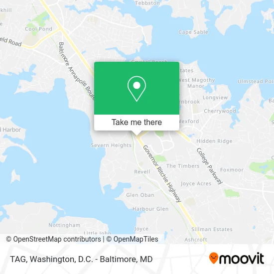
See TAG, Anne Arundel County, on the map
Public Transit to TAG in Anne Arundel County
Wondering how to get to TAG in Anne Arundel County? Moovit helps you find the best way to get to TAG with step-by-step directions from the nearest public transit station.
Moovit provides free maps and live directions to help you navigate through your city. View schedules, routes, timetables, and find out how long does it take to get to TAG in real time.
Looking for the nearest stop or station to TAG? Check out this list of stops closest to your destination: College Pkwy & Peninsula Farm Rd Wb; Severna Park Park & Ride.
Bus: 70, 230, 260.
Want to see if there’s another route that gets you there at an earlier time? Moovit helps you find alternative routes or times. Get directions from and directions to TAG easily from the Moovit App or Website.
We make riding to TAG easy, which is why over 1.5 million users, including users in Anne Arundel County, trust Moovit as the best app for public transit. You don’t need to download an individual bus app or train app, Moovit is your all-in-one transit app that helps you find the best bus time or train time available.
For information on prices of bus, light rail and train, costs and ride fares to TAG, please check the Moovit app.
Use the app to navigate to popular places including to the airport, hospital, stadium, grocery store, mall, coffee shop, school, college, and university.
TAG Address: 1244 Ritchie Hwy street in Anne Arundel County
- Ymca,
- G Menzies Kenneth Jr CPA,
- Tammys Cool Things,
- World Class Carpet Cleaning,
- Re Key Locksmith,
- DUNKIN',
- Kimmel Homes,
- Speech Matters,
- Gab Company,
- Gabriel V Castillo's Account,
- Physical Therapy Near Me,
- chick-fil-a on AACC campus,
- AACC CADE Art Gallery,
- Y of Central Maryland,
- Straw Albaugh Appraisals,
- Mental Health Services,
- Maryland Primary Care Physicians,
- Birthright of Annapolis,
- Privia Health,
- Ramona G Seidel MD
Places Near TAG (Anne Arundel County)
- National Museum of African American History and Culture, Washington,
- Sibley Memorial Hospital, Washington,
- Washington National Cathedral, Washington,
- Georgetown, Washington,
- Museum Of The Bible, Washington,
- Washington DC VA Medical Center, Washington,
- Capital One Arena, Washington,
- PG Mall, Prince George's County,
- Rock Creek Tennis Center, Washington,
- Camden Yards, Baltimore,
- Warner Theatre, Washington,
- Westfield Montgomery Mall, Montgomery County,
- The Anthem, Washington,
- National Theatre, Washington,
- Marriott Marquis Washington, DC, Washington,
- Amazon Hq2, Arlington County,
- M&T Bank Stadium, Baltimore,
- National Zoo, Washington,
- Pennsylvania Ave NW (3rd st and pennsylvania), Washington,
- Basilica of the National Shrine, Washington
How to get to popular places in Washington, D.C. - Baltimore, MD with public transit
Get around Anne Arundel County by public transit!
Traveling around Anne Arundel County has never been so easy. See step by step directions as you travel to any attraction, street or major public transit station. View bus and train schedules, arrival times, service alerts and detailed routes on a map, so you know exactly how to get to anywhere in Anne Arundel County.
When traveling to any destination around Anne Arundel County use Moovit's Live Directions with Get Off Notifications to know exactly where and how far to walk, how long to wait for your line, and how many stops are left. Moovit will alert you when it's time to get off — no need to constantly re-check whether yours is the next stop.
Wondering how to use public transit in Anne Arundel County or how to pay for public transit in Anne Arundel County? Moovit public transit app can help you navigate your way with public transit easily, and at minimum cost. It includes public transit fees, ticket prices, and costs. Looking for a map of Anne Arundel County public transit lines? Moovit public transit app shows all public transit maps in Anne Arundel County with all Bus, Train, Metro, Light Rail and Ferry routes and stops on an interactive map.
Washington, D.C. - Baltimore, MD has 5 transit type(s), including: Bus, Train, Metro, Light Rail and Ferry, operated by several transit agencies, including WMATA, Montgomery County Ride On, Fairfax Connector, TheBus, PRTC, DASH - Alexandria, Arlington Transit (ART), RTA of Central Maryland, MDOT MTA, MDOT MTA Light RailLink, MDOT MTA Commuter Bus, MDOT MTA Local Bus, FXBGO!, Virginia Railway Express (VRE) and MARC