How to get to TPSS Community Kitchen by bus?
Click on the bus route to see step by step directions with maps, line arrival times and updated time schedules.
From Longworth House Office Building, Washington
75 minFrom Rayburn House Office Building, Washington
75 minFrom American University, Washington
52 minFrom Hubert H. Humphrey Building, Washington
73 minFrom Cannon House Office Building, Washington
74 minFrom The Conrad, Washington
61 minFrom U.S. Department of Health and Human Services (HHS), Washington
74 minFrom Purple Patch Food and Drink, Washington
46 minFrom Echostage, Washington
48 minFrom AC Hotel by Marriott Washington DC Downtown (AC Hotel Washington DC Downtown), Washington
67 min
How to get to TPSS Community Kitchen by train?
Click on the train route to see step by step directions with maps, line arrival times and updated time schedules.
From Longworth House Office Building, Washington
70 minFrom Rayburn House Office Building, Washington
71 minFrom Hubert H. Humphrey Building, Washington
74 minFrom Cannon House Office Building, Washington
70 minFrom The Conrad, Washington
72 minFrom U.S. Department of Health and Human Services (HHS), Washington
73 min
How to get to TPSS Community Kitchen by metro?
Click on the metro route to see step by step directions with maps, line arrival times and updated time schedules.
From Longworth House Office Building, Washington
41 minFrom Rayburn House Office Building, Washington
43 minFrom AC Hotel by Marriott Washington DC Downtown (AC Hotel Washington DC Downtown), Washington
33 minFrom American University, Washington
59 minFrom Hubert H. Humphrey Building, Washington
41 minFrom Cannon House Office Building, Washington
41 minFrom The Conrad, Washington
32 minFrom U.S. Department of Health and Human Services (HHS), Washington
40 minFrom Purple Patch Food and Drink, Washington
28 min
Bus stops near TPSS Community Kitchen in Montgomery County
Metro stations near TPSS Community Kitchen in Montgomery County
Train station near TPSS Community Kitchen in Montgomery County
- Silver Spring Marc Eb, 54 min walk,VIEW
Bus lines to TPSS Community Kitchen in Montgomery County
What are the closest stations to TPSS Community Kitchen?
The closest stations to TPSS Community Kitchen are:
- Maple Ave & Tulip Ave is 84 yards away, 2 min walk.
- Carroll Ave & Maple Ave is 373 yards away, 5 min walk.
- Eastern Av+Laurel Av is 551 yards away, 7 min walk.
- Takoma is 3244 yards away, 39 min walk.
- Silver Spring Marc Eb is 4573 yards away, 54 min walk.
- Fort Totten is 4786 yards away, 57 min walk.
Which bus lines stop near TPSS Community Kitchen?
These bus lines stop near TPSS Community Kitchen: C75, D5X, P42.
Which train line stops near TPSS Community Kitchen?
MARC (Inbound - Brunswick)
Which metro line stops near TPSS Community Kitchen?
RED (Glenmont)
What’s the nearest bus station to TPSS Community Kitchen in Montgomery County?
The nearest bus station to TPSS Community Kitchen in Montgomery County is Maple Ave & Tulip Ave. It’s a 2 min walk away.
What time is the first metro to TPSS Community Kitchen in Montgomery County?
The RED is the first metro that goes to TPSS Community Kitchen in Montgomery County. It stops nearby at 5:10 AM.
What time is the last metro to TPSS Community Kitchen in Montgomery County?
The GREEN is the last metro that goes to TPSS Community Kitchen in Montgomery County. It stops nearby at 12:30 AM.
What time is the first train to TPSS Community Kitchen in Montgomery County?
The MARC is the first train that goes to TPSS Community Kitchen in Montgomery County. It stops nearby at 5:51 AM.
What time is the last train to TPSS Community Kitchen in Montgomery County?
The MARC is the last train that goes to TPSS Community Kitchen in Montgomery County. It stops nearby at 7:37 PM.
What time is the first bus to TPSS Community Kitchen in Montgomery County?
The 16 is the first bus that goes to TPSS Community Kitchen in Montgomery County. It stops nearby at 4:26 AM.
What time is the last bus to TPSS Community Kitchen in Montgomery County?
The 16 is the last bus that goes to TPSS Community Kitchen in Montgomery County. It stops nearby at 1:46 AM.
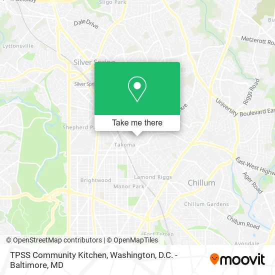
See TPSS Community Kitchen, Montgomery County, on the map
Public Transit to TPSS Community Kitchen in Montgomery County
Wondering how to get to TPSS Community Kitchen in Montgomery County? Moovit helps you find the best way to get to TPSS Community Kitchen with step-by-step directions from the nearest public transit station.
Moovit provides free maps and live directions to help you navigate through your city. View schedules, routes, timetables, and find out how long does it take to get to TPSS Community Kitchen in real time.
Looking for the nearest stop or station to TPSS Community Kitchen? Check out this list of stops closest to your destination: Maple Ave & Tulip Ave; Carroll Ave & Maple Ave; Eastern Av+Laurel Av; Takoma; Silver Spring Marc Eb; Fort Totten.
Bus: C75, D5X, P42, 25, 12, 13, 16, 18, C77.Train: MARC.Metro: RED, GREEN, YELLOW.
Want to see if there’s another route that gets you there at an earlier time? Moovit helps you find alternative routes or times. Get directions from and directions to TPSS Community Kitchen easily from the Moovit App or Website.
We make riding to TPSS Community Kitchen easy, which is why over 1.5 million users, including users in Montgomery County, trust Moovit as the best app for public transit. You don’t need to download an individual bus app or train app, Moovit is your all-in-one transit app that helps you find the best bus time or train time available.
For information on prices of metro, bus and train, costs and ride fares to TPSS Community Kitchen, please check the Moovit app.
Use the app to navigate to popular places including to the airport, hospital, stadium, grocery store, mall, coffee shop, school, college, and university.
TPSS Community Kitchen Address: 310 Tulip Ave Takoma Park, MD 20912 street in Montgomery County
- Takoma Soccer,
- Butterqueen Bakery,
- Larry Asbell Editing,
- Dynamic Hammock,
- School of Musical,
- Sam Kittner Photographer,
- Sligo Computer Services Inc,
- Kennedy Care,
- Muoi Tieu,
- Indigro,
- Zone Reflexolo,
- David Creekmore - Lifetime Financial,
- Cynthia A Ross Zenick Attorney,
- Canopy Family Care,
- Things From Egypt and Beyond,
- Aware,
- The Naturelab,
- Takoma Park Old Town Gazebo,
- Red Hound,
- Maintenance Heating & Cooling
Places Near TPSS Community Kitchen (Montgomery County)
- PG Mall, Prince George's County,
- Washington DC VA Medical Center, Washington,
- Capital One Arena, Washington,
- Washington National Cathedral, Washington,
- Georgetown, Washington,
- Marriott Marquis Washington, DC, Washington,
- Warner Theatre, Washington,
- The Anthem, Washington,
- National Museum of African American History and Culture, Washington,
- M&T Bank Stadium, Baltimore,
- Rock Creek Tennis Center, Washington,
- Westfield Montgomery Mall, Montgomery County,
- Sibley Memorial Hospital, Washington,
- Pennsylvania Ave NW (3rd st and pennsylvania), Washington,
- Basilica of the National Shrine, Washington,
- National Theatre, Washington,
- Camden Yards, Baltimore,
- National Zoo, Washington,
- Museum Of The Bible, Washington,
- Amazon Hq2, Arlington County
How to get to popular places in Washington, D.C. - Baltimore, MD with public transit
Get around Montgomery County by public transit!
Traveling around Montgomery County has never been so easy. See step by step directions as you travel to any attraction, street or major public transit station. View bus and train schedules, arrival times, service alerts and detailed routes on a map, so you know exactly how to get to anywhere in Montgomery County.
When traveling to any destination around Montgomery County use Moovit's Live Directions with Get Off Notifications to know exactly where and how far to walk, how long to wait for your line, and how many stops are left. Moovit will alert you when it's time to get off — no need to constantly re-check whether yours is the next stop.
Wondering how to use public transit in Montgomery County or how to pay for public transit in Montgomery County? Moovit public transit app can help you navigate your way with public transit easily, and at minimum cost. It includes public transit fees, ticket prices, and costs. Looking for a map of Montgomery County public transit lines? Moovit public transit app shows all public transit maps in Montgomery County with all Bus, Train, Metro, Light Rail and Ferry routes and stops on an interactive map.
Washington, D.C. - Baltimore, MD has 5 transit type(s), including: Bus, Train, Metro, Light Rail and Ferry, operated by several transit agencies, including WMATA, Montgomery County Ride On, Fairfax Connector, TheBus, PRTC, DASH - Alexandria, Arlington Transit (ART), RTA of Central Maryland, MDOT MTA, MDOT MTA Light RailLink, MDOT MTA Commuter Bus, MDOT MTA Local Bus, FXBGO!, Virginia Railway Express (VRE) and MARC