How to get to T-Lab Gym by bus?
Click on the bus route to see step by step directions with maps, line arrival times and updated time schedules.
From Campi Bisenzio, Campi Bisenzio
55 minFrom Mondo Convenienza, Campi Bisenzio
55 minFrom Viola Park, Bagno a Ripoli
50 minFrom Asmana, Campi Bisenzio
67 minFrom Casellina, Scandicci
58 minFrom Montalvo Villa, Campi Bisenzio
58 minFrom Monterivecchi Social Recreation Center, Florence
57 minFrom Calenzano, Calenzano
65 minFrom Firenze Rovezzano, Florence
44 min
How to get to T-Lab Gym by train?
Click on the train route to see step by step directions with maps, line arrival times and updated time schedules.
Bus stops near T-Lab Gym in Florence
Light Rail stations near T-Lab Gym in Florence
- Porta Al Prato-Leopolda, 17 min walk,VIEW
Bus lines to T-Lab Gym in Florence
- 36, Cascine Del Riccio,VIEW
- 37, Orti Oricellari Station,VIEW
- 39, Florence Bus Station,VIEW
- 39, Impruneta Vittorio Veneto Street,VIEW
- C4, Santa Maria Maggiore,VIEW
- 6, Adua Square Station,VIEW
- 13, Orti Oricellari Station,VIEW
- C3, Beccaria Square,VIEW
- 12, San Miniato Square,VIEW
- 50G, Grosseto Station,VIEW
- 131, Tozzi Street,VIEW
- 131, Poggibonsi Railway Station,VIEW
- 131R, Tozzi Street,VIEW
- 131R, Salceto,VIEW
- 365 A, Greve Piazza Trento,VIEW
- 368 A, Mercatale Val Di Pesa,VIEW
- 370 A, Montefiridolfi,VIEW
- 371 A, Cerbaia Monument Square,VIEW
- 372 A, Tavarnelle Center To Siena,VIEW
- 373, Castelfiorentino Station,VIEW
What are the closest stations to T-Lab Gym?
The closest stations to T-Lab Gym are:
- Ariosto Aleardi is 65 meters away, 2 min walk.
- Ariosto Dell'Orto is 78 meters away, 2 min walk.
- Porta San Frediano is 222 meters away, 3 min walk.
- Soderini Torrino Santa Rosa is 322 meters away, 5 min walk.
- Pratolini is 325 meters away, 5 min walk.
- Piazza D'Ognissanti is 668 meters away, 9 min walk.
- Porta Al Prato-Leopolda is 1321 meters away, 17 min walk.
Which bus lines stop near T-Lab Gym?
These bus lines stop near T-Lab Gym: 36, 370 A, 6, C4.
Which train line stops near T-Lab Gym?
R (Prato/Firenze)
What’s the nearest light rail station to T-Lab Gym in Florence?
The nearest light rail station to T-Lab Gym in Florence is Porta Al Prato-Leopolda. It’s a 17 min walk away.
What’s the nearest bus station to T-Lab Gym in Florence?
The nearest bus stations to T-Lab Gym in Florence are Ariosto Aleardi and Ariosto Dell'Orto. The closest one is a 2 min walk away.
What time is the first light rail to T-Lab Gym in Florence?
The T2 is the first light rail that goes to T-Lab Gym in Florence. It stops nearby at 4:47 AM.
What time is the last light rail to T-Lab Gym in Florence?
The T2 is the last light rail that goes to T-Lab Gym in Florence. It stops nearby at 12:51 AM.
What time is the first bus to T-Lab Gym in Florence?
The 12 is the first bus that goes to T-Lab Gym in Florence. It stops nearby at 6:10 AM.
What time is the last bus to T-Lab Gym in Florence?
The 6 is the last bus that goes to T-Lab Gym in Florence. It stops nearby at 12:24 AM.
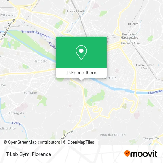
See T-Lab Gym, Florence, on the map
Public Transit to T-Lab Gym in Florence
Wondering how to get to T-Lab Gym in Florence? Moovit helps you find the best way to get to T-Lab Gym with step-by-step directions from the nearest public transit station.
Moovit provides free maps and live directions to help you navigate through your city. View schedules, routes, timetables, and find out how long does it take to get to T-Lab Gym in real time.
Looking for the nearest stop or station to T-Lab Gym? Check out this list of stops closest to your destination: Ariosto Aleardi; Ariosto Dell'Orto; Porta San Frediano; Soderini Torrino Santa Rosa; Pratolini; Piazza D'Ognissanti; Porta Al Prato-Leopolda.
Bus: 36, 370 A, 6, C4, 37, 39, 39, 39, 13, C3, 12, 50G, 131, 131, 131, 131, 11.Train: R.
Want to see if there’s another route that gets you there at an earlier time? Moovit helps you find alternative routes or times. Get directions from and directions to T-Lab Gym easily from the Moovit App or Website.
We make riding to T-Lab Gym easy, which is why over 1.5 million users, including users in Florence, trust Moovit as the best app for public transit. You don’t need to download an individual bus app or train app, Moovit is your all-in-one transit app that helps you find the best bus time or train time available.
For information on prices of bus and train, costs and ride fares to T-Lab Gym, please check the Moovit app.
Use the app to navigate to popular places including to the airport, hospital, stadium, grocery store, mall, coffee shop, school, college, and university.
T-Lab Gym Address: Viale Ludovico Ariosto, 11 street in Florence
- Convent Garden,
- ODA,
- Ludovico Ariosto Avenue / Orto Street,
- 30ft - Showroom,
- Ariosto Via Dell'Orto,
- Rouille's,
- Your Florence - the House of the Garden,
- Household Goods Store Milanese S. Agostino,
- Newsstand: Newspapers and Magazines,
- 12 Orto Street,
- Montuoro Esposito Angela Architecture Studio,
- The Usual Place,
- Pisana Street,
- L'Ornitorinco by Lilit,
- Wild Buns Bakery,
- 140 Roo Florence,
- Ladislao & James,
- Momio,
- Flet,
- Ceramic Art by Lydaki Kalliopi
Places Near T-Lab Gym (Florence)
- OOO, Florence,
- Cascine Park, Florence,
- Tobacco Manufacture, Florence,
- Santa Maria Novella Station, Florence,
- IKEA Florence, Sesto Fiorentino,
- Santa Maria Nuova Hospital, Florence,
- I Gigli, Campi Bisenzio,
- Michelangelo Square, Florence,
- Mandela Forum (Nelson Mandela Forum), Florence,
- Verdi Theater, Florence,
- Michelangelo Square, Florence,
- Artemio Franchi Municipal Stadium, Florence,
- Campi Bisenzio, Campi Bisenzio,
- Field of Mars, Florence,
- Visarno Hippodrome, Florence,
- Visarno Arena, Florence,
- Asmana, Campi Bisenzio,
- Torregalli Hospital Scandicci *, Scandicci,
- Piero Palagi Hospital Facility-Florence, Florence,
- Nelson Mandela Forum, Florence
How to get to popular places in Florence with public transit
Get around Florence by public transit!
Traveling around Florence has never been so easy. See step by step directions as you travel to any attraction, street or major public transit station. View bus and train schedules, arrival times, service alerts and detailed routes on a map, so you know exactly how to get to anywhere in Florence.
When traveling to any destination around Florence use Moovit's Live Directions with Get Off Notifications to know exactly where and how far to walk, how long to wait for your line, and how many stops are left. Moovit will alert you when it's time to get off — no need to constantly re-check whether yours is the next stop.
Wondering how to use public transit in Florence or how to pay for public transit in Florence? Moovit public transit app can help you navigate your way with public transit easily, and at minimum cost. It includes public transit fees, ticket prices, and costs. Looking for a map of Florence public transit lines? Moovit public transit app shows all public transit maps in Florence with all Bus, Train, Light Rail, Ferry and Funicular routes and stops on an interactive map.
Florence has 5 transit type(s), including: Bus, Train, Light Rail, Ferry and Funicular, operated by several transit agencies, including Florence Urban - Tuscan Bus Lines, GEST, Livorno and Province - Tuscan Bus Lines, Arezzo, Florence and Provinces - Tuscan Bus Lines, Prato and Province - Tuscan Bus Lines, Lucca and Province - Tuscan Bus Lines, Massa, Carrara and Province - Tuscan Bus Lines, Pisa and Province - Tuscan Bus Lines, Grosseto, Siena and Provinces - Tuscan Bus Lines, Arezzo, Siena and Provinces - Tuscan Bus Lines, Florence and Province - Tuscan Bus Lines, Pistoia and Province - Tuscan Bus Lines, Siena and Province - Tuscan Bus Lines, Arezzo and Province - Tuscan Bus Lines and Trenitalia