How to get to T-Mobile by bus?
Click on the bus route to see step by step directions with maps, line arrival times and updated time schedules.
From George Mason University, Fairfax County
54 minFrom Kaiser Permanente - Falls Church Medical Center, Falls Church
20 minFrom Springhill Suites Alexandria Old Town/Southwest, Alexandria
64 minFrom U.S. Department of State SA-28, Fairfax County
53 minFrom Tysons Corner Center, Fairfax County
50 minFrom Punch Bowl Social, Arlington County
49 minFrom Arlington Cinema 'N' Drafthouse, Arlington County
37 minFrom Shirlington, Arlington County
48 minFrom Navy Federal Credit Union, Fairfax County
67 minFrom Tysons Galleria, Fairfax County
54 min
Bus stops near T-Mobile in Fairfax County
Train station near T-Mobile in Fairfax County
- Backlick Road Station, 36 min walk,VIEW
Bus lines to T-Mobile in Fairfax County
What are the closest stations to T-Mobile?
The closest stations to T-Mobile are:
- Columbia Pike @ Maple Pl is 104 yards away, 2 min walk.
- Rt 236 Little River Tpke & Ravenswo is 144 yards away, 2 min walk.
- Little River Turnpike @ Ravensworth is 151 yards away, 2 min walk.
- Annandale @ Little River is 161 yards away, 3 min walk.
- Backlick Road Station is 3060 yards away, 36 min walk.
Which bus lines stop near T-Mobile?
These bus lines stop near T-Mobile: 401, 402, 803, F23, F24, F44.
What’s the nearest bus station to T-Mobile in Fairfax County?
The nearest bus stations to T-Mobile in Fairfax County are Columbia Pike @ Maple Pl, Rt 236 Little River Tpke & Ravenswo and Little River Turnpike @ Ravensworth. The closest one is a 2 min walk away.
What time is the first train to T-Mobile in Fairfax County?
The MANASSAS LINE is the first train that goes to T-Mobile in Fairfax County. It stops nearby at 5:42 AM.
What time is the last train to T-Mobile in Fairfax County?
The MANASSAS LINE is the last train that goes to T-Mobile in Fairfax County. It stops nearby at 7:34 PM.
What time is the first bus to T-Mobile in Fairfax County?
The 401 is the first bus that goes to T-Mobile in Fairfax County. It stops nearby at 3:51 AM.
What time is the last bus to T-Mobile in Fairfax County?
The 402 is the last bus that goes to T-Mobile in Fairfax County. It stops nearby at 2:07 AM.
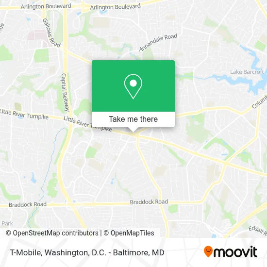
See T-Mobile, Fairfax County, on the map
Public Transit to T-Mobile in Fairfax County
Wondering how to get to T-Mobile in Fairfax County? Moovit helps you find the best way to get to T-Mobile with step-by-step directions from the nearest public transit station.
Moovit provides free maps and live directions to help you navigate through your city. View schedules, routes, timetables, and find out how long does it take to get to T-Mobile in real time.
Looking for the nearest stop or station to T-Mobile? Check out this list of stops closest to your destination: Columbia Pike @ Maple Pl; Rt 236 Little River Tpke & Ravenswo; Little River Turnpike @ Ravensworth; Annandale @ Little River; Backlick Road Station.
Bus: 401, 402, 803, F23, F24, F44, F85, 834.Train: MANASSAS LINE.
Want to see if there’s another route that gets you there at an earlier time? Moovit helps you find alternative routes or times. Get directions from and directions to T-Mobile easily from the Moovit App or Website.
We make riding to T-Mobile easy, which is why over 1.5 million users, including users in Fairfax County, trust Moovit as the best app for public transit. You don’t need to download an individual bus app or train app, Moovit is your all-in-one transit app that helps you find the best bus time or train time available.
For information on prices of bus, costs and ride fares to T-Mobile, please check the Moovit app.
Use the app to navigate to popular places including to the airport, hospital, stadium, grocery store, mall, coffee shop, school, college, and university.
T-Mobile Address: 7262 Columbia Pike street in Fairfax County
- Burke & Herbert Bank,
- Annandale Rd & RT 236 Little River Turnpike,
- Ravensworth VA-236,
- A Security Training Academy,
- Annandale, Virginia,
- Korean American Women Org,
- Uriona Construction,
- Kogiya Korean Bbq,
- CS Barber School,
- Honey Pig Gooldaegee Korean Grill,
- Bowlero Annandale,
- Oegadgib,
- Vcaom Omc,
- Akil's Mobile Brake Services,
- Shell,
- Dong in Acupuncture,
- Safeway,
- STARBUCKS,
- Amazon Locker-Buttercup,
- Gaboja
Places Near T-Mobile (Fairfax County)
- PG Mall, Prince George's County,
- Museum Of The Bible, Washington,
- Amazon Hq2, Arlington County,
- Georgetown, Washington,
- Washington National Cathedral, Washington,
- Rock Creek Tennis Center, Washington,
- Basilica of the National Shrine, Washington,
- Capital One Arena, Washington,
- Westfield Montgomery Mall, Montgomery County,
- Marriott Marquis Washington, DC, Washington,
- The Anthem, Washington,
- Warner Theatre, Washington,
- Sibley Memorial Hospital, Washington,
- National Zoo, Washington,
- National Theatre, Washington,
- National Museum of African American History and Culture, Washington,
- M&T Bank Stadium, Baltimore,
- Pennsylvania Ave NW (3rd st and pennsylvania), Washington,
- Washington DC VA Medical Center, Washington,
- Camden Yards, Baltimore
How to get to popular places in Washington, D.C. - Baltimore, MD with public transit
Get around Fairfax County by public transit!
Traveling around Fairfax County has never been so easy. See step by step directions as you travel to any attraction, street or major public transit station. View bus and train schedules, arrival times, service alerts and detailed routes on a map, so you know exactly how to get to anywhere in Fairfax County.
When traveling to any destination around Fairfax County use Moovit's Live Directions with Get Off Notifications to know exactly where and how far to walk, how long to wait for your line, and how many stops are left. Moovit will alert you when it's time to get off — no need to constantly re-check whether yours is the next stop.
Wondering how to use public transit in Fairfax County or how to pay for public transit in Fairfax County? Moovit public transit app can help you navigate your way with public transit easily, and at minimum cost. It includes public transit fees, ticket prices, and costs. Looking for a map of Fairfax County public transit lines? Moovit public transit app shows all public transit maps in Fairfax County with all Bus, Train, Metro, Light Rail and Ferry routes and stops on an interactive map.
Washington, D.C. - Baltimore, MD has 5 transit type(s), including: Bus, Train, Metro, Light Rail and Ferry, operated by several transit agencies, including WMATA, Montgomery County Ride On, Fairfax Connector, TheBus, PRTC, DASH - Alexandria, Arlington Transit (ART), RTA of Central Maryland, MDOT MTA, MDOT MTA Light RailLink, MDOT MTA Commuter Bus, MDOT MTA Local Bus, FXBGO!, Virginia Railway Express (VRE) and MARC