Directions to T-Mobile Center (Kansas City) with public transportation
The following transit lines have routes that pass near T-Mobile Center
How to get to T-Mobile Center by bus?
Click on the bus route to see step by step directions with maps, line arrival times and updated time schedules.
Bus stops near T-Mobile Center in Kansas City
- On Oak at 13th Northbound Nearside, 3 min walk,
- On 13th at Grand/Mcgee Westbound Nearside, 4 min walk,
- On 13th at Locust Westbound, 5 min walk,
- On 12th at Mcgee Eastbound, 5 min walk,
- On Grand at 12th Southbound, 5 min walk,
- On 12th Between Grand And Mcgee Eastbound, 5 min walk,
- On Grand at 12th Northbound, 6 min walk,
- On 12th at Grand Eastbound, 6 min walk,
Light Rail stations near T-Mobile Center in Kansas City
- Kauffman Center on Main at 16th St Nb, 10 min walk,
Bus lines to T-Mobile Center in Kansas City
- 404, Downtown Kansas City,
- 520, Pennsylvania/12th,
- 563, Northbound,
- 569, On Pennsylvania at 12th Southbound,
- 201, 201 - North Oak / To 27th And Main,
- TMAX, Troost Max / To Downtown,
- 29, On Grand at 9th Southbound Farside,
- 550, 550 - Lee's Summit/ To Lee's Summit,
- 47, 47 - 12th / Wyandotte,
- 238, 238 - Meadowbrook/East Village,
- MMAX, Main Max/ To Waldo,
- 9, 9th Street/Truman & Ewing,
- 11, 11-Northeast-Westside/To Mcc,
- 12, 12 - 12th Street/31st & Van Brunt,
- 18, 18 - Indiana/Kc Zoo,
- 23, 23 - 23rd Street / To Park Tower,
- 24, 24 - Independence/To Downtown,
- 210, 210-Front Street / To Downtown,
- 229, 229-Boardwalk / To East Village,
- 85, 85 - Paseo/To 3rd And Grand,
What are the closest stations to T-Mobile Center?
The closest stations to T-Mobile Center are:
- On Oak at 13th Northbound Nearside is 167 yards away, 3 min walk.
- On 13th at Grand/Mcgee Westbound Nearside is 207 yards away, 4 min walk.
- On 13th at Locust Westbound is 273 yards away, 5 min walk.
- On 12th at Mcgee Eastbound is 282 yards away, 5 min walk.
- On Grand at 12th Southbound is 287 yards away, 5 min walk.
- On 12th Between Grand And Mcgee Eastbound is 297 yards away, 5 min walk.
- On Grand at 12th Northbound is 367 yards away, 6 min walk.
- On 12th at Grand Eastbound is 367 yards away, 6 min walk.
- Kauffman Center on Main at 16th St Nb is 717 yards away, 10 min walk.
Which bus lines stop near T-Mobile Center?
These bus lines stop near T-Mobile Center: 101, 11, 201, 28, 404, PMAX.
What’s the nearest light rail station to T-Mobile Center in Kansas City?
The nearest light rail station to T-Mobile Center in Kansas City is Kauffman Center on Main at 16th St Nb. It’s a 10 min walk away.
What’s the nearest bus station to T-Mobile Center in Kansas City?
The nearest bus station to T-Mobile Center in Kansas City is On Oak at 13th Northbound Nearside. It’s a 3 min walk away.
What time is the first light rail to T-Mobile Center in Kansas City?
The TESTROUTE is the first light rail that goes to T-Mobile Center in Kansas City. It stops nearby at 4:35 AM.
What time is the last light rail to T-Mobile Center in Kansas City?
The TESTROUTE is the last light rail that goes to T-Mobile Center in Kansas City. It stops nearby at 12:47 AM.
What time is the first bus to T-Mobile Center in Kansas City?
The 12 is the first bus that goes to T-Mobile Center in Kansas City. It stops nearby at 4:48 AM.
What time is the last bus to T-Mobile Center in Kansas City?
The MMAX is the last bus that goes to T-Mobile Center in Kansas City. It stops nearby at 12:50 AM.
See T-Mobile Center, Kansas City, on the map
Public Transit to T-Mobile Center in Kansas City
Wondering how to get to T-Mobile Center in Kansas City? Moovit helps you find the best way to get to T-Mobile Center with step-by-step directions from the nearest public transit station.
Moovit provides free maps and live directions to help you navigate through your city. View schedules, routes, timetables, and find out how long does it take to get to T-Mobile Center in real time.
Looking for the nearest stop or station to T-Mobile Center? Check out this list of stops closest to your destination: On Oak at 13th Northbound Nearside; On 13th at Grand/Mcgee Westbound Nearside; On 13th at Locust Westbound; On 12th at Mcgee Eastbound; On Grand at 12th Southbound; On 12th Between Grand And Mcgee Eastbound; On Grand at 12th Northbound; On 12th at Grand Eastbound; Kauffman Center on Main at 16th St Nb.
Bus: 101, 11, 201, 28, 404, PMAX, 520, 563, 569, TMAX, 29, 550, 47, 238, MMAX, 9, 12, 18, 23.
Want to see if there’s another route that gets you there at an earlier time? Moovit helps you find alternative routes or times. Get directions from and directions to T-Mobile Center easily from the Moovit App or Website.
We make riding to T-Mobile Center easy, which is why over 1.5 million users, including users in Kansas City, trust Moovit as the best app for public transit. You don’t need to download an individual bus app or train app, Moovit is your all-in-one transit app that helps you find the best bus time or train time available.
For information on prices of bus, costs and ride fares to T-Mobile Center, please check the Moovit app.
Use the app to navigate to popular places including to the airport, hospital, stadium, grocery store, mall, coffee shop, school, college, and university.
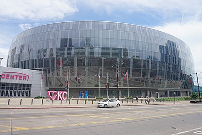
T-Mobile Center Address: Grand Boulevard street in Kansas City
Places Near T-Mobile Center (Kansas City)
How to get to popular places in Kansas City with public transit
Get around Kansas City by public transit!
Traveling around Kansas City has never been so easy. See step by step directions as you travel to any attraction, street or major public transit station. View bus and train schedules, arrival times, service alerts and detailed routes on a map, so you know exactly how to get to anywhere in Kansas City.
When traveling to any destination around Kansas City use Moovit's Live Directions with Get Off Notifications to know exactly where and how far to walk, how long to wait for your line, and how many stops are left. Moovit will alert you when it's time to get off — no need to constantly re-check whether yours is the next stop.
Wondering how to use public transit in Kansas City or how to pay for public transit in Kansas City? Moovit public transit app can help you navigate your way with public transit easily, and at minimum cost. It includes public transit fees, ticket prices, and costs. Looking for a map of Kansas City public transit lines? Moovit public transit app shows all public transit maps in Kansas City with all Bus, Train and Light Rail routes and stops on an interactive map.
Kansas City has 3 transit type(s), including: Bus, Train and Light Rail, operated by several transit agencies, including Kansas City Area Transportation Authority, Lawrence Transit, Topeka Metro, RideKC Johnson County, Amtrak, Greyhound-us and FlixBus-us