How to get to Tabac la Chope by bus?
Click on the bus route to see step by step directions with maps, line arrival times and updated time schedules.
From Montesson, Montesson
112 minFrom Institut Mutualiste Montsouris, Paris
73 minFrom Paris Expo Porte de Versailles, Paris
71 minFrom La Butte aux Cailles, Paris
76 minFrom Primark France S.a., Paris
47 minFrom Place d'Italie, Paris
72 minFrom Arènes de Lutèce, Paris
62 minFrom Rambouillet, Paris
88 minFrom 13 Rue Vergniaud, Paris
72 minFrom Hôpital Pitié Salpêtrière, Paris
83 min
How to get to Tabac la Chope by train?
Click on the train route to see step by step directions with maps, line arrival times and updated time schedules.
How to get to Tabac la Chope by metro?
Click on the metro route to see step by step directions with maps, line arrival times and updated time schedules.
From Institut Mutualiste Montsouris, Paris
64 minFrom Paris Expo Porte de Versailles, Paris
59 minFrom La Butte aux Cailles, Paris
61 minFrom Primark France S.a., Paris
44 minFrom Place d'Italie, Paris
60 minFrom Arènes de Lutèce, Paris
53 minFrom Rambouillet, Paris
52 minFrom 13 Rue Vergniaud, Paris
61 minFrom Hôpital Pitié Salpêtrière, Paris
51 min
Bus stops near Tabac la Chope in Asnieres-Sur-Seine
Metro stations near Tabac la Chope in Asnieres-Sur-Seine
Train station near Tabac la Chope in Asnieres-Sur-Seine
- Gare D'Asnieres, 14 min walk,VIEW
Bus lines to Tabac la Chope in Asnieres-Sur-Seine
What are the closest stations to Tabac la Chope?
The closest stations to Tabac la Chope are:
- Gare D'Asnières is 26 meters away, 1 min walk.
- Gallieni is 234 meters away, 4 min walk.
- Rue de la Station / Asnières-Sur-Seine is 290 meters away, 4 min walk.
- Pont de Levallois - Bécon is 643 meters away, 9 min walk.
- Gare D'Asnieres is 1043 meters away, 14 min walk.
- Gabriel Péri is 1086 meters away, 15 min walk.
Which train lines stop near Tabac la Chope?
These train lines stop near Tabac la Chope: J, L.
Which metro line stops near Tabac la Chope?
3 (Gallieni)
Which bus lines stop near Tabac la Chope?
These bus lines stop near Tabac la Chope: 165, 277.
What’s the nearest metro station to Tabac la Chope in Asnieres-Sur-Seine?
The nearest metro station to Tabac la Chope in Asnieres-Sur-Seine is Pont de Levallois - Bécon. It’s a 9 min walk away.
What’s the nearest train station to Tabac la Chope in Asnieres-Sur-Seine?
The nearest train station to Tabac la Chope in Asnieres-Sur-Seine is Gare D'Asnieres. It’s a 14 min walk away.
What’s the nearest bus station to Tabac la Chope in Asnieres-Sur-Seine?
The nearest bus station to Tabac la Chope in Asnieres-Sur-Seine is Gare D'Asnières. It’s a 1 min walk away.
What time is the first metro to Tabac la Chope in Asnieres-Sur-Seine?
The 3 is the first metro that goes to Tabac la Chope in Asnieres-Sur-Seine. It stops nearby at 5:30 AM.
What time is the last metro to Tabac la Chope in Asnieres-Sur-Seine?
The 3 is the last metro that goes to Tabac la Chope in Asnieres-Sur-Seine. It stops nearby at 1:15 AM.
What time is the first train to Tabac la Chope in Asnieres-Sur-Seine?
The J is the first train that goes to Tabac la Chope in Asnieres-Sur-Seine. It stops nearby at 4:59 AM.
What time is the last train to Tabac la Chope in Asnieres-Sur-Seine?
The J is the last train that goes to Tabac la Chope in Asnieres-Sur-Seine. It stops nearby at 1:10 AM.
What time is the first bus to Tabac la Chope in Asnieres-Sur-Seine?
The N154 is the first bus that goes to Tabac la Chope in Asnieres-Sur-Seine. It stops nearby at 4:00 AM.
What time is the last bus to Tabac la Chope in Asnieres-Sur-Seine?
The N154 is the last bus that goes to Tabac la Chope in Asnieres-Sur-Seine. It stops nearby at 2:54 AM.
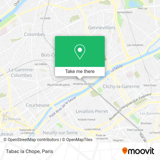
See Tabac la Chope, Asnieres-Sur-Seine, on the map
Public Transit to Tabac la Chope in Asnieres-Sur-Seine
Wondering how to get to Tabac la Chope in Asnieres-Sur-Seine? Moovit helps you find the best way to get to Tabac la Chope with step-by-step directions from the nearest public transit station.
Moovit provides free maps and live directions to help you navigate through your city. View schedules, routes, timetables, and find out how long does it take to get to Tabac la Chope in real time.
Looking for the nearest stop or station to Tabac la Chope? Check out this list of stops closest to your destination: Gare D'Asnières; Gallieni; Rue de la Station / Asnières-Sur-Seine; Pont de Levallois - Bécon; Gare D'Asnieres; Gabriel Péri.
Train: J, L.Metro: 3, 13.Bus: 165, 277, 238.
Want to see if there’s another route that gets you there at an earlier time? Moovit helps you find alternative routes or times. Get directions from and directions to Tabac la Chope easily from the Moovit App or Website.
We make riding to Tabac la Chope easy, which is why over 1.5 million users, including users in Asnieres-Sur-Seine, trust Moovit as the best app for public transit. You don’t need to download an individual bus app or train app, Moovit is your all-in-one transit app that helps you find the best bus time or train time available.
For information on prices of metro, bus and train, costs and ride fares to Tabac la Chope, please check the Moovit app.
Use the app to navigate to popular places including to the airport, hospital, stadium, grocery store, mall, coffee shop, school, college, and university.
Tabac la Chope Address: 27 Avenue de la Marne 92600 Asnières-sur-Seine street in Asnieres-Sur-Seine
- Résidence Principale,
- Déménagements Letendre,
- Dr. Bénita Gisèle,
- Gda Services,
- Rp Green Asnières,
- Lorette Caillon Naturopathe,
- Gare d Asnières,
- Le Wagon Indien,
- Alain Père et Fils,
- Secours Catholique des Hauts de Seine,
- La Bonne Baguette,
- Noo Wok,
- 6 Avenue Flachat,
- Odf Kohava,
- Lead Select,
- Jpm Rénov,
- Dr. Korchia-Marciano Esther,
- Le Studio,
- Garage C.A.R.,
- Pharmacie Pham Duy
Places Near Tabac la Chope (Asnieres-Sur-Seine)
- Hôpital Henri Mondor, Creteil,
- Galeries Lafayette, Paris,
- Théâtre Mogador, Paris,
- Fondation Louis Vuitton, Paris,
- Gare Routière Flixbus, Paris,
- Créteil Soleil, Creteil,
- Hôpital de la Pitié-Salpêtrière, Paris,
- Hopital Lariboisière, Paris,
- Centre Hospitalier des 15/20, Paris,
- Hôpital Necker, Paris,
- Hôpital Beaujon, Clichy,
- 29 Rue Manin, Paris,
- Hôpital Pitié Salpêtrière, Paris,
- Atelier Des Lumieres, Paris,
- Hôpital Saint-Joseph, Paris,
- Institut Curie, Paris,
- Hopital Foch, Suresnes,
- Galeries Lafayette Haussmann, Paris,
- Marché Saint-Pierre, Paris,
- Hôpital Cochin, Paris
How to get to popular places in Paris with public transit
Get around Asnieres-Sur-Seine by public transit!
Traveling around Asnieres-Sur-Seine has never been so easy. See step by step directions as you travel to any attraction, street or major public transit station. View bus and train schedules, arrival times, service alerts and detailed routes on a map, so you know exactly how to get to anywhere in Asnieres-Sur-Seine.
When traveling to any destination around Asnieres-Sur-Seine use Moovit's Live Directions with Get Off Notifications to know exactly where and how far to walk, how long to wait for your line, and how many stops are left. Moovit will alert you when it's time to get off — no need to constantly re-check whether yours is the next stop.
Wondering how to use public transit in Asnieres-Sur-Seine or how to pay for public transit in Asnieres-Sur-Seine? Moovit public transit app can help you navigate your way with public transit easily, and at minimum cost. It includes public transit fees, ticket prices, and costs. Looking for a map of Asnieres-Sur-Seine public transit lines? Moovit public transit app shows all public transit maps in Asnieres-Sur-Seine with all Bus, Train, Metro, Light Rail, RER, Funicular and Gondola routes and stops on an interactive map.
Paris has 7 transit type(s), including: Bus, Train, Metro, Light Rail, RER, Funicular and Gondola, operated by several transit agencies, including RATP, RER, RER Bus de remplacement, Train, Train Bus de remplacement, Tramway Bus de remplacement, TER, ADP, Magical Shuttle, Argenteuil - Boucles de Seine, Autocars Dominique, Bièvre, Brie et 2 Morin, Le Bus - C.C. du Clermontois and Cœur d’Essonne