How to get to Taberna dos Prazeres by bus?
Click on the bus route to see step by step directions with maps, line arrival times and updated time schedules.
From Parque de Estacionamento da Central de Camionagem de Braga, São Vicente
32 minFrom Os Zés das Caldas da Rainha (Bifanas), São José de São Lázaro e São João do Souto
55 minFrom Braga Parque, São Vítor
63 minFrom Estação Ferroviária de Braga, Maximinos, Sé e Cividade
49 minFrom Sameiro, Braga
80 minFrom IPCA - Instituto Politécnico do Cávado e do Ave - Pólo de Braga, São José de São Lázaro e São João do Souto
59 minFrom Aldeia dos Macacos, São José de São Lázaro e São João do Souto
56 minFrom Central de Camionagem de Braga, Maximinos, Sé e Cividade
39 minFrom Stadium Municipal De Braga, Lomar e Arcos
67 minFrom O Gerês, Braga
70 min
Bus stops near Taberna dos Prazeres in Ferreiros, Prozelo e Besteiros
Bus lines to Taberna dos Prazeres in Ferreiros, Prozelo e Besteiros
What are the closest stations to Taberna dos Prazeres?
The closest stations to Taberna dos Prazeres are:
- Ferreiros (Mercado) is 167 meters away, 3 min walk.
- Ferreiros (Santo António) is 272 meters away, 4 min walk.
Which bus line stops near Taberna dos Prazeres?
201 (Vidoeiro via S. Bento da Porta Aberta)
What’s the nearest bus station to Taberna dos Prazeres in Ferreiros, Prozelo e Besteiros?
The nearest bus station to Taberna dos Prazeres in Ferreiros, Prozelo e Besteiros is Ferreiros (Mercado). It’s a 3 min walk away.
What time is the first bus to Taberna dos Prazeres in Ferreiros, Prozelo e Besteiros?
The 201 is the first bus that goes to Taberna dos Prazeres in Ferreiros, Prozelo e Besteiros. It stops nearby at 8:06 AM.
What time is the last bus to Taberna dos Prazeres in Ferreiros, Prozelo e Besteiros?
The 201 is the last bus that goes to Taberna dos Prazeres in Ferreiros, Prozelo e Besteiros. It stops nearby at 7:41 PM.
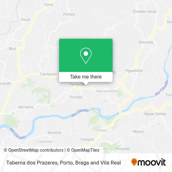
See Taberna dos Prazeres, Ferreiros, Prozelo e Besteiros, on the map
Public Transit to Taberna dos Prazeres in Ferreiros, Prozelo e Besteiros
Wondering how to get to Taberna dos Prazeres in Ferreiros, Prozelo e Besteiros? Moovit helps you find the best way to get to Taberna dos Prazeres with step-by-step directions from the nearest public transit station.
Moovit provides free maps and live directions to help you navigate through your city. View schedules, routes, timetables, and find out how long does it take to get to Taberna dos Prazeres in real time.
Looking for the nearest stop or station to Taberna dos Prazeres? Check out this list of stops closest to your destination: Ferreiros (Mercado); Ferreiros (Santo António).
Bus: 201, 204, 202, 219, 300, 302.
Want to see if there’s another route that gets you there at an earlier time? Moovit helps you find alternative routes or times. Get directions from and directions to Taberna dos Prazeres easily from the Moovit App or Website.
We make riding to Taberna dos Prazeres easy, which is why over 1.5 million users, including users in Ferreiros, Prozelo e Besteiros, trust Moovit as the best app for public transit. You don’t need to download an individual bus app or train app, Moovit is your all-in-one transit app that helps you find the best bus time or train time available.
For information on prices of bus, costs and ride fares to Taberna dos Prazeres, please check the Moovit app.
Use the app to navigate to popular places including to the airport, hospital, stadium, grocery store, mall, coffee shop, school, college, and university.
Taberna dos Prazeres Address: Avenida Santo António 36A Ferreiros, 4720-343 Amares street in Ferreiros, Prozelo e Besteiros
- Bom Doce,
- A Sua Imobiliária,
- In-Model Agency,
- Sexto Sentido,
- Unilabs Amares - Santo António,
- Funerária Fernando Fernandes Braga,
- Riso,
- Cosmoíndice Unipessoal,
- Forminho - Formação e Consultoria Em Hotelaria e Turismo,
- Bar do Litos,
- Oticas Minho Ferreir,
- Intercotas - Sociedad de Construções,
- Acdk Imobiliária, S.a.,
- Homenagem a João Barbosa de Macedo,
- Spazio Interiores,
- Biscoito d' Laranja,
- Martinho - Mediação de Seguros,
- Dolce Caramello,
- Ópticas Minho,
- SOCIEDADE INTERBANCARIA DE SERVICOS S A SIBS
Places Near Taberna dos Prazeres (Ferreiros, Prozelo e Besteiros)
- Palácio de Cristal, Lordelo do Ouro e Massarelos,
- Espinho, Espinho,
- Avintes, Vila Nova De Gaia,
- Hospital Santos Silva, Vila Nova De Gaia,
- Valongo, Valongo,
- Estádio do Dragão, Campanhã,
- Maia, Maia,
- MAR Shopping, Matosinhos e Leça da Palmeira,
- Acesso ao Shopping Parque Nascente, Campanhã,
- Parque Aquatico Amarante - Aqua Aventura, Amarante,
- Hospital de Santo António, Cedofeita, Santo Ildefonso, Sé, Miragaia, São Nicolau e Vitória,
- Hospital da Prelada, Ramalde,
- Canidelo, Vila Nova De Gaia,
- Zoo Santo Inácio, Vila Nova De Gaia,
- Senhor de Matosinhos, Matosinhos e Leça da Palmeira,
- Leça da Palmeira, Matosinhos e Leça da Palmeira,
- Rua Calouste Gulbenkian, Lordelo do Ouro e Massarelos,
- El Corte Inglés de Gaia, Mafamude e Vilar do Paraíso,
- Arrábida Shopping, Santa Marinha e São Pedro da Afurada,
- VILA do CONDE PORTO FASHION OUTLET, Modivas
How to get to popular places in Porto, Braga and Vila Real with public transit
Get around Ferreiros, Prozelo e Besteiros by public transit!
Traveling around Ferreiros, Prozelo e Besteiros has never been so easy. See step by step directions as you travel to any attraction, street or major public transit station. View bus and train schedules, arrival times, service alerts and detailed routes on a map, so you know exactly how to get to anywhere in Ferreiros, Prozelo e Besteiros.
When traveling to any destination around Ferreiros, Prozelo e Besteiros use Moovit's Live Directions with Get Off Notifications to know exactly where and how far to walk, how long to wait for your line, and how many stops are left. Moovit will alert you when it's time to get off — no need to constantly re-check whether yours is the next stop.
Wondering how to use public transit in Ferreiros, Prozelo e Besteiros or how to pay for public transit in Ferreiros, Prozelo e Besteiros? Moovit public transit app can help you navigate your way with public transit easily, and at minimum cost. It includes public transit fees, ticket prices, and costs. Looking for a map of Ferreiros, Prozelo e Besteiros public transit lines? Moovit public transit app shows all public transit maps in Ferreiros, Prozelo e Besteiros with all Bus, Train, Metro, Ferry, Funicular and Gondola routes and stops on an interactive map.
Porto, Braga and Vila Real has 6 transit type(s), including: Bus, Train, Metro, Ferry, Funicular and Gondola, operated by several transit agencies, including Metro do Porto, Metro do Porto - Metrobus, CP - Comboios de Portugal, STCP, UNIR Mobilidade da Area Metropolitana do Porto, Getbus - Aerobus, Mobiave, Valpibus, TUB - Transportes Urbanos de Braga, TuViana, Guimabus, Ave Mobilidade, Cávado Mobilidade, Transdev and Câmara Municipal de Santo Tirso