How to get to Tabla by bus?
Click on the bus route to see step by step directions with maps, line arrival times and updated time schedules.
From National Guard Bureau, Arlington County
88 minFrom St Elizabeths Hospital, Washington
68 minFrom Residence Inn by Marriott Arlington Capital View, Arlington County
88 minFrom Bolling AFB, Washington
130 minFrom Knollwood, Washington
47 minFrom National Institutes of Health (NIH), Montgomery County
76 minFrom Hains Point, Washington
59 minFrom French Embassy, Washington
51 minFrom Ballou High School, Washington
76 min
How to get to Tabla by metro?
Click on the metro route to see step by step directions with maps, line arrival times and updated time schedules.
Bus stops near Tabla in Washington
Metro stations near Tabla in Washington
Bus lines to Tabla in Washington
What are the closest stations to Tabla?
The closest stations to Tabla are:
- Georgia Av Nw+Lamont St NW is 19 yards away, 1 min walk.
- Georgia Av Nw+Irving St NW is 287 yards away, 4 min walk.
- Irving St Nw+Georgia Av NW is 288 yards away, 4 min walk.
- New Hampshire Av Nw+Monroe St NW is 558 yards away, 7 min walk.
- Georgia Ave - Petworth is 731 yards away, 9 min walk.
- Brookland-Cua is 3084 yards away, 37 min walk.
Which bus lines stop near Tabla?
These bus lines stop near Tabla: C61, D40, D44, D4X.
Which metro lines stop near Tabla?
These metro lines stop near Tabla: GREEN, YELLOW.
What’s the nearest metro station to Tabla in Washington?
The nearest metro station to Tabla in Washington is Georgia Ave - Petworth. It’s a 9 min walk away.
What’s the nearest bus station to Tabla in Washington?
The nearest bus station to Tabla in Washington is Georgia Av Nw+Lamont St NW. It’s a 1 min walk away.
What time is the first metro to Tabla in Washington?
The GREEN is the first metro that goes to Tabla in Washington. It stops nearby at 5:14 AM.
What time is the last metro to Tabla in Washington?
The GREEN is the last metro that goes to Tabla in Washington. It stops nearby at 12:27 AM.
What time is the first bus to Tabla in Washington?
The D40 is the first bus that goes to Tabla in Washington. It stops nearby at 3:00 AM.
What time is the last bus to Tabla in Washington?
The D40 is the last bus that goes to Tabla in Washington. It stops nearby at 3:03 AM.
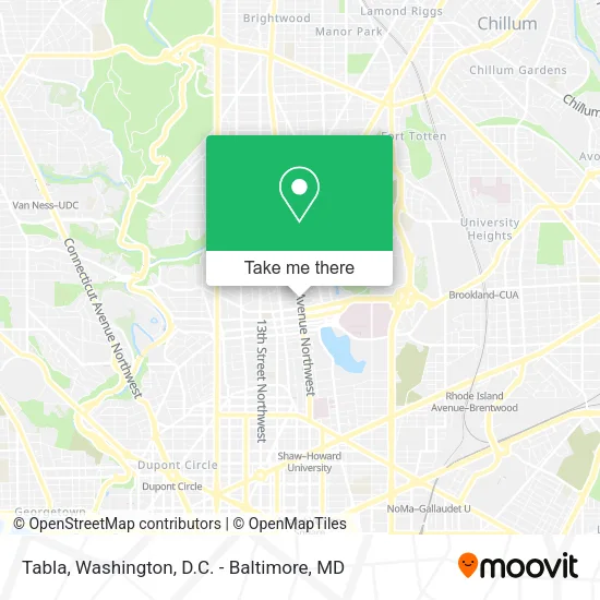
See Tabla, Washington, on the map
Public Transit to Tabla in Washington
Wondering how to get to Tabla in Washington? Moovit helps you find the best way to get to Tabla with step-by-step directions from the nearest public transit station.
Moovit provides free maps and live directions to help you navigate through your city. View schedules, routes, timetables, and find out how long does it take to get to Tabla in real time.
Looking for the nearest stop or station to Tabla? Check out this list of stops closest to your destination: Georgia Av Nw+Lamont St NW; Georgia Av Nw+Irving St NW; Irving St Nw+Georgia Av NW; New Hampshire Av Nw+Monroe St NW; Georgia Ave - Petworth; Brookland-Cua.
Bus: C61, D40, D44, D4X, C63, D74.Metro: GREEN, YELLOW, RED.
Want to see if there’s another route that gets you there at an earlier time? Moovit helps you find alternative routes or times. Get directions from and directions to Tabla easily from the Moovit App or Website.
We make riding to Tabla easy, which is why over 1.5 million users, including users in Washington, trust Moovit as the best app for public transit. You don’t need to download an individual bus app or train app, Moovit is your all-in-one transit app that helps you find the best bus time or train time available.
For information on prices of bus and metro, costs and ride fares to Tabla, please check the Moovit app.
Use the app to navigate to popular places including to the airport, hospital, stadium, grocery store, mall, coffee shop, school, college, and university.
Tabla Address: Georgia Avenue Northwest street in Washington
- Call Your Mother,
- Botanica San Cipriano,
- Midlands Beer Garden,
- Morton St and Georgia Ave,
- Kraken Axes,
- Park View Farmers Market,
- Ashraf U Choudhury Dr DDS (Ashraf Uddin Choudhury),
- Metro Lab (Metro Labs),
- B and W Stat Laboratory,
- Park View, District of Columbia,
- Riteway Medical Supplies (Riteway Medical Equipment Supp),
- Greater Harvest Baptist Church of DC,
- Cat Sitter by Alejandra,
- MedStar Washington Hospital Center,
- Bruce-Monroe Community Park ,
- VIP Clientele,
- Park Rd & New Hampshire Ave NW,
- Rincon Catracho,
- NuVegan Café,
- E.L. Haynes Public Charter School
Places Near Tabla (Washington)
- Pennsylvania Ave NW (3rd st and pennsylvania), Washington,
- National Mall, Washington,
- Westfield Montgomery Mall, Montgomery County,
- Museum Of The Bible, Washington,
- Rock Creek Tennis Center, Washington,
- The Anthem, Washington,
- National Museum of African American History and Culture, Washington,
- PG Mall, Prince George's County,
- Georgetown, Washington,
- Washington National Cathedral, Washington,
- Capital One Arena, Washington,
- National Zoo, Washington,
- Basilica of the National Shrine, Washington,
- Sibley Memorial Hospital, Washington,
- Camden Yards, Baltimore,
- Marriott Marquis Washington, DC, Washington,
- Warner Theatre, Washington,
- Amazon Hq2, Arlington County,
- Washington DC VA Medical Center, Washington,
- M&T Bank Stadium, Baltimore
How to get to popular places in Washington, D.C. - Baltimore, MD with public transit
Get around Washington by public transit!
Traveling around Washington has never been so easy. See step by step directions as you travel to any attraction, street or major public transit station. View bus and train schedules, arrival times, service alerts and detailed routes on a map, so you know exactly how to get to anywhere in Washington.
When traveling to any destination around Washington use Moovit's Live Directions with Get Off Notifications to know exactly where and how far to walk, how long to wait for your line, and how many stops are left. Moovit will alert you when it's time to get off — no need to constantly re-check whether yours is the next stop.
Wondering how to use public transit in Washington or how to pay for public transit in Washington? Moovit public transit app can help you navigate your way with public transit easily, and at minimum cost. It includes public transit fees, ticket prices, and costs. Looking for a map of Washington public transit lines? Moovit public transit app shows all public transit maps in Washington with all Bus, Train, Metro, Light Rail and Ferry routes and stops on an interactive map.
Washington, D.C. - Baltimore, MD has 5 transit type(s), including: Bus, Train, Metro, Light Rail and Ferry, operated by several transit agencies, including WMATA, Montgomery County Ride On, Fairfax Connector, TheBus, PRTC, DASH - Alexandria, Arlington Transit (ART), RTA of Central Maryland, MDOT MTA, MDOT MTA Light RailLink, MDOT MTA Commuter Bus, MDOT MTA Local Bus, FXBGO!, Virginia Railway Express (VRE) and MARC