How to get to Giulia Tacci by bus?
Click on the bus route to see step by step directions with maps, line arrival times and updated time schedules.
From Villa Bertelli, Union of Municipalities of Versilia
201 minFrom Tonfano, Union of Municipalities of Versilia
133 minFrom Lido di Camaiore, Camaiore
77 minFrom Pope Paul VI Square, Viareggio
92 minFrom La Capannina by Franceschi - Forte dei Marmi, Forte Dei Marmi
207 minFrom Arena of Versilia, Montignoso
130 minFrom Darsena, Union of Municipalities of Versilia
67 minFrom San Camillo Care Home, Forte Dei Marmi
196 minFrom Viareggio Beach, Viareggio
63 min
Bus stops near Giulia Tacci in Massarosa
What are the closest stations to Giulia Tacci?
The closest stations to Giulia Tacci are:
- Via Sezioni Bar is 152 meters away, 3 min walk.
- Via Pedona Corner Casesi is 982 meters away, 13 min walk.
Which bus lines stop near Giulia Tacci?
These bus lines stop near Giulia Tacci: E2, E29.
What’s the nearest bus station to Giulia Tacci in Massarosa?
The nearest bus station to Giulia Tacci in Massarosa is Via Sezioni Bar. It’s a 3 min walk away.
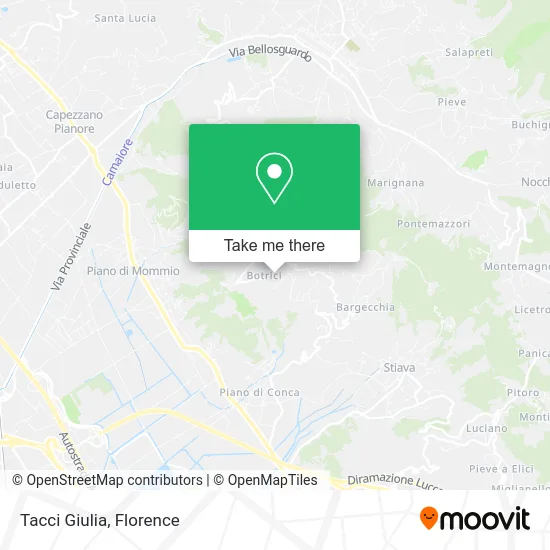
See Giulia Tacci, Massarosa, on the map
Public Transit to Giulia Tacci in Massarosa
Wondering how to get to Giulia Tacci in Massarosa? Moovit helps you find the best way to get to Giulia Tacci with step-by-step directions from the nearest public transit station.
Moovit provides free maps and live directions to help you navigate through your city. View schedules, routes, timetables, and find out how long does it take to get to Giulia Tacci in real time.
Looking for the nearest stop or station to Giulia Tacci? Check out this list of stops closest to your destination: Via Sezioni Bar; Via Pedona Corner Casesi.
Bus: E2, E29, E31, E31.
Want to see if there’s another route that gets you there at an earlier time? Moovit helps you find alternative routes or times. Get directions from and directions to Giulia Tacci easily from the Moovit App or Website.
We make riding to Giulia Tacci easy, which is why over 1.5 million users, including users in Massarosa, trust Moovit as the best app for public transit. You don’t need to download an individual bus app or train app, Moovit is your all-in-one transit app that helps you find the best bus time or train time available.
For information on prices of bus and train, costs and ride fares to Giulia Tacci, please check the Moovit app.
Use the app to navigate to popular places including to the airport, hospital, stadium, grocery store, mall, coffee shop, school, college, and university.
Giulia Tacci Address: Via delle Sezioni, 55054 Massarosa street in Massarosa
- Tulsi by Alessandra Zaltieri & Co.,
- Botrici,
- Bar from Prato - Grocery - Fruits and Vegetables,
- Belvedere 2,
- Little Sun House,
- Termoroi di Roi Giuseppe,
- Simonini Francesco,
- Pietro Dini,
- Ca' ai Venti,
- Corsanico Cemetery,
- Villa Oliveto Bed & Breakfast,
- Villa Capo Corso,
- Carlo Limena,
- Tobacco Shop No. 3,
- Municipal Pharmacy 1,
- Tobacco and Newsstand,
- Le Pielle,
- Riccardo Ba Butcher Shop,
- Vecoli Clothing and Newspapers,
- Far.Mas
Places Near Giulia Tacci (Massarosa)
- Cascine Park, Florence,
- Santa Maria Nuova Hospital, Florence,
- Asmana, Campi Bisenzio,
- Santa Maria Novella Station, Florence,
- Michelangelo Square, Florence,
- Campi Bisenzio, Campi Bisenzio,
- IKEA Florence, Sesto Fiorentino,
- Field of Mars, Florence,
- OOO, Florence,
- Verdi Theater, Florence,
- Mandela Forum (Nelson Mandela Forum), Florence,
- Michelangelo Square, Florence,
- Piero Palagi Hospital Facility-Florence, Florence,
- Torregalli Hospital Scandicci *, Scandicci,
- Nelson Mandela Forum, Florence,
- Artemio Franchi Municipal Stadium, Florence,
- Visarno Hippodrome, Florence,
- Visarno Arena, Florence,
- I Gigli, Campi Bisenzio,
- Tobacco Manufacture, Florence
How to get to popular places in Florence with public transit
Get around Massarosa by public transit!
Traveling around Massarosa has never been so easy. See step by step directions as you travel to any attraction, street or major public transit station. View bus and train schedules, arrival times, service alerts and detailed routes on a map, so you know exactly how to get to anywhere in Massarosa.
When traveling to any destination around Massarosa use Moovit's Live Directions with Get Off Notifications to know exactly where and how far to walk, how long to wait for your line, and how many stops are left. Moovit will alert you when it's time to get off — no need to constantly re-check whether yours is the next stop.
Wondering how to use public transit in Massarosa or how to pay for public transit in Massarosa? Moovit public transit app can help you navigate your way with public transit easily, and at minimum cost. It includes public transit fees, ticket prices, and costs. Looking for a map of Massarosa public transit lines? Moovit public transit app shows all public transit maps in Massarosa with all Bus, Train, Light Rail, Ferry and Funicular routes and stops on an interactive map.
Florence has 5 transit type(s), including: Bus, Train, Light Rail, Ferry and Funicular, operated by several transit agencies, including Florence Urban - Tuscan Bus Lines, GEST, Livorno and Province - Tuscan Bus Lines, Arezzo, Florence and Provinces - Tuscan Bus Lines, Prato and Province - Tuscan Bus Lines, Lucca and Province - Tuscan Bus Lines, Massa, Carrara and Province - Tuscan Bus Lines, Pisa and Province - Tuscan Bus Lines, Grosseto, Siena and Provinces - Tuscan Bus Lines, Arezzo, Siena and Provinces - Tuscan Bus Lines, Florence and Province - Tuscan Bus Lines, Pistoia and Province - Tuscan Bus Lines, Siena and Province - Tuscan Bus Lines, Arezzo and Province - Tuscan Bus Lines and Trenitalia