How to get to Tacos Chamizal by bus?
Click on the bus route to see step by step directions with maps, line arrival times and updated time schedules.
From Calle Gabriel Mancera Colonia del Valle Centro, Miguel Hidalgo
74 minFrom Hospital Ángeles Metropolitano, Miguel Hidalgo
63 minFrom Plaza Oasis Coyoacán, Alvaro Obregón
93 minFrom U.M.F. Hospital General #8 del I.M.S.S. "Gilberto Flores Izquierdo", Cuajimalpa De Morelos
95 minFrom Cruz Roja Delegacion Polanco, Azcapotzalco
54 minFrom Plaza México (Plaza de Toros Monumental de México), Miguel Hidalgo
79 minFrom Metrobús Altavista-L1, Miguel Hidalgo
83 minFrom Unitec Campus Marina - MBA, Tultitlán
59 minFrom Mercado Medellín (Mercado de Medellín), Miguel Hidalgo
59 minFrom Plaza Oasis Coyoacán, Alvaro Obregón
92 min
Bus stops near Tacos Chamizal in Naucalpan De Juárez
Bus lines to Tacos Chamizal in Naucalpan De Juárez
What are the closest stations to Tacos Chamizal?
The closest stations to Tacos Chamizal are:
- Bosques de La Reforma - Bosques de Gardenias is 589 meters away, 8 min walk.
- Gardenias is 590 meters away, 8 min walk.
- Cerrada Cuarto Retorno Stim #12090 is 606 meters away, 8 min walk.
Which bus lines stop near Tacos Chamizal?
These bus lines stop near Tacos Chamizal: 114, 8A.
What’s the nearest bus station to Tacos Chamizal in Naucalpan De Juárez?
The nearest bus stations to Tacos Chamizal in Naucalpan De Juárez are Bosques de La Reforma - Bosques de Gardenias, Gardenias and Cerrada Cuarto Retorno Stim #12090. The closest one is a 8 min walk away.
What time is the first bus to Tacos Chamizal in Naucalpan De Juárez?
The 113-B is the first bus that goes to Tacos Chamizal in Naucalpan De Juárez. It stops nearby at 5:09 AM.
What time is the last bus to Tacos Chamizal in Naucalpan De Juárez?
The 8A is the last bus that goes to Tacos Chamizal in Naucalpan De Juárez. It stops nearby at 11:40 PM.
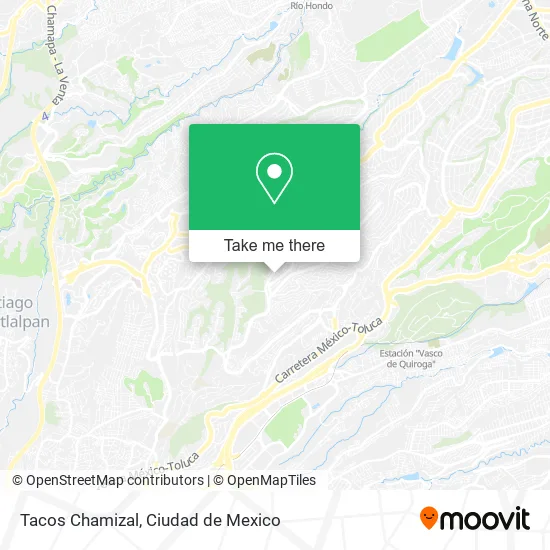
See Tacos Chamizal, Naucalpan De Juárez, on the map
Public Transit to Tacos Chamizal in Naucalpan De Juárez
Wondering how to get to Tacos Chamizal in Naucalpan De Juárez? Moovit helps you find the best way to get to Tacos Chamizal with step-by-step directions from the nearest public transit station.
Moovit provides free maps and live directions to help you navigate through your city. View schedules, routes, timetables, and find out how long does it take to get to Tacos Chamizal in real time.
Looking for the nearest stop or station to Tacos Chamizal? Check out this list of stops closest to your destination: Bosques de La Reforma - Bosques de Gardenias; Gardenias; Cerrada Cuarto Retorno Stim #12090.
Bus: 114, 8A, 113-B.
Want to see if there’s another route that gets you there at an earlier time? Moovit helps you find alternative routes or times. Get directions from and directions to Tacos Chamizal easily from the Moovit App or Website.
We make riding to Tacos Chamizal easy, which is why over 1.5 million users, including users in Naucalpan De Juárez, trust Moovit as the best app for public transit. You don’t need to download an individual bus app or train app, Moovit is your all-in-one transit app that helps you find the best bus time or train time available.
For information on prices of bus and metro, costs and ride fares to Tacos Chamizal, please check the Moovit app.
Use the app to navigate to popular places including to the airport, hospital, stadium, grocery store, mall, coffee shop, school, college, and university.
Tacos Chamizal Address: Tacos Chamizal, 23 de Septiembre 7, Lomas del Chamizal, 05129 Cuajimalpa de Morelos, Ciudad de Méxi street in Naucalpan De Juárez
- Capilla Nuestra Señora de Guadalupe,
- Betania,
- Honey & Nails,
- Amaranto Pasteleria Fina,
- Kosher Click,
- Estética Brisna,
- Disfraces de Peli,
- Las KeCostras STIM,
- Amazon Counter-Pak Mail Chamizal,
- Bongher,
- Paseo de Los Ahuehuetes Norte,
- Mirka Mexicana,
- Reparación de Calzado La Union,
- Av Stim Lomas del Chamizal Cuajimalpa de Morelos,
- Lomas del Chamizal,
- Tel Aviv Store,
- PASEO DE LOS AHUEHUETES NORTE 1381 BOSQUE DE LAS LOMAS,
- Portofino Bosques DE LAS Lomas SM,
- Restaurante La Casita Chamizal,
- Bosque de de Fábrica de Pólvora
Places Near Tacos Chamizal (Naucalpan De Juárez)
- Centro Banamex (Centro Citibanamex), Naucalpan De Juárez,
- Parque Las Antenas, Iztapalapa,
- Plaza Parque Tezontle, Iztapalapa,
- Clínica 29 Imss, Gustavo A. Madero,
- Hospital Magdalena de las Salinas, Gustavo A. Madero,
- Hospital Regional Lic. Adolfo López Mateos, Miguel Hidalgo,
- Central de Abasto de la Ciudad de México, Cuauhtémoc,
- HAMBURGO 213, Azcapotzalco,
- Antara Polanco (Antara Polanco-Puerta 1), Naucalpan De Juárez,
- Zona de Hospitales Tlalpan, Alvaro Obregón,
- Plaza Galerias De Las Estrellas, Azcapotzalco,
- Plaza Tepeyac, Gustavo A. Madero,
- Deportivo Los Galeana, Gustavo A. Madero,
- Monumental Plaza de Toros México, Miguel Hidalgo,
- Hospital Gabriel Mancera - Urgencias, Miguel Hidalgo,
- CECyT 6 Miguel Othón de Mendizábal, Azcapotzalco,
- Instituto Nacional de Neurologia y Neurocirugia "Manuel Velasco Suarez", Alvaro Obregón,
- BUCARELI 134 COL CENTRO DELEG CUAUHTEMOC D F, Azcapotzalco,
- Hospital Juarez de México, Gustavo A. Madero,
- World Trade Center Ciudad de México, Miguel Hidalgo
How to get to popular places in Ciudad de Mexico with public transit
Get around Naucalpan De Juárez by public transit!
Traveling around Naucalpan De Juárez has never been so easy. See step by step directions as you travel to any attraction, street or major public transit station. View bus and train schedules, arrival times, service alerts and detailed routes on a map, so you know exactly how to get to anywhere in Naucalpan De Juárez.
When traveling to any destination around Naucalpan De Juárez use Moovit's Live Directions with Get Off Notifications to know exactly where and how far to walk, how long to wait for your line, and how many stops are left. Moovit will alert you when it's time to get off — no need to constantly re-check whether yours is the next stop.
Wondering how to use public transit in Naucalpan De Juárez or how to pay for public transit in Naucalpan De Juárez? Moovit public transit app can help you navigate your way with public transit easily, and at minimum cost. It includes public transit fees, ticket prices, and costs. Looking for a map of Naucalpan De Juárez public transit lines? Moovit public transit app shows all public transit maps in Naucalpan De Juárez with all Bus, Train, Metro, Cable Car and Gondola routes and stops on an interactive map.
Ciudad de Mexico has 5 transit type(s), including: Bus, Train, Metro, Cable Car and Gondola, operated by several transit agencies, including STC (Metro CDMX), Metrobús, RTP, Trolebús elevado, Trolebús, Tren El Insurgente, Tren Ligero, Cablebús, Corredores Concesionados, Ferrocarriles Suburbanos, Mexibus, Mexicable, Puma Bus and Potrobús