How to get to Tacos Doña Chuy by bus?
Click on the bus route to see step by step directions with maps, line arrival times and updated time schedules.
From Villas de Nuestra Señora de la Asunción, Aguascalientes
38 minFrom CECyTEA Plantel Aguascalientes, Aguascalientes
30 minFrom Bosch, Aguascalientes
53 minFrom Residencial Las Plazas, Aguascalientes
47 minFrom CENTRAL CAMIONERA, Aguascalientes
44 minFrom Venaderos, Aguascalientes
50 minFrom San Francisco de Los Romo-Aguascalientes, Aguascalientes
53 minFrom Laboratorio Clínico del Campestre, Aguascalientes
36 minFrom Mirador de las Culturas II, Aguascalientes
39 min
Bus stops near Tacos Doña Chuy in Aguascalientes
Bus lines to Tacos Doña Chuy in Aguascalientes
- RUTA 02, Centro (Jardín Carpio),VIEW
- RUTA 12, Vicente Guerrero,VIEW
- RUTA 18, Uaa,VIEW
- RUTA 28, Jesús María,VIEW
- RUTA 51, Casa Blanca,VIEW
- RUTA 23, Villa Montaña,VIEW
- RUTA 24, Vistas De Oriente - Los Negritos,VIEW
- RUTA 25, Las Palmas,VIEW
- RUTA 41, Terminal Oriente (Penal),VIEW
- RUTA 41, Terminal Oriente (Alameda),VIEW
- RUTA 29, Centro (Jardínde Zaragoza),VIEW
- RUTA 39, Centro (Jardínde Zaragoza),VIEW
What are the closest stations to Tacos Doña Chuy?
The closest stations to Tacos Doña Chuy are:
- Avenida Héroe De Nacozari, 753 is 160 meters away, 3 min walk.
- Ezequiel A. Chávez, 623 is 257 meters away, 4 min walk.
- Licenciado Adolfo López Mateos Oriente, 835 is 275 meters away, 4 min walk.
- Avenida Héroe De Nacozari, 809 is 452 meters away, 6 min walk.
- Avenida Paseo De La Cruz, 905 is 481 meters away, 7 min walk.
Which bus lines stop near Tacos Doña Chuy?
These bus lines stop near Tacos Doña Chuy: RUTA 18, RUTA 23, RUTA 25, RUTA 28.
What’s the nearest bus station to Tacos Doña Chuy in Aguascalientes?
The nearest bus station to Tacos Doña Chuy in Aguascalientes is Avenida Héroe De Nacozari, 753. It’s a 3 min walk away.
What time is the first bus to Tacos Doña Chuy in Aguascalientes?
The RUTA 41 is the first bus that goes to Tacos Doña Chuy in Aguascalientes. It stops nearby at 5:50 AM.
What time is the last bus to Tacos Doña Chuy in Aguascalientes?
The RUTA 02 is the last bus that goes to Tacos Doña Chuy in Aguascalientes. It stops nearby at 10:33 PM.
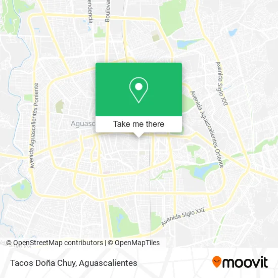
See Tacos Doña Chuy, Aguascalientes, on the map
Public Transit to Tacos Doña Chuy in Aguascalientes
Wondering how to get to Tacos Doña Chuy in Aguascalientes? Moovit helps you find the best way to get to Tacos Doña Chuy with step-by-step directions from the nearest public transit station.
Moovit provides free maps and live directions to help you navigate through your city. View schedules, routes, timetables, and find out how long does it take to get to Tacos Doña Chuy in real time.
Looking for the nearest stop or station to Tacos Doña Chuy? Check out this list of stops closest to your destination: Avenida Héroe De Nacozari; Ezequiel A. Chávez; Licenciado Adolfo López Mateos Oriente; Avenida Héroe De Nacozari; Avenida Paseo De La Cruz.
Bus: RUTA 18, RUTA 23, RUTA 25, RUTA 28, RUTA 02, RUTA 12, RUTA 51, RUTA 24, RUTA 41, RUTA 41, RUTA 29, RUTA 39.
Want to see if there’s another route that gets you there at an earlier time? Moovit helps you find alternative routes or times. Get directions from and directions to Tacos Doña Chuy easily from the Moovit App or Website.
We make riding to Tacos Doña Chuy easy, which is why over 1.5 million users, including users in Aguascalientes, trust Moovit as the best app for public transit. You don’t need to download an individual bus app or train app, Moovit is your all-in-one transit app that helps you find the best bus time or train time available.
For information on prices of bus, costs and ride fares to Tacos Doña Chuy, please check the Moovit app.
Use the app to navigate to popular places including to the airport, hospital, stadium, grocery store, mall, coffee shop, school, college, and university.
Tacos Doña Chuy Address: Avenida Héroe de Nacozari Sur Fracc Gámez 20249 Aguascalientes, Aguascalientes street in Aguascalientes
- El Rincon Del Pay,
- Prepa UNEA,
- Loncheria Magaña,
- UNEA,
- La Huerta Gamez,
- Viajes Ambolo,
- Junta Local De Conciliación y Arbitraje,
- Cinemas Kristal,
- Sat,
- Gastronomy Food Inc.,
- Plaza Kristal,
- Bansefi,
- Chichimeco 119,
- Despacho Jurídico de la Universidad Cuauhtémoc,
- Myt Legal Sc,
- Juzgado Segundo De Lo Civil,
- Monumento A Don Quijote,
- Glorieta El Quijote,
- Fiscalia General del Estado,
- Registro Civil
Places Near Tacos Doña Chuy (Aguascalientes)
- Villas de Nuestra Señora de la Asunción, Aguascalientes,
- Centro Comercial Altaria, Aguascalientes,
- Centro, Aguascalientes,
- Agropecuario, Aguascalientes,
- clinica 3 uaa, Aguascalientes,
- Villasuncion, Aguascalientes,
- Aeropuerto de Aguascalientes S.A. de C.V., Aguascalientes,
- Central De Autobuses, Aguascalientes,
- Nuevo Hospital Hidalgo, Aguascalientes,
- Jesús María, Aguascalientes,
- La Isla San Marcos, Aguascalientes,
- Parque Las Tres Centurias, Aguascalientes,
- Terminal De Combis, Aguascalientes,
- Isla San Marcos, Aguascalientes,
- Ciudad industrial, Aguascalientes,
- Imss Clinica 1, Aguascalientes,
- Blvd. Luis Donaldo Colosio, Aguascalientes,
- Universidad Autónoma de Aguascalientes, Aguascalientes,
- ESPACIOS, Aguascalientes,
- Hospital Imss No. 3, Aguascalientes
How to get to popular places in Aguascalientes with public transit
Get around Aguascalientes by public transit!
Traveling around Aguascalientes has never been so easy. See step by step directions as you travel to any attraction, street or major public transit station. View bus and train schedules, arrival times, service alerts and detailed routes on a map, so you know exactly how to get to anywhere in Aguascalientes.
When traveling to any destination around Aguascalientes use Moovit's Live Directions with Get Off Notifications to know exactly where and how far to walk, how long to wait for your line, and how many stops are left. Moovit will alert you when it's time to get off — no need to constantly re-check whether yours is the next stop.
Wondering how to use public transit in Aguascalientes or how to pay for public transit in Aguascalientes? Moovit public transit app can help you navigate your way with public transit easily, and at minimum cost. It includes public transit fees, ticket prices, and costs. Looking for a map of Aguascalientes public transit lines? Moovit public transit app shows all public transit maps in Aguascalientes with all bus routes and stops on an interactive map.
Aguascalientes has 1 transit type(s), including: bus, operated by several transit agencies, including Coordinación General de Movilidad