Directions to Tacos El Chaparro (Wichita) with public transportation
The following transit lines have routes that pass near Tacos El Chaparro
How to get to Tacos El Chaparro by bus?
Click on the bus route to see step by step directions with maps, line arrival times and updated time schedules.
From Dillons Money Services, Wichita
74 minFrom Beauty Design by Elena, Wichita
69 minFrom Record Nations, Wichita
36 minFrom Jesus Life Church, Wichita
56 minFrom Maruka USA, Wichita
92 minFrom STARBUCKS, Wichita
74 minFrom 600 S Eisenhower Airport Pkwy, Wichita
75 minFrom W 8th St N & N West St, Wichita
21 minFrom Walmart Supercenter, Wichita
49 minFrom Alina Borchardt MD, Wichita
53 min
Bus stops near Tacos El Chaparro in Wichita
Bus lines to Tacos El Chaparro in Wichita
What are the closest stations to Tacos El Chaparro?
The closest stations to Tacos El Chaparro are:
- 29th And Arkansas is 69 yards away, 2 min walk.
- Arkansas & 27th St Ib is 549 yards away, 7 min walk.
- Broadway And 29th St Ib is 943 yards away, 12 min walk.
- Woodland And Evergreen Park is 1161 yards away, 14 min walk.
Which bus line stops near Tacos El Chaparro?
ROUTE15: DOUGLAS (15obtic1dh)
What’s the nearest bus station to Tacos El Chaparro in Wichita?
The nearest bus station to Tacos El Chaparro in Wichita is 29th And Arkansas. It’s a 2 min walk away.
What time is the first bus to Tacos El Chaparro in Wichita?
The ROUTE15: DOUGLAS is the first bus that goes to Tacos El Chaparro in Wichita. It stops nearby at 5:33 AM.
What time is the last bus to Tacos El Chaparro in Wichita?
The ROUTE15: DOUGLAS is the last bus that goes to Tacos El Chaparro in Wichita. It stops nearby at 6:56 PM.
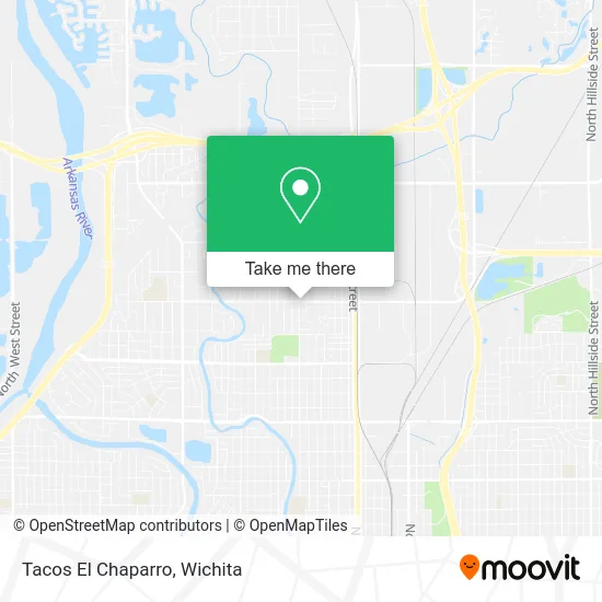
See Tacos El Chaparro, Wichita, on the map
Public Transit to Tacos El Chaparro in Wichita
Wondering how to get to Tacos El Chaparro in Wichita? Moovit helps you find the best way to get to Tacos El Chaparro with step-by-step directions from the nearest public transit station.
Moovit provides free maps and live directions to help you navigate through your city. View schedules, routes, timetables, and find out how long does it take to get to Tacos El Chaparro in real time.
Looking for the nearest stop or station to Tacos El Chaparro? Check out this list of stops closest to your destination: 29th And Arkansas; Arkansas & 27th St Ib; Broadway And 29th St Ib; Woodland And Evergreen Park.
Bus: ROUTE15: DOUGLAS, ROUTE17: RIVERSI, ROUTE13: N BDWY-, NORTH HIGH SCHOO.
Want to see if there’s another route that gets you there at an earlier time? Moovit helps you find alternative routes or times. Get directions from and directions to Tacos El Chaparro easily from the Moovit App or Website.
We make riding to Tacos El Chaparro easy, which is why over 1.5 million users, including users in Wichita, trust Moovit as the best app for public transit. You don’t need to download an individual bus app or train app, Moovit is your all-in-one transit app that helps you find the best bus time or train time available.
For information on prices of bus, costs and ride fares to Tacos El Chaparro, please check the Moovit app.
Use the app to navigate to popular places including to the airport, hospital, stadium, grocery store, mall, coffee shop, school, college, and university.
Tacos El Chaparro Address: 508 W 29th St N Wichita, KS 67204 street in Wichita
- Love Your Community,
- Bill's Charcoal Grill,
- Los Plebones Muffler,
- El Rum Rum Muffler Sho,
- Phoenix Body Works Collision Repair,
- Quality Electric,
- TJ's Detailing,
- William E Laughlin,
- B & B Hydraulics, Inc.,
- American Payday Loans,
- Audio Video Architects,
- Palmer Bud Auction,
- Tacos la Pesada,
- Big Chill Ice Cream,
- N Woodland St,
- Santiago Express Wichita KS,
- Iglesia Bautista Nueva Vida,
- Aesthetic & Plastic Surgery Pa,
- Mi Mexico Lindo Market,
- A.V. Tires
Places Near Tacos El Chaparro (Wichita)
- McConnell Air Force Base, Mcconnell Afb,
- Hubb's glory hole, Wichita,
- East 21st Street North and Webb Road, Wichita,
- Afghan Halal Market, Wichita,
- Paige Place Apartments, Wichita,
- Towne East Mall, Wichita,
- Sena African Hair Braiding LLC, Wichita,
- 21st & Maize, Wichita,
- Four Corners Cafe @ Wesley Medical Center, Wichita,
- North High School, Wichita,
- Spirit AeroSystems, Bldg 2-280J (Section 9),
- Ascencion Via Christi Hospital St Francis, Wichita,
- Bmer Tech Automotive, Wichita,
- Spirit Aerosystems Inc, Building 1-198D,
- Lopez Services, Wichita,
- Wichita Dwight D. Eisenhower National Airport (ICT) (Wichita Eisenhower National Airport), Wichita,
- Westside Athletic Field (Friends University Baseball Field), Wichita,
- Ratcliff Auto and Truck Repair, Wichita,
- Spirit Aerosystems,
- Total Card Solutions, Wichita
How to get to popular places in Wichita with public transit
Get around Wichita by public transit!
Traveling around Wichita has never been so easy. See step by step directions as you travel to any attraction, street or major public transit station. View bus and train schedules, arrival times, service alerts and detailed routes on a map, so you know exactly how to get to anywhere in Wichita.
When traveling to any destination around Wichita use Moovit's Live Directions with Get Off Notifications to know exactly where and how far to walk, how long to wait for your line, and how many stops are left. Moovit will alert you when it's time to get off — no need to constantly re-check whether yours is the next stop.
Wondering how to use public transit in Wichita or how to pay for public transit in Wichita? Moovit public transit app can help you navigate your way with public transit easily, and at minimum cost. It includes public transit fees, ticket prices, and costs. Looking for a map of Wichita public transit lines? Moovit public transit app shows all public transit maps in Wichita with all bus routes and stops on an interactive map.
Wichita has 1 transit type(s), including: bus, operated by several transit agencies, including Wichita Transit, Greyhound-us and FlixBus-us