How to get to Tacos Los Chilanguitos by bus?
Click on the bus route to see step by step directions with maps, line arrival times and updated time schedules.
From Hospital General del Sur, San Andrés Cholula
51 minFrom Outlet, Puebla
59 minFrom Plaza Comercial Angelopolis, San Andrés Cholula
49 minFrom Jardín del Arte, San Andrés Cholula
51 minFrom Fiscalía General del Estado, San Andrés Cholula
58 minFrom Escuela Normal Superior Del Estado De Puebla, San Andrés Cholula
43 minFrom Parque del Carmen, San Andrés Cholula
57 minFrom Lomas de Angelópolis III, Ocoyucan
38 minFrom Boulevard Atlixco y 25 Poniente, San Andrés Cholula
63 minFrom Lateral Recta a Cholula, San Andrés Cholula
64 min
Bus stops near Tacos Los Chilanguitos in Ocoyucan
Bus lines to Tacos Los Chilanguitos in Ocoyucan
What are the closest stations to Tacos Los Chilanguitos?
The closest stations to Tacos Los Chilanguitos are:
- Avenida Amapolas, 1739 is 129 meters away, 2 min walk.
- Calle 143 F Poniente, 1704 is 244 meters away, 4 min walk.
- Calle 143 Poniente, 1510 is 446 meters away, 6 min walk.
- Calle Trinidad, 13943 is 644 meters away, 9 min walk.
Which bus lines stop near Tacos Los Chilanguitos?
These bus lines stop near Tacos Los Chilanguitos: LÍNEA 2, RUTA NGA.
What’s the nearest bus station to Tacos Los Chilanguitos in Ocoyucan?
The nearest bus station to Tacos Los Chilanguitos in Ocoyucan is Avenida Amapolas, 1739. It’s a 2 min walk away.
What time is the first bus to Tacos Los Chilanguitos in Ocoyucan?
The A28 is the first bus that goes to Tacos Los Chilanguitos in Ocoyucan. It stops nearby at 4:30 AM.
What time is the last bus to Tacos Los Chilanguitos in Ocoyucan?
The A24 is the last bus that goes to Tacos Los Chilanguitos in Ocoyucan. It stops nearby at 11:53 PM.
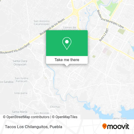
See Tacos Los Chilanguitos, Ocoyucan, on the map
Public Transit to Tacos Los Chilanguitos in Ocoyucan
Wondering how to get to Tacos Los Chilanguitos in Ocoyucan? Moovit helps you find the best way to get to Tacos Los Chilanguitos with step-by-step directions from the nearest public transit station.
Moovit provides free maps and live directions to help you navigate through your city. View schedules, routes, timetables, and find out how long does it take to get to Tacos Los Chilanguitos in real time.
Looking for the nearest stop or station to Tacos Los Chilanguitos? Check out this list of stops closest to your destination: Avenida Amapolas; Calle 143 F Poniente; Calle 143 Poniente; Calle Trinidad.
Bus: LÍNEA 2, RUTA NGA, A28, A24, RA24.
Want to see if there’s another route that gets you there at an earlier time? Moovit helps you find alternative routes or times. Get directions from and directions to Tacos Los Chilanguitos easily from the Moovit App or Website.
We make riding to Tacos Los Chilanguitos easy, which is why over 1.5 million users, including users in Ocoyucan, trust Moovit as the best app for public transit. You don’t need to download an individual bus app or train app, Moovit is your all-in-one transit app that helps you find the best bus time or train time available.
For information on prices of bus, costs and ride fares to Tacos Los Chilanguitos, please check the Moovit app.
Use the app to navigate to popular places including to the airport, hospital, stadium, grocery store, mall, coffee shop, school, college, and university.
Tacos Los Chilanguitos Address: Tacos Los Chilanguitos, Calle 19 Sur, Jardines de Castillotla 5ta Sección, 72498 Puebla, Puebla street in Ocoyucan
- Polleria El Poyuelo,
- Cosmetica,
- bachillerato Gral Of. Gregorio de Gante,
- Tecilli,
- Miscelanea Isabel,
- Tae Kwon do,
- Cocina Doña Chela,
- Farmacia del Centro de Salud San Bernabe Temoxtitla,
- Carniceria La Estrella,
- Centro de Salud San Bernabe Temoxtitla,
- Floreria Iris,
- Jardines de Castillotla 5ta Sección,
- Super Cocina Fede,
- La Taberna del Abuelo,
- Centro Cristiano Philadelphia,
- Persianas Decoalum Puebla,
- Bambinos Pizza,
- Estancia Infantil Tonanzi Comunitaria Castillotla, fuente de Vida,
- Distribuidor Telcel Accesorios de Telefonos,
- San Isidro Castillotla 2ª, 3ª, Y 4ª, Sección
Places Near Tacos Los Chilanguitos (Ocoyucan)
- Estadio Cuauhtémoc, Puebla,
- Parque Puebla, Puebla,
- 25 Zona Militar, Puebla,
- Ciudad Universitaria, Puebla,
- Centro Comercial Angelópolis, San Andrés Cholula,
- Tres Cruces, Puebla,
- Hospital Traumatología y Ortopedia de Puebla, San Pedro Cholula,
- Centro de Desarrollo Comunitario Tres Cruces, Puebla,
- Hospital Imss La Margarita, Puebla,
- Ciudad Judicial del Estado de Puebla, San Andrés Cholula,
- Centro Integral de Servicios CIS, San Andrés Cholula,
- Complejo Cultural Universitario, Ocoyucan,
- Plaza Las Animas, Puebla,
- Plaza Dorada Centro Comercial, Puebla,
- Parque Ecologico, Pue., San Andrés Cholula,
- Secretaria de Finanzas, Puebla,
- Galerías Serdán, San Pedro Cholula,
- Zona de los Fuertes, Puebla,
- Hospital General Regional 36 IMSS San Alejandro, San Andrés Cholula,
- SAT, San Andrés Cholula
How to get to popular places in Puebla with public transit
Get around Ocoyucan by public transit!
Traveling around Ocoyucan has never been so easy. See step by step directions as you travel to any attraction, street or major public transit station. View bus and train schedules, arrival times, service alerts and detailed routes on a map, so you know exactly how to get to anywhere in Ocoyucan.
When traveling to any destination around Ocoyucan use Moovit's Live Directions with Get Off Notifications to know exactly where and how far to walk, how long to wait for your line, and how many stops are left. Moovit will alert you when it's time to get off — no need to constantly re-check whether yours is the next stop.
Wondering how to use public transit in Ocoyucan or how to pay for public transit in Ocoyucan? Moovit public transit app can help you navigate your way with public transit easily, and at minimum cost. It includes public transit fees, ticket prices, and costs. Looking for a map of Ocoyucan public transit lines? Moovit public transit app shows all public transit maps in Ocoyucan with all bus routes and stops on an interactive map.
Puebla has 1 transit type(s), including: bus, operated by several transit agencies, including RUTA, RUTA Alimentadoras, Rutas Convencionales and Líneas temporales