Taivallahti stop - Sunday schedule
| Line | Direction | Time |
|---|---|---|
| 25 | Pajamaki | 6:47 AM |
| 25 | Pajamaki | 7:17 AM |
| 25 | Pajamaki | 7:47 AM |
| 25 | Pajamaki | 8:18 AM |
| 25 | Pajamaki | 8:48 AM |
| 25 | Pajamaki | 9:14 AM |
| 24 | Seurasaari | 9:21 AM |
| 25 | Pajamaki | 9:34 AM |
| 24 | Seurasaari | 9:51 AM |
| 25 | Pajamaki | 9:54 AM |
| 25 | Pajamaki | 10:14 AM |
| 24 | Seurasaari | 10:21 AM |
| 25 | Pajamaki | 10:34 AM |
| 24 | Seurasaari | 10:51 AM |
| 25 | Pajamaki | 10:54 AM |
| 25 | Pajamaki | 11:13 AM |
| 24 | Seurasaari | 11:21 AM |
| 25 | Pajamaki | 11:33 AM |
| 24 | Seurasaari | 11:51 AM |
| 25 | Pajamaki | 11:54 AM |
| 25 | Pajamaki | 12:14 PM |
| 24 | Seurasaari | 12:21 PM |
| 25 | Pajamaki | 12:34 PM |
| 24 | Seurasaari | 12:51 PM |
| 25 | Pajamaki | 12:54 PM |
Directions to Taivallahti stop (Helsinki) with public transit
The following transit lines have routes that pass near Taivallahti
 Bus: 25, 30, 37, 41, 42.
- Train: I, K, L.
- Metro: M1.
- Tram: 2, 8T.
How to get to Taivallahti stop by bus?
Click on the bus route to see step by step directions with maps, line arrival times and updated time schedules.
How to get to Taivallahti stop by train?
Click on the train route to see step by step directions with maps, line arrival times and updated time schedules.
How to get to Taivallahti stop by metro?
Click on the metro route to see step by step directions with maps, line arrival times and updated time schedules.
Bus stops near Taivallahti stop in Helsinki
- Taivallahti, 2 min walk,
- Apollo Street, 4 min walk,
- Töölö Square, 8 min walk,
Tram stations near Taivallahti station in Helsinki
- Apollo Street, 4 min walk,
- Arcadia Street, 4 min walk,
Bus lines to Taivallahti stop in Helsinki
- 25, Kamppi,
- 24, Seurasaari,
- 20, Eira-Kamppi-Munkkivuori,
- 30, Eira-Kamppi-Munkkiniemi-Konala-Malminkartano-Myyrmaki,
- 37, Kamppi-Konala-Malminkartano-Honkasuo-Myyrmaki,
- 41, Kamppi-North Haaga Station,
- 42, Kamppi-Maununneva-Kannelmäki,
- 63, Kamppi-Ruskeasuo-Maunula-Paloheinä,
- 69, Kamppi-Pasila-Kapyla-Malmi-Jakomaki,
- 69N, Kamppi-Ilmala-Oulunkylä-East Pakila,
- 70, Kamppi-Töölö-Pihlajamäki-Pukinmäki-Malmi,
- 212, Kamppi-Meilahti-Laajalahti-Kauniainen,
- 213, Kamppi-Meilahti-Suvela-Espoo Center-Kauklahti,
- 213N, Kamppi-Meilahti-Laajalahti-Suvela-Espoo Center,
- 400, Kamppi-Martinlaakso-Vantaankoski,
- 280, Kamppi-Turku Highway-Veikkola,
- 280A, Kamppi-Turku Highway-Veikkola-(Kalkkimäki),
- 282, Kamppi-Turku Highway-Veikkola-(Lohja),
- 282B, Kamppi-Turku Highway-Veikkola-(Lohja),
- 285, Kamppi-Turku Highway-Veikkola-(Karkkila),
What are the closest stations to Taivallahti?
The closest stations to Taivallahti are:
- Taivallahti is 93 meters away, 2 min walk.
- Apollo Street is 263 meters away, 4 min walk.
- Arcadia Street is 282 meters away, 4 min walk.
- Töölö Square is 607 meters away, 8 min walk.
Which bus lines stop near Taivallahti?
These bus lines stop near Taivallahti: 25, 30, 37, 41, 42, 69.
Which train lines stop near Taivallahti?
These train lines stop near Taivallahti: I, K, L.
Which metro line stops near Taivallahti?
M1 (Vuosaari)
Which tram lines stop near Taivallahti?
These tram lines stop near Taivallahti: 2, 8T.
What’s the nearest tram station to Taivallahti in Helsinki?
The nearest tram stations to Taivallahti in Helsinki are Apollo Street and Arcadia Street. The closest one is a 4 min walk away.
What’s the nearest bus station to Taivallahti in Helsinki?
The nearest bus station to Taivallahti in Helsinki is Taivallahti. It’s a 2 min walk away.
What time is the first tram to Taivallahti in Helsinki?
The 1T is the first tram that goes to Taivallahti in Helsinki. It stops nearby at 6:17 AM.
What time is the last tram to Taivallahti in Helsinki?
The 2H is the last tram that goes to Taivallahti in Helsinki. It stops nearby at 1:46 AM.
What time is the first bus to Taivallahti in Helsinki?
The 37 is the first bus that goes to Taivallahti in Helsinki. It stops nearby at 3:02 AM.
What time is the last bus to Taivallahti in Helsinki?
The 30 is the last bus that goes to Taivallahti in Helsinki. It stops nearby at 2:32 AM.
Taivallahti station
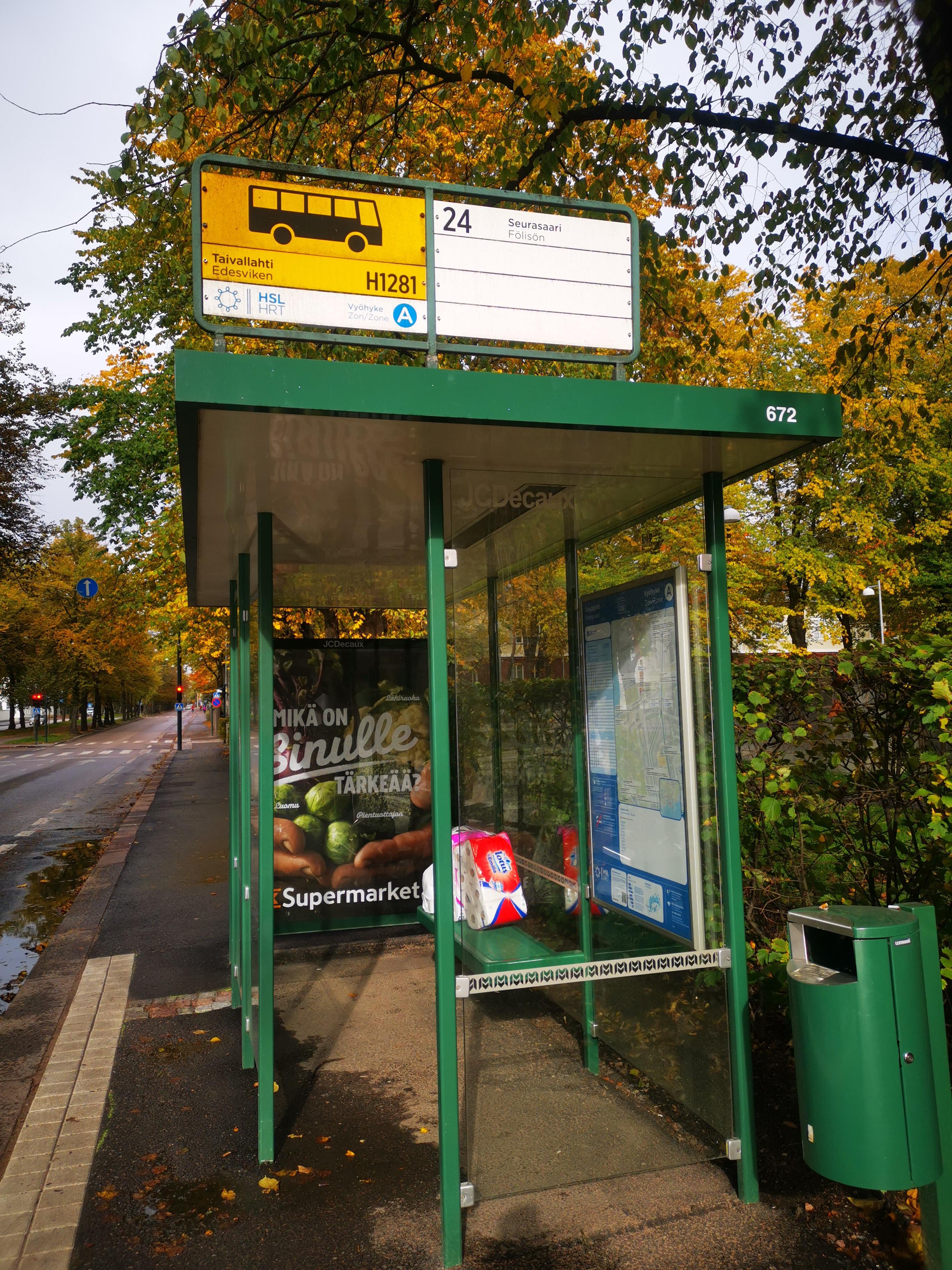 Taken by MrsOblak E.
See Taivallahti stop, Helsinki, on the map
Public transit to Taivallahti stop (ID: H1281) in Helsinki
Looking for directions to Taivallahti in Helsinki, Finland?
Download the Moovit App to find the current schedule and step-by-step directions for Bus, Metro, Tram, Train or Ferry routes that pass through Taivallahti.
Looking for the nearest stops closest to Taivallahti ? Check out this list of closest stops to your destination: Taivallahti; Apollo Street; Arcadia Street; Töölö Square.
Bus: 25, 30, 37, 41, 42, 69, 24, 20, 280, 280A, 282, 282B, 285, FORSSA - KARKKILA - HELSINKI, HELSINKI - KARKKILA - MARTTILA, HELSINKI - NUMMELA - KARKKILA, HELSINKI BUS STATION - KARKKILA BUS STATION, KARKKILA - NUMMELA - HELSINKI.Train: I, K, L.Metro: M1.Tram: 2, 8T.
We make riding on public transit to Taivallahti easy, which is why over 1.5 million users, including users in Helsinki trust Moovit as the best app for public transit.
Use the app to navigate to popular places including to the airport, hospital, stadium, grocery store, mall, coffee shop, school, college, and university.
Taivallahti stop’s code is H1281
The first line to this stop is 25, at 6:47 AM, and the last line is 25 at 11:35 PM.
This stop serves HSL’s lines
- Taivallahti,
- Apollo Street,
- Töölö Square
Bus stops near Taivallahti stop
- Apollo Street,
- Arcadia Street
Tram stations near Taivallahti station
- Biology Street,
- Alakivi Road 5,
- Song Alley [Arc],
- Shooting Star Road,
- Spruce Road,
- Kumpula,
- Post Office 1,
- Munkkivuori,
- Marjaniemi,
- Home Rock,
- Weaving Road,
- East Hakkila,
- Eastern River Park,
- City Garden,
- Meilahti Hospital,
- Käpylä Fire Station,
- Peijas,
- Malmi Cemetery,
- Viertola Road,
- Päiväkumpu
Popular public transit stations in Helsinki
Get around Helsinki by public transit!
Traveling around Helsinki has never been so easy. See step by step directions as you travel to any attraction, street or major public transit station. View bus and train schedules, arrival times, service alerts and detailed routes on a map, so you know exactly how to get to anywhere in Helsinki.
When traveling to any destination around Helsinki use Moovit's Live Directions with Get Off Notifications to know exactly where and how far to walk, how long to wait for your line, and how many stops are left. Moovit will alert you when it's time to get off — no need to constantly re-check whether yours is the next stop.
Wondering how to use public transit in Helsinki or how to pay for public transit in Helsinki? Moovit public transit app can help you navigate your way with public transit easily, and at minimum cost. It includes public transit fees, ticket prices, and costs. Looking for a map of Helsinki public transit lines? Moovit public transit app shows all public transit maps in Helsinki with all Bus, Train, Metro, Tram, Ferry and Funicular routes and stops on an interactive map.
Helsinki has 6 transit type(s), including: Bus, Train, Metro, Tram, Ferry and Funicular, operated by several transit agencies, including HSL, Nysse/Valkeakoski Transport Ltd, Ely/Charter Transport Lampinen Ltd, FÖLI Turku Region Public Transport, Ely/Bussi-Manninen Ltd, LS Transit Lines Ltd, FÖLI / Regional+ (Waltti), Nysse/Vekka Group Ltd, VR, Nysse/Koiviston Auto Tampere, Nysse/Remoted Ltd, Nysse/Pohjolan Liikenne Ltd, Nysse/VR, Nysse/Länsilinjat Ltd and Ely/Vekka Group Ltd