Talbot Ave @ Centre St stop - Monday schedule
| Line | Direction | Time |
|---|---|---|
| 23 | Ruggles | 5:05 AM |
| 22 | Ruggles | 5:07 AM |
| 22 | Ruggles | 5:17 AM |
| 23 | Ruggles | 5:18 AM |
| 26 | Gallivan Blvd Via Norfolk St | 5:20 AM |
| 22 | Ruggles | 5:27 AM |
| 23 | Ruggles | 5:31 AM |
| 22 | Ruggles | 5:37 AM |
| 23 | Ruggles | 5:42 AM |
| 26 | Gallivan Blvd Via Norfolk St | 5:43 AM |
| 22 | Ruggles | 5:45 AM |
| 23 | Ruggles | 5:49 AM |
| 22 | Ruggles | 5:53 AM |
| 23 | Ruggles | 5:56 AM |
| 22 | Ruggles | 6:01 AM |
| 23 | Ruggles | 6:03 AM |
| 26 | Gallivan Blvd Via Norfolk St | 6:06 AM |
| 22 | Ruggles | 6:08 AM |
| 23 | Ruggles | 6:09 AM |
| 23 | Ruggles | 6:15 AM |
| 22 | Ruggles | 6:15 AM |
| 23 | Ruggles | 6:22 AM |
| 22 | Ruggles | 6:22 AM |
| 23 | Ruggles | 6:27 AM |
| 22 | Ruggles | 6:29 AM |
Directions to Talbot Ave @ Centre St stop (Boston) with public transit
The following transit lines have routes that pass near Talbot Ave @ Centre St
 Bus: 22, 23, 26.
- Train: FAIRMOUNT, FRANKLIN/FOXBORO, FAIRMOUNT LINE SHUTTLE, PROVIDENCE/STOUGHTON.
- Subway: RED LINE, MATTAPAN LINE.
How to get to Talbot Ave @ Centre St stop by bus?
Click on the bus route to see step by step directions with maps, line arrival times and updated time schedules.
How to get to Talbot Ave @ Centre St stop by train?
Click on the train route to see step by step directions with maps, line arrival times and updated time schedules.
How to get to Talbot Ave @ Centre St stop by subway?
Click on the subway route to see step by step directions with maps, line arrival times and updated time schedules.
Bus stops near Talbot Ave @ Centre St stop in Boston
- Talbot Ave @ Lithgow St, 1 min walk,
Subway stations near Talbot Ave @ Centre St station in Boston
- Shawmut, 8 min walk,
- Cedar Grove, 21 min walk,
Train stations near Talbot Ave @ Centre St station in Boston
- Talbot Avenue, 9 min walk,
Bus lines to Talbot Ave @ Centre St stop in Boston
- 22, Ruggles,
- 23, Ashmont,
- 26, Gallivan Blvd Via Norfolk St,
What are the closest stations to Talbot Ave @ Centre St?
The closest stations to Talbot Ave @ Centre St are:
- Talbot Ave @ Lithgow St stop is 61 yards away, 1 min walk.
- Shawmut station is 671 yards away, 8 min walk.
- Talbot Avenue station is 745 yards away, 9 min walk.
- Cedar Grove station is 1791 yards away, 21 min walk.
Which bus lines stop near Talbot Ave @ Centre St?
These bus lines stop near Talbot Ave @ Centre St: 22, 23, 26.
Which train line stops near Talbot Ave @ Centre St?
FAIRMOUNT (#1615 | Readville)
Which subway line stops near Talbot Ave @ Centre St?
RED LINE (Ashmont/Braintree)
What’s the nearest subway station to Talbot Ave @ Centre St in Boston?
The nearest subway station to Talbot Ave @ Centre St in Boston is Shawmut. It’s a 8 min walk away.
What’s the nearest train station to Talbot Ave @ Centre St in Boston?
The nearest train station to Talbot Ave @ Centre St in Boston is Talbot Avenue. It’s a 9 min walk away.
What’s the nearest bus station to Talbot Ave @ Centre St in Boston?
The nearest bus station to Talbot Ave @ Centre St in Boston is Talbot Ave @ Lithgow St. It’s a 1 min walk away.
What time is the first subway to Talbot Ave @ Centre St in Boston?
The MATTAPAN LINE is the first subway that goes to Talbot Ave @ Centre St in Boston. It stops nearby at 5:10 AM.
What time is the last subway to Talbot Ave @ Centre St in Boston?
The MATTAPAN LINE is the last subway that goes to Talbot Ave @ Centre St in Boston. It stops nearby at 1:31 AM.
What time is the first train to Talbot Ave @ Centre St in Boston?
The FAIRMOUNT is the first train that goes to Talbot Ave @ Centre St in Boston. It stops nearby at 4:56 AM.
What time is the last train to Talbot Ave @ Centre St in Boston?
The FRANKLIN/FOXBORO is the last train that goes to Talbot Ave @ Centre St in Boston. It stops nearby at 12:11 AM.
What time is the first bus to Talbot Ave @ Centre St in Boston?
The 23 is the first bus that goes to Talbot Ave @ Centre St in Boston. It stops nearby at 4:50 AM.
What time is the last bus to Talbot Ave @ Centre St in Boston?
The 23 is the last bus that goes to Talbot Ave @ Centre St in Boston. It stops nearby at 2:41 AM.
Talbot Ave @ Centre St station
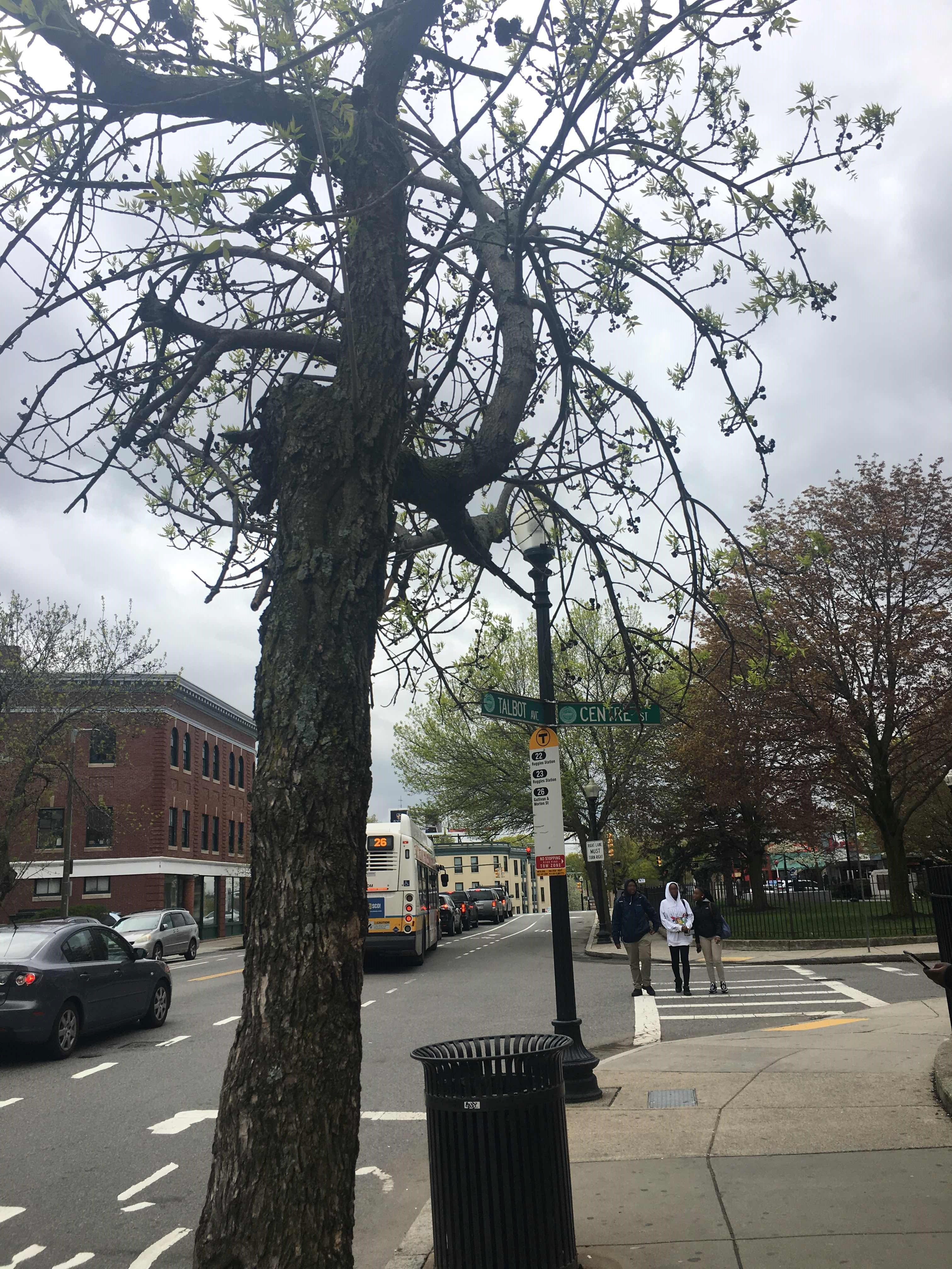 Taken by Anonymous
See Talbot Ave @ Centre St stop, Boston, on the map
Public transit to Talbot Ave @ Centre St stop (ID: 371) in Boston
Looking for directions to Talbot Ave @ Centre St in Boston, United States?
Download the Moovit App to find the current schedule and step-by-step directions for Bus, Subway or Train routes that pass through Talbot Ave @ Centre St.
Looking for the nearest stops closest to Talbot Ave @ Centre St ? Check out this list of closest stops to your destination: Talbot Ave @ Lithgow St; Shawmut; Talbot Avenue; Cedar Grove.
Bus: 22, 23, 26.Train: FAIRMOUNT, FRANKLIN/FOXBORO, FAIRMOUNT LINE SHUTTLE, PROVIDENCE/STOUGHTON.Subway: RED LINE, MATTAPAN LINE.
We make riding on public transit to Talbot Ave @ Centre St easy, which is why over 1.7 billion users, including users in Boston trust Moovit as the best app for public transit.
Use the app to navigate to popular places including to the airport, hospital, stadium, grocery store, mall, coffee shop, school, college, and university.
Talbot Ave @ Centre St stop’s code is 371
The first line to this stop is 23, at 5:05 AM, and the last line is 26 at 4:57 AM.
Talbot Avenue, Boston, MA, USA
This stop serves MBTA’s lines
- Talbot Ave @ Lithgow St
Bus stop near Talbot Ave @ Centre St stop
- Shawmut,
- Cedar Grove
Subway stations near Talbot Ave @ Centre St station
- Talbot Avenue
Train station near Talbot Ave @ Centre St station
- Washington Square Transit Center,
- Elm St @ Jackson Ave,
- Eastern Ave @ Broadway,
- Arsenal St @ Arlington St,
- L St @ Broadway,
- Main St @ Belmont St,
- 172 Bowdoin St,
- Andover Mbta Station,
- 255 Chelmsford St,
- Granite St @ Wood Rd,
- Neptune Blvd @ Commercial St,
- Nicholas J. Costello Transportation Center,
- Museum Of Fine Arts,
- Tremont St @ Washington St,
- Washington St @ Medford St,
- Cummins Hwy @ Fairway St,
- Park Row West (Drop-Off Only),
- Forge Park/495,
- Cambridge St @ Norfolk St,
- Brighton Ave @ Commonwealth Ave
Popular public transit stations in Boston
Get around Boston by public transit!
Traveling around Boston has never been so easy. See step by step directions as you travel to any attraction, street or major public transit station. View bus and train schedules, arrival times, service alerts and detailed routes on a map, so you know exactly how to get to anywhere in Boston.
When traveling to any destination around Boston use Moovit's Live Directions with Get Off Notifications to know exactly where and how far to walk, how long to wait for your line, and how many stops are left. Moovit will alert you when it's time to get off — no need to constantly re-check whether yours is the next stop.
Wondering how to use public transit in Boston or how to pay for public transit in Boston? Moovit public transit app can help you navigate your way with public transit easily, and at minimum cost. It includes public transit fees, ticket prices, and costs. Looking for a map of Boston public transit lines? Moovit public transit app shows all public transit maps in Boston with all Bus, Train, Subway and Ferry routes and stops on an interactive map.
Boston has 4 transit type(s), including: Bus, Train, Subway and Ferry, operated by several transit agencies, including MBTA, Southeastern Regional Transit Authority, MetroWest Regional Transit Authority, Rhode Island Public Transit Authority, WRTA, Lowell Regional Transit Authority, MEVA, Montachusett Regional Transit Authority, Cape Cod Regional Transit Authority, Brockton Area Transit Authority, Martha's Vineyard Transit Authority, Nantucket Regional Transit Authority, GATRA, Cape Ann Transportation Authority and Massport