How to get to Tall Rabbit Cafe + Community by bus?
Click on the bus route to see step by step directions with maps, line arrival times and updated time schedules.
From Bodigon's H-D Motorcycle, New Haven
36 minFrom Lutheran Medical Group 7916 West Jefferson Blvd., Fort Wayne
152 minFrom Drama Queen Boutique, Fort Wayne
23 minFrom Lincoln Electric Company, Fort Wayne
30 minFrom Area Realty Brokers, New Haven
37 minFrom Brandy Chase, Fort Wayne
50 minFrom New Haven Lodge, New Haven
38 minFrom I 69 North, Fort Wayne
158 minFrom South Bridge Apartments, Fort Wayne
29 min
Bus stops near Tall Rabbit Cafe + Community in Fort Wayne
Bus lines to Tall Rabbit Cafe + Community in Fort Wayne
What are the closest stations to Tall Rabbit Cafe + Community?
The closest stations to Tall Rabbit Cafe + Community are:
- Calhoun at Masterson (Sb) is 138 yards away, 2 min walk.
- Central Station - Bay G is 266 yards away, 4 min walk.
- Central Station - Bay H is 281 yards away, 4 min walk.
- Calhoun Near Wallace is 290 yards away, 4 min walk.
- Masterson at Hoagland is 577 yards away, 7 min walk.
- Central Station - Bay Q is 617 yards away, 8 min walk.
- Central Station - Bay P is 631 yards away, 8 min walk.
Which bus lines stop near Tall Rabbit Cafe + Community?
These bus lines stop near Tall Rabbit Cafe + Community: 10NH, 2TC, 4WL, 8C, 8GN.
What’s the nearest bus station to Tall Rabbit Cafe + Community in Fort Wayne?
The nearest bus station to Tall Rabbit Cafe + Community in Fort Wayne is Calhoun at Masterson (Sb). It’s a 2 min walk away.
What time is the first bus to Tall Rabbit Cafe + Community in Fort Wayne?
The 3VW is the first bus that goes to Tall Rabbit Cafe + Community in Fort Wayne. It stops nearby at 6:01 AM.
What time is the last bus to Tall Rabbit Cafe + Community in Fort Wayne?
The 8GN is the last bus that goes to Tall Rabbit Cafe + Community in Fort Wayne. It stops nearby at 9:35 PM.
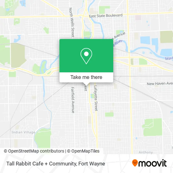
See Tall Rabbit Cafe + Community, Fort Wayne, on the map
Public Transit to Tall Rabbit Cafe + Community in Fort Wayne
Wondering how to get to Tall Rabbit Cafe + Community in Fort Wayne? Moovit helps you find the best way to get to Tall Rabbit Cafe + Community with step-by-step directions from the nearest public transit station.
Moovit provides free maps and live directions to help you navigate through your city. View schedules, routes, timetables, and find out how long does it take to get to Tall Rabbit Cafe + Community in real time.
Looking for the nearest stop or station to Tall Rabbit Cafe + Community? Check out this list of stops closest to your destination: Calhoun at Masterson (Sb); Central Station - Bay G; Central Station - Bay H; Calhoun Near Wallace; Masterson at Hoagland; Central Station - Bay Q; Central Station - Bay P.
Bus: 10NH, 2TC, 4WL, 8C, 8GN, 3VW, 7ANT, 6S, 9BT, 2G.
Want to see if there’s another route that gets you there at an earlier time? Moovit helps you find alternative routes or times. Get directions from and directions to Tall Rabbit Cafe + Community easily from the Moovit App or Website.
We make riding to Tall Rabbit Cafe + Community easy, which is why over 1.5 million users, including users in Fort Wayne, trust Moovit as the best app for public transit. You don’t need to download an individual bus app or train app, Moovit is your all-in-one transit app that helps you find the best bus time or train time available.
For information on prices of bus, costs and ride fares to Tall Rabbit Cafe + Community, please check the Moovit app.
Get to Tall Rabbit Cafe + Community with public transit and pay for the ride in the Moovit app. In addition to all info you may need for your trip to Tall Rabbit Cafe + Community, including live directions, real-time arrivals and fare prices, you can also buy public transit passes for your rides. No need for cash or paper tickets to get to Tall Rabbit Cafe + Community - everything you need is accessible in the app with a click of the button.
Use the app to navigate to popular places including to the airport, hospital, stadium, grocery store, mall, coffee shop, school, college, and university.
Tall Rabbit Cafe + Community Address: 2001 S Calhoun St Fort Wayne, IN 46802 street in Fort Wayne
- Superior Water Conditioners,
- Magnatech,
- Family Tax Company,
- Lam Medical LLC,
- Quick Goodman Central Air Conditioners,
- Centurion Security Services,
- Automotive Color and S,
- Wright Choice Hairquarters,
- Allen County Sheriffs Office,
- Mungovan & Sons Memorial Musalla,
- The Preston Joan Group,
- 1835 Bldg.,
- Records & Music,
- KBZ Motorwerkz,
- The Art Leadership Center,
- W Williams St,
- neighborhood health clinic,
- Reliable Movers,
- Cromwell Ct,
- Libertyx Bitcoin ATM
Places Near Tall Rabbit Cafe + Community (Fort Wayne)
- german Roasted Nuts Stand (Glenbrook Mall), Fort Wayne,
- Lima Rd / W Coliseum Blvd, Fort Wayne,
- Dupont Hospital, Fort Wayne,
- North Side High School, Fort Wayne,
- Fort Wayne International Airport (FWA) (Fort Wayne International Airport), Fort Wayne,
- Maplecrest Rd / Stellhorn Rd, Fort Wayne,
- Parkview Randallia Infusion Center, Fort Wayne,
- Trine University, Fort Wayne,
- Legacy Dental,
- Lutheran Ministries Media, Fort Wayne,
- Jefferson Pointe, Fort Wayne,
- Walmart Supercenter, Fort Wayne,
- Citilink Bus 10 (New Haven), Fort Wayne,
- South Side Baseball - Derbyshire Field,
- Illinois Road & Hadley Road Intersection, Fort Wayne,
- Parkview North Hospital,
- Parkview Hospital Parking Garage, Fort Wayne,
- Sweetwater Sound, Fort Wayne,
- Aunt Gena's Sweet Corn,
- Fort Wayne International Airport, Fort Wayne
How to get to popular places in Fort Wayne with public transit
Get around Fort Wayne by public transit!
Traveling around Fort Wayne has never been so easy. See step by step directions as you travel to any attraction, street or major public transit station. View bus and train schedules, arrival times, service alerts and detailed routes on a map, so you know exactly how to get to anywhere in Fort Wayne.
When traveling to any destination around Fort Wayne use Moovit's Live Directions with Get Off Notifications to know exactly where and how far to walk, how long to wait for your line, and how many stops are left. Moovit will alert you when it's time to get off — no need to constantly re-check whether yours is the next stop.
Wondering how to use public transit in Fort Wayne or how to pay for public transit in Fort Wayne? Moovit public transit app can help you navigate your way with public transit easily, and at minimum cost. It includes public transit fees, ticket prices, and costs. Looking for a map of Fort Wayne public transit lines? Moovit public transit app shows all public transit maps in Fort Wayne with all bus routes and stops on an interactive map.
Fort Wayne has 1 transit type(s), including: bus, operated by several transit agencies, including Citilink