Directions to Tammy's Angels (Baltimore County) with public transportation
The following transit lines have routes that pass near Tammy's Angels
 Bus: 40, 79, CITYLINK BLUE, 37, 31.
How to get to Tammy's Angels by bus?
Click on the bus route to see step by step directions with maps, line arrival times and updated time schedules.
From Lord Baltimore Hotel, Baltimore
37 minFrom University Of Maryland Medical Center, Baltimore
42 minFrom Baltimore City Community College (BCCC) - Liberty Campus, Baltimore
35 minFrom Medstar Union Memorial Hospital, Baltimore
59 minFrom Hopkins Plaza, Baltimore
38 minFrom M&T Bank Stadium, Baltimore
48 minFrom Loyola University Maryland, Baltimore
65 minFrom Walmart, Baltimore County
64 minFrom Baltimore Penn Station, Baltimore
36 minFrom Baltimore Marriott Inner Harbor at Camden Yards, Baltimore
40 min
Bus stops near Tammy's Angels in Baltimore County
Bus lines to Tammy's Angels in Baltimore County
What are the closest stations to Tammy's Angels?
The closest stations to Tammy's Angels are:
- Security Blvd & Gwynn Oak Ave Eb is 184 yards away, 3 min walk.
- Woodlawn Dr & Parallel Dr Sb is 601 yards away, 8 min walk.
- Woodlawn Dr & Super Fresh Sb is 749 yards away, 10 min walk.
Which bus lines stop near Tammy's Angels?
These bus lines stop near Tammy's Angels: 40, 79, CITYLINK BLUE.
What’s the nearest bus station to Tammy's Angels in Baltimore County?
The nearest bus station to Tammy's Angels in Baltimore County is Security Blvd & Gwynn Oak Ave Eb. It’s a 3 min walk away.
What time is the first bus to Tammy's Angels in Baltimore County?
The 31 is the first bus that goes to Tammy's Angels in Baltimore County. It stops nearby at 3:59 AM.
What time is the last bus to Tammy's Angels in Baltimore County?
The 31 is the last bus that goes to Tammy's Angels in Baltimore County. It stops nearby at 1:52 AM.
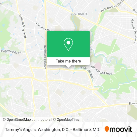
See Tammy's Angels, Baltimore County, on the map
Public Transit to Tammy's Angels in Baltimore County
Wondering how to get to Tammy's Angels in Baltimore County? Moovit helps you find the best way to get to Tammy's Angels with step-by-step directions from the nearest public transit station.
Moovit provides free maps and live directions to help you navigate through your city. View schedules, routes, timetables, and find out how long does it take to get to Tammy's Angels in real time.
Looking for the nearest stop or station to Tammy's Angels? Check out this list of stops closest to your destination: Security Blvd & Gwynn Oak Ave Eb; Woodlawn Dr & Parallel Dr Sb; Woodlawn Dr & Super Fresh Sb.
Bus: 40, 79, CITYLINK BLUE, 37, 31.
Want to see if there’s another route that gets you there at an earlier time? Moovit helps you find alternative routes or times. Get directions from and directions to Tammy's Angels easily from the Moovit App or Website.
We make riding to Tammy's Angels easy, which is why over 1.7 million users, including users in Baltimore County, trust Moovit as the best app for public transit. You don’t need to download an individual bus app or train app, Moovit is your all-in-one transit app that helps you find the best bus time or train time available.
For information on prices of bus and light rail, costs and ride fares to Tammy's Angels, please check the Moovit app.
Use the app to navigate to popular places including to the airport, hospital, stadium, grocery store, mall, coffee shop, school, college, and university.
Tammy's Angels Address: 6340 Security Blvd street in Baltimore County
- Gwynn Oak Ave,
- Social Security Headquarters, Woodlawn, MD.,
- Social Security Administration (Robert M. Ball Building),
- SSA Fitness Center,
- Social Security Administration - Headquarters - Annex,
- Woodlawn High School,
- Gwynn Oak Top Locksmith,
- Woodlawn High School (Woodlawn High Center for Pre-Eng. Res),
- KLM Express,
- Social Security Administration WOC Bldg.,
- Greek Orthodox Cemetery,
- Security Blvd & Whitehead Rd Eb,
- K&G,
- Drug Rehab Woodlawn,
- Ash the Barber,
- BMO Harris Bank,
- Baltimore County Police - Precinct 2 (Woodlawn),
- Woodlawn, Maryland,
- Catholic Charities,
- Monika Pl (monika place woodlawn)
Places Near Tammy's Angels (Baltimore County)
- PG Mall, Prince George's County,
- Westfield Montgomery Mall, Montgomery County,
- Amazon Hq2, Arlington County,
- Basilica of the National Shrine, Washington,
- Camden Yards, Baltimore,
- National Zoo, Washington,
- Sibley Memorial Hospital, Washington,
- Pennsylvania Ave NW (3rd st and pennsylvania), Washington,
- M&T Bank Stadium, Baltimore,
- Capital One Arena, Washington,
- Washington DC VA Medical Center, Washington,
- Rock Creek Tennis Center, Washington,
- National Theatre, Washington,
- Georgetown, Washington,
- National Museum of African American History and Culture, Washington,
- The Anthem, Washington,
- Marriott Marquis Washington, DC, Washington,
- Museum Of The Bible, Washington,
- Warner Theatre, Washington,
- Washington National Cathedral, Washington
How to get to popular places in Washington, D.C. - Baltimore, MD with public transit
Get around Baltimore County by public transit!
Traveling around Baltimore County has never been so easy. See step by step directions as you travel to any attraction, street or major public transit station. View bus and train schedules, arrival times, service alerts and detailed routes on a map, so you know exactly how to get to anywhere in Baltimore County.
When traveling to any destination around Baltimore County use Moovit's Live Directions with Get Off Notifications to know exactly where and how far to walk, how long to wait for your line, and how many stops are left. Moovit will alert you when it's time to get off — no need to constantly re-check whether yours is the next stop.
Wondering how to use public transit in Baltimore County or how to pay for public transit in Baltimore County? Moovit public transit app can help you navigate your way with public transit easily, and at minimum cost. It includes public transit fees, ticket prices, and costs. Looking for a map of Baltimore County public transit lines? Moovit public transit app shows all public transit maps in Baltimore County with all Bus, Train, Metro, Light Rail and Ferry routes and stops on an interactive map.
Washington, D.C. - Baltimore, MD has 5 transit type(s), including: Bus, Train, Metro, Light Rail and Ferry, operated by several transit agencies, including WMATA, Montgomery County Ride On, Fairfax Connector, TheBus, PRTC, DASH - Alexandria, Arlington Transit (ART), RTA of Central Maryland, MDOT MTA, MDOT MTA Light RailLink, MDOT MTA Commuter Bus, MDOT MTA Local Bus, FXBGO!, Virginia Railway Express (VRE) and MARC