Directions to Tap Community Development Outreach (Lexington) with public transportation
The following transit lines have routes that pass near Tap Community Development Outreach
 Bus: VIRGINIA BREEZE, MAURY EXPRESS.
How to get to Tap Community Development Outreach by bus?
Click on the bus route to see step by step directions with maps, line arrival times and updated time schedules.
From Centreville, VA, Fairfax County
343 minFrom Wegmans, Prince William County
435 minFrom The Cheesecake Factory, Fairfax County
344 minFrom Manassas, VA, Manassas
383 minFrom Walmart Supercenter, Fairfax County
387 minFrom I-95 Exit 158: Prince William Pkwy, Prince William County
382 minFrom Herndon, Virginia, Fairfax County
324 minFrom Dumfries, VA, Prince William County
412 minFrom IKEA, Prince William County
422 min
Bus stop near Tap Community Development Outreach in Lexington
- E. Nelson Street, 3 min walk,VIEW
Bus lines to Tap Community Development Outreach in Lexington
- MAURY EXPRESS, Lexington,VIEW
What are the closest stations to Tap Community Development Outreach?
The closest stations to Tap Community Development Outreach are:
- E. Nelson Street is 183 yards away, 3 min walk.
Which bus line stops near Tap Community Development Outreach?
VIRGINIA BREEZE
What’s the nearest bus station to Tap Community Development Outreach in Lexington?
The nearest bus station to Tap Community Development Outreach in Lexington is E. Nelson Street. It’s a 3 min walk away.
What time is the first bus to Tap Community Development Outreach in Lexington?
The MAURY EXPRESS is the first bus that goes to Tap Community Development Outreach in Lexington. It stops nearby at 8:05 AM.
What time is the last bus to Tap Community Development Outreach in Lexington?
The MAURY EXPRESS is the last bus that goes to Tap Community Development Outreach in Lexington. It stops nearby at 5:53 PM.
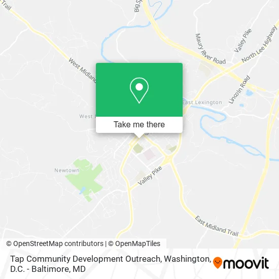
See Tap Community Development Outreach, Lexington, on the map
Public Transit to Tap Community Development Outreach in Lexington
Wondering how to get to Tap Community Development Outreach in Lexington? Moovit helps you find the best way to get to Tap Community Development Outreach with step-by-step directions from the nearest public transit station.
Moovit provides free maps and live directions to help you navigate through your city. View schedules, routes, timetables, and find out how long does it take to get to Tap Community Development Outreach in real time.
Looking for the nearest stop or station to Tap Community Development Outreach? Check out this list of stops closest to your destination: E. Nelson Street.
Bus: VIRGINIA BREEZE, MAURY EXPRESS.
Want to see if there’s another route that gets you there at an earlier time? Moovit helps you find alternative routes or times. Get directions from and directions to Tap Community Development Outreach easily from the Moovit App or Website.
We make riding to Tap Community Development Outreach easy, which is why over 1.5 million users, including users in Lexington, trust Moovit as the best app for public transit. You don’t need to download an individual bus app or train app, Moovit is your all-in-one transit app that helps you find the best bus time or train time available.
For information on prices of bus, metro and train, costs and ride fares to Tap Community Development Outreach, please check the Moovit app.
Use the app to navigate to popular places including to the airport, hospital, stadium, grocery store, mall, coffee shop, school, college, and university.
Tap Community Development Outreach Address: 20 E Preston St Lexington, VA 24450 street in Lexington
- Rockbridge Area Social Services,
- Lexington Buena Vista,
- Habitat for Humanity,
- Harris M Teresa,
- Rockbridge Mutual Fire Ins,
- Ace Bookkeeping & Tax Preparation,
- Scott & Stringfellow,
- Tobacco Bank,
- Shenandoah Specialty Publishing,
- Rockbridge Farmers Co-OP,
- Rockbridge County District Court,
- Rockbridge County Ext Service,
- Commonwealth of Virginia,
- Virginia Polytechnic Institute & State University,
- Rockbridge Recycling Coordinator,
- Rockbridge County Administrative Offices,
- Manly Memorial Baptist Church,
- Matsumoto,
- Ellington David A MD,
- Carilion Clinic Family Medicine - Lexington, S Main Street
Places Near Tap Community Development Outreach (Lexington)
- Camden Yards, Baltimore,
- M&T Bank Stadium, Baltimore,
- Basilica of the National Shrine, Washington,
- Amazon Hq2, Arlington County,
- Westfield Montgomery Mall, Montgomery County,
- Sibley Memorial Hospital, Washington,
- Marriott Marquis Washington, DC, Washington,
- Museum Of The Bible, Washington,
- National Mall, Washington,
- National Zoo, Washington,
- Rock Creek Tennis Center, Washington,
- Capital One Arena, Washington,
- Washington National Cathedral, Washington,
- Warner Theatre, Washington,
- Washington DC VA Medical Center, Washington,
- Pennsylvania Ave NW (3rd st and pennsylvania), Washington,
- PG Mall, Prince George's County,
- National Museum of African American History and Culture, Washington,
- The Anthem, Washington,
- Georgetown, Washington
How to get to popular places in Washington, D.C. - Baltimore, MD with public transit
Get around Lexington by public transit!
Traveling around Lexington has never been so easy. See step by step directions as you travel to any attraction, street or major public transit station. View bus and train schedules, arrival times, service alerts and detailed routes on a map, so you know exactly how to get to anywhere in Lexington.
When traveling to any destination around Lexington use Moovit's Live Directions with Get Off Notifications to know exactly where and how far to walk, how long to wait for your line, and how many stops are left. Moovit will alert you when it's time to get off — no need to constantly re-check whether yours is the next stop.
Wondering how to use public transit in Lexington or how to pay for public transit in Lexington? Moovit public transit app can help you navigate your way with public transit easily, and at minimum cost. It includes public transit fees, ticket prices, and costs. Looking for a map of Lexington public transit lines? Moovit public transit app shows all public transit maps in Lexington with all Bus, Train, Metro, Light Rail and Ferry routes and stops on an interactive map.
Washington, D.C. - Baltimore, MD has 5 transit type(s), including: Bus, Train, Metro, Light Rail and Ferry, operated by several transit agencies, including WMATA, Montgomery County Ride On, Fairfax Connector, TheBus, PRTC, DASH - Alexandria, Arlington Transit (ART), RTA of Central Maryland, MDOT MTA, MDOT MTA Light RailLink, MDOT MTA Commuter Bus, MDOT MTA Local Bus, FXBGO!, Virginia Railway Express (VRE) and MARC