How to get to Taquería by bus?
Click on the bus route to see step by step directions with maps, line arrival times and updated time schedules.
From Calvillo, Aguascalientes
40 minFrom Oftalmologo Dr. Gerardo Velasco Velasco, Aguascalientes
41 minFrom Trojes de Alonso, Aguascalientes
41 minFrom Fracc. Las Brisas, Aguascalientes
46 minFrom Teleperformance, Aguascalientes
41 minFrom Fracc. Campestre La Herradura, Aguascalientes
38 minFrom Fraccionamiento La Rioja, Aguascalientes
68 minFrom Panteon Municipal de la Asuncion, Aguascalientes
52 minFrom Macias Arellano, Aguascalientes
62 minFrom Terminal De Combis, Aguascalientes
53 min
Bus stops near Taquería in Aguascalientes
Bus lines to Taquería in Aguascalientes
What are the closest stations to Taquería?
The closest stations to Taquería are:
- Avenida Constitución, 104 is 461 meters away, 6 min walk.
- Avenida Constitución, 301 is 485 meters away, 7 min walk.
- Avenida Constitución, 132a is 709 meters away, 9 min walk.
Which bus lines stop near Taquería?
These bus lines stop near Taquería: RUTA 04, RUTA 06, RUTA 33.
What’s the nearest bus station to Taquería in Aguascalientes?
The nearest bus station to Taquería in Aguascalientes is Avenida Constitución, 104. It’s a 6 min walk away.
What time is the first bus to Taquería in Aguascalientes?
The RUTA 04 is the first bus that goes to Taquería in Aguascalientes. It stops nearby at 5:55 AM.
What time is the last bus to Taquería in Aguascalientes?
The RUTA 33 is the last bus that goes to Taquería in Aguascalientes. It stops nearby at 10:19 PM.
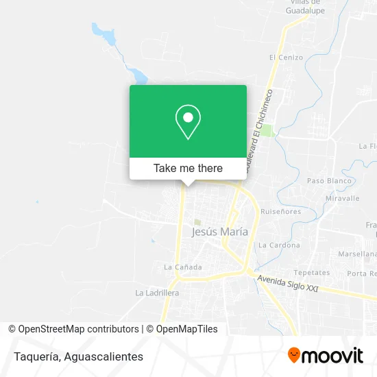
See Taquería, Aguascalientes, on the map
Public Transit to Taquería in Aguascalientes
Wondering how to get to Taquería in Aguascalientes? Moovit helps you find the best way to get to Taquería with step-by-step directions from the nearest public transit station.
Moovit provides free maps and live directions to help you navigate through your city. View schedules, routes, timetables, and find out how long does it take to get to Taquería in real time.
Looking for the nearest stop or station to Taquería? Check out this list of stops closest to your destination: Avenida Constitución; Avenida Constitución; Avenida Constitución.
Bus: RUTA 04, RUTA 06, RUTA 33.
Want to see if there’s another route that gets you there at an earlier time? Moovit helps you find alternative routes or times. Get directions from and directions to Taquería easily from the Moovit App or Website.
We make riding to Taquería easy, which is why over 1.5 million users, including users in Aguascalientes, trust Moovit as the best app for public transit. You don’t need to download an individual bus app or train app, Moovit is your all-in-one transit app that helps you find the best bus time or train time available.
For information on prices of bus, costs and ride fares to Taquería, please check the Moovit app.
Use the app to navigate to popular places including to the airport, hospital, stadium, grocery store, mall, coffee shop, school, college, and university.
Taquería Address: Calle Domingo de Lima, Solar de Jonacatique, 20928 Jesús María, Aguascalientes street in Aguascalientes
- Templo del Niño Jesús,
- WESTERN UNION,
- Gabriela Mistral,
- Cooperativa Escuela Primaria Gabriela Mistral Turno Matutino,
- Hotel Cuesta Real,
- Salón Los Tres Diamantes,
- Minisuper Ange,
- Papeleria Mayu Bross,
- 15 de Septiembre Agu,
- WESTERN UNION,
- Estética,
- Unidad Deportiva Luis Donaldo Colosio,
- Tienda de Abarrotes,
- Cueritos Curtidos,
- Templo Virgen de San Juan,
- Taquería,
- Tarimas y Embalajes de Jesus Maria,
- Centro Cristiano Mi Refugió,
- Terminal Jesus Maria,
- Plata Venta de
Places Near Taquería (Aguascalientes)
- Centro Comercial Altaria, Aguascalientes,
- Agropecuario, Aguascalientes,
- Villasuncion, Aguascalientes,
- clinica 3 uaa, Aguascalientes,
- Aeropuerto de Aguascalientes S.A. de C.V., Aguascalientes,
- ESPACIOS, Aguascalientes,
- Hospital Imss No. 3, Aguascalientes,
- Villas de Nuestra Señora de la Asunción, Aguascalientes,
- Nuevo Hospital Hidalgo, Aguascalientes,
- Imss Clinica 1, Aguascalientes,
- Ciudad industrial, Aguascalientes,
- Central De Autobuses, Aguascalientes,
- Jesús María, Aguascalientes,
- Isla San Marcos, Aguascalientes,
- Terminal De Combis, Aguascalientes,
- Parque Las Tres Centurias, Aguascalientes,
- La Isla San Marcos, Aguascalientes,
- Universidad Autónoma de Aguascalientes, Aguascalientes,
- Centro, Aguascalientes,
- Blvd. Luis Donaldo Colosio, Aguascalientes
How to get to popular places in Aguascalientes with public transit
Get around Aguascalientes by public transit!
Traveling around Aguascalientes has never been so easy. See step by step directions as you travel to any attraction, street or major public transit station. View bus and train schedules, arrival times, service alerts and detailed routes on a map, so you know exactly how to get to anywhere in Aguascalientes.
When traveling to any destination around Aguascalientes use Moovit's Live Directions with Get Off Notifications to know exactly where and how far to walk, how long to wait for your line, and how many stops are left. Moovit will alert you when it's time to get off — no need to constantly re-check whether yours is the next stop.
Wondering how to use public transit in Aguascalientes or how to pay for public transit in Aguascalientes? Moovit public transit app can help you navigate your way with public transit easily, and at minimum cost. It includes public transit fees, ticket prices, and costs. Looking for a map of Aguascalientes public transit lines? Moovit public transit app shows all public transit maps in Aguascalientes with all bus routes and stops on an interactive map.
Aguascalientes has 1 transit type(s), including: bus, operated by several transit agencies, including Coordinación General de Movilidad