How to get to Target by bus?
Click on the bus route to see step by step directions with maps, line arrival times and updated time schedules.
From Allstate Insurance Agent: Azqa Goraya, Prince George's County
64 minFrom Hillwood Estate, Museum & Gardens, Washington
94 minFrom College Park Marriott Hotel & Conference Center, Prince George's County
77 minFrom Embassy Suites-Bethesda Washington DC, Montgomery County
54 minFrom Clyde's of Chevy Chase, Montgomery County
60 minFrom Consulado General de El Salvador en El Dmv, Montgomery County
45 minFrom National Institutes of Health (NIH), Montgomery County
24 minFrom Embassy Of Pakistan, Washington
84 minFrom Tenleytown, Washington
53 minFrom Roosevelt High School, Washington
61 min
How to get to Target by train?
Click on the train route to see step by step directions with maps, line arrival times and updated time schedules.
How to get to Target by metro?
Click on the metro route to see step by step directions with maps, line arrival times and updated time schedules.
From Allstate Insurance Agent: Azqa Goraya, Prince George's County
53 minFrom Hillwood Estate, Museum & Gardens, Washington
72 minFrom Clyde's of Chevy Chase, Montgomery County
60 minFrom Consulado General de El Salvador en El Dmv, Montgomery County
36 minFrom National Institutes of Health (NIH), Montgomery County
68 minFrom Embassy Of Pakistan, Washington
67 minFrom Tenleytown, Washington
56 minFrom Roosevelt High School, Washington
49 min
Bus stops near Target in Montgomery County
Metro station near Target in Montgomery County
- Wheaton Metro Station, 16 min walk,VIEW
Train station near Target in Montgomery County
- Kensington Marc Wb, 27 min walk,VIEW
Bus lines to Target in Montgomery County
What are the closest stations to Target?
The closest stations to Target are:
- University W Blvd & Drumm Ave is 448 yards away, 6 min walk.
- University Bl+Valley View Av is 452 yards away, 6 min walk.
- Veirs Mill Rd & W University Bv is 702 yards away, 9 min walk.
- Wheaton Metro Station is 1284 yards away, 16 min walk.
- Kensington Marc Wb is 2282 yards away, 27 min walk.
Which bus lines stop near Target?
These bus lines stop near Target: 34, 4, M12, M20, M22.
Which train line stops near Target?
MARC (Inbound - Brunswick)
Which metro line stops near Target?
RED (Glenmont)
What’s the nearest metro station to Target in Montgomery County?
The nearest metro station to Target in Montgomery County is Wheaton Metro Station. It’s a 16 min walk away.
What’s the nearest train station to Target in Montgomery County?
The nearest train station to Target in Montgomery County is Kensington Marc Wb. It’s a 27 min walk away.
What’s the nearest bus station to Target in Montgomery County?
The nearest bus stations to Target in Montgomery County are University W Blvd & Drumm Ave and University Bl+Valley View Av. The closest one is a 6 min walk away.
What time is the first metro to Target in Montgomery County?
The RED is the first metro that goes to Target in Montgomery County. It stops nearby at 5:00 AM.
What time is the last metro to Target in Montgomery County?
The RED is the last metro that goes to Target in Montgomery County. It stops nearby at 12:37 AM.
What time is the first train to Target in Montgomery County?
The MARC is the first train that goes to Target in Montgomery County. It stops nearby at 5:45 AM.
What time is the last train to Target in Montgomery County?
The MARC is the last train that goes to Target in Montgomery County. It stops nearby at 7:42 PM.
What time is the first bus to Target in Montgomery County?
The M12 is the first bus that goes to Target in Montgomery County. It stops nearby at 4:28 AM.
What time is the last bus to Target in Montgomery County?
The M12 is the last bus that goes to Target in Montgomery County. It stops nearby at 2:32 AM.
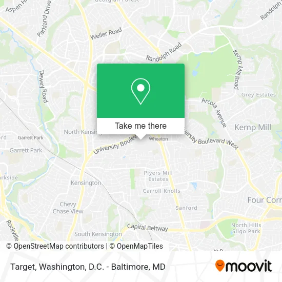
See Target, Montgomery County, on the map
Public Transit to Target in Montgomery County
Wondering how to get to Target in Montgomery County? Moovit helps you find the best way to get to Target with step-by-step directions from the nearest public transit station.
Moovit provides free maps and live directions to help you navigate through your city. View schedules, routes, timetables, and find out how long does it take to get to Target in real time.
Looking for the nearest stop or station to Target? Check out this list of stops closest to your destination: University W Blvd & Drumm Ave; University Bl+Valley View Av; Veirs Mill Rd & W University Bv; Wheaton Metro Station; Kensington Marc Wb.
Bus: 34, 4, M12, M20, M22, 38, 40, 48, 8, 9.Train: MARC.Metro: RED.
Want to see if there’s another route that gets you there at an earlier time? Moovit helps you find alternative routes or times. Get directions from and directions to Target easily from the Moovit App or Website.
We make riding to Target easy, which is why over 1.5 million users, including users in Montgomery County, trust Moovit as the best app for public transit. You don’t need to download an individual bus app or train app, Moovit is your all-in-one transit app that helps you find the best bus time or train time available.
For information on prices of bus, metro and train, costs and ride fares to Target, please check the Moovit app.
Use the app to navigate to popular places including to the airport, hospital, stadium, grocery store, mall, coffee shop, school, college, and university.
Target Address: 11160 Veirs Mill Rd street in Montgomery County
- Mac Cosmetics,
- Relax Station,
- Macy's,
- Last Stop,
- Diama Hair Braiding,
- Coinstar - Bitcoin ATM,
- Premium Jewelry Studio,
- K-Mobile Tech,
- Carols Daughter Store,
- Look Store,
- Westfield Wheaton,
- Royal Jewelers,
- Two Hands Corn Dogs - Wheaton,
- CINNABON,
- Bubble Bounce,
- Smoothie Spot,
- Furniture Place,
- Costco Wholesale,
- Quick Fix Jewelry & Watch Repair,
- Wheaton Plaza
Places Near Target (Montgomery County)
- Museum Of The Bible, Washington,
- The Anthem, Washington,
- Basilica of the National Shrine, Washington,
- Sibley Memorial Hospital, Washington,
- Amazon Hq2, Arlington County,
- National Museum of African American History and Culture, Washington,
- Capital One Arena, Washington,
- Westfield Montgomery Mall, Montgomery County,
- Rock Creek Tennis Center, Washington,
- M&T Bank Stadium, Baltimore,
- National Zoo, Washington,
- Camden Yards, Baltimore,
- PG Mall, Prince George's County,
- Marriott Marquis Washington, DC, Washington,
- Pennsylvania Ave NW (3rd st and pennsylvania), Washington,
- National Theatre, Washington,
- Washington National Cathedral, Washington,
- Georgetown, Washington,
- Washington DC VA Medical Center, Washington,
- Warner Theatre, Washington
How to get to popular places in Washington, D.C. - Baltimore, MD with public transit
Get around Montgomery County by public transit!
Traveling around Montgomery County has never been so easy. See step by step directions as you travel to any attraction, street or major public transit station. View bus and train schedules, arrival times, service alerts and detailed routes on a map, so you know exactly how to get to anywhere in Montgomery County.
When traveling to any destination around Montgomery County use Moovit's Live Directions with Get Off Notifications to know exactly where and how far to walk, how long to wait for your line, and how many stops are left. Moovit will alert you when it's time to get off — no need to constantly re-check whether yours is the next stop.
Wondering how to use public transit in Montgomery County or how to pay for public transit in Montgomery County? Moovit public transit app can help you navigate your way with public transit easily, and at minimum cost. It includes public transit fees, ticket prices, and costs. Looking for a map of Montgomery County public transit lines? Moovit public transit app shows all public transit maps in Montgomery County with all Bus, Train, Metro, Light Rail and Ferry routes and stops on an interactive map.
Washington, D.C. - Baltimore, MD has 5 transit type(s), including: Bus, Train, Metro, Light Rail and Ferry, operated by several transit agencies, including WMATA, Montgomery County Ride On, Fairfax Connector, TheBus, PRTC, DASH - Alexandria, Arlington Transit (ART), RTA of Central Maryland, MDOT MTA, MDOT MTA Light RailLink, MDOT MTA Commuter Bus, MDOT MTA Local Bus, FXBGO!, Virginia Railway Express (VRE) and MARC