How to get to Target by bus?
Click on the bus route to see step by step directions with maps, line arrival times and updated time schedules.
From Elkridge, MD, Howard County
62 minFrom I-95 Exit 33 - Laurel/Burtonsville (Sandy Spring Rd/MD 198), Prince George's County
112 minFrom Laurel, Maryland, Prince George's County
75 minFrom Lincoln Tech, Howard County
122 minFrom Archbishop Spalding High School, Severn
189 minFrom NSA Friendship Annex (FANX), Anne Arundel County
80 minFrom MVA Glen Burnie, Anne Arundel County
117 minFrom Glen Burnie, MD, Anne Arundel County
132 minFrom Guinness Open Gate Brewery & Barrel House, Baltimore County
153 min
Train station near Target in Anne Arundel County
- Jessup Marc Nb, 57 min walk,VIEW
What are the closest stations to Target?
The closest stations to Target are:
- Jessup Marc Nb is 4862 yards away, 57 min walk.
Which bus lines stop near Target?
These bus lines stop near Target: 501, 502, 75.
What time is the first train to Target in Anne Arundel County?
The MARC is the first train that goes to Target in Anne Arundel County. It stops nearby at 6:53 AM.
What time is the last train to Target in Anne Arundel County?
The MARC is the last train that goes to Target in Anne Arundel County. It stops nearby at 5:59 PM.
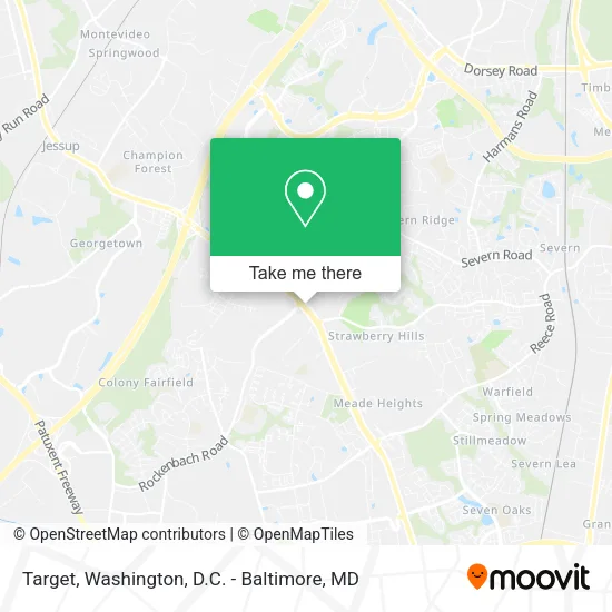
See Target, Anne Arundel County, on the map
Public Transit to Target in Anne Arundel County
Wondering how to get to Target in Anne Arundel County? Moovit helps you find the best way to get to Target with step-by-step directions from the nearest public transit station.
Moovit provides free maps and live directions to help you navigate through your city. View schedules, routes, timetables, and find out how long does it take to get to Target in real time.
Looking for the nearest stop or station to Target? Check out this list of stops closest to your destination: Jessup Marc Nb.
Bus: 501, 502, 75.Train: MARC.
Want to see if there’s another route that gets you there at an earlier time? Moovit helps you find alternative routes or times. Get directions from and directions to Target easily from the Moovit App or Website.
We make riding to Target easy, which is why over 1.5 million users, including users in Anne Arundel County, trust Moovit as the best app for public transit. You don’t need to download an individual bus app or train app, Moovit is your all-in-one transit app that helps you find the best bus time or train time available.
For information on prices of bus, light rail and train, costs and ride fares to Target, please check the Moovit app.
Get to Target with public transit and pay for the ride in the Moovit app. In addition to all info you may need for your trip to Target, including live directions, real-time arrivals and fare prices, you can also buy public transit passes for your rides. No need for cash or paper tickets to get to Target - everything you need is accessible in the app with a click of the button.
Use the app to navigate to popular places including to the airport, hospital, stadium, grocery store, mall, coffee shop, school, college, and university.
Target Address: 2618 Annapolis Rd street in Anne Arundel County
- Day & Night Locksmith,
- Severn Locksmith Store,
- Plumbing Services Company,
- Anne Arundel County Public Library,
- Severn Cleaners,
- Severn Beauty Supply,
- Upholstery Cleaning,
- Apple Dental,
- Gianni's Pizza,
- Severn Community Library (One-Hour Service Severn Dry),
- SH- Rid Rd,
- Annapolis Ridge Rd,
- Annapolis Rd (annapolis rockenbach),
- China Sea Restaurant,
- Severn Community Library,
- Geico Insurance,
- Shell,
- CHOICES HAIRCUTS,
- Sunny's Tailor,
- Jimmy John's
Places Near Target (Anne Arundel County)
- Pennsylvania Ave NW (3rd st and pennsylvania), Washington,
- Basilica of the National Shrine, Washington,
- Museum Of The Bible, Washington,
- Rock Creek Tennis Center, Washington,
- Washington National Cathedral, Washington,
- Georgetown, Washington,
- Marriott Marquis Washington, DC, Washington,
- Warner Theatre, Washington,
- Washington DC VA Medical Center, Washington,
- PG Mall, Prince George's County,
- Amazon Hq2, Arlington County,
- National Museum of African American History and Culture, Washington,
- National Mall, Washington,
- M&T Bank Stadium, Baltimore,
- National Zoo, Washington,
- Sibley Memorial Hospital, Washington,
- Camden Yards, Baltimore,
- Westfield Montgomery Mall, Montgomery County,
- The Anthem, Washington,
- Capital One Arena, Washington
How to get to popular places in Washington, D.C. - Baltimore, MD with public transit
Get around Anne Arundel County by public transit!
Traveling around Anne Arundel County has never been so easy. See step by step directions as you travel to any attraction, street or major public transit station. View bus and train schedules, arrival times, service alerts and detailed routes on a map, so you know exactly how to get to anywhere in Anne Arundel County.
When traveling to any destination around Anne Arundel County use Moovit's Live Directions with Get Off Notifications to know exactly where and how far to walk, how long to wait for your line, and how many stops are left. Moovit will alert you when it's time to get off — no need to constantly re-check whether yours is the next stop.
Wondering how to use public transit in Anne Arundel County or how to pay for public transit in Anne Arundel County? Moovit public transit app can help you navigate your way with public transit easily, and at minimum cost. It includes public transit fees, ticket prices, and costs. Looking for a map of Anne Arundel County public transit lines? Moovit public transit app shows all public transit maps in Anne Arundel County with all Bus, Train, Metro, Light Rail and Ferry routes and stops on an interactive map.
Washington, D.C. - Baltimore, MD has 5 transit type(s), including: Bus, Train, Metro, Light Rail and Ferry, operated by several transit agencies, including WMATA, Montgomery County Ride On, Fairfax Connector, TheBus, PRTC, DASH - Alexandria, Arlington Transit (ART), RTA of Central Maryland, MDOT MTA, MDOT MTA Light RailLink, MDOT MTA Commuter Bus, MDOT MTA Local Bus, FXBGO!, Virginia Railway Express (VRE) and MARC