Directions to Target (York County) with public transportation
The following transit lines have routes that pass near Target
 Bus: 3.
How to get to Target by bus?
Click on the bus route to see step by step directions with maps, line arrival times and updated time schedules.
Bus stop near Target in York County
- Whittakers Trace at Target, 3 min walk,VIEW
Bus lines to Target in York County
- 3, 3 Merrimac Trl,VIEW
What are the closest stations to Target?
The closest stations to Target are:
- Whittakers Trace at Target is 121 yards away, 3 min walk.
Which bus line stops near Target?
3 (3 Merrimac Trl)
What’s the nearest bus station to Target in York County?
The nearest bus station to Target in York County is Whittakers Trace at Target. It’s a 3 min walk away.
What time is the first bus to Target in York County?
The 3 is the first bus that goes to Target in York County. It stops nearby at 6:35 AM.
What time is the last bus to Target in York County?
The 3 is the last bus that goes to Target in York County. It stops nearby at 8:37 PM.
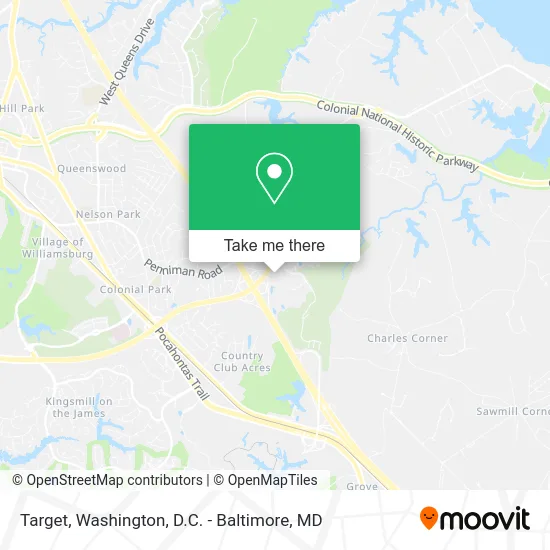
See Target, York County, on the map
Public Transit to Target in York County
Wondering how to get to Target in York County? Moovit helps you find the best way to get to Target with step-by-step directions from the nearest public transit station.
Moovit provides free maps and live directions to help you navigate through your city. View schedules, routes, timetables, and find out how long does it take to get to Target in real time.
Looking for the nearest stop or station to Target? Check out this list of stops closest to your destination: Whittakers Trace at Target.
Bus: 3.
Want to see if there’s another route that gets you there at an earlier time? Moovit helps you find alternative routes or times. Get directions from and directions to Target easily from the Moovit App or Website.
We make riding to Target easy, which is why over 1.5 million users, including users in York County, trust Moovit as the best app for public transit. You don’t need to download an individual bus app or train app, Moovit is your all-in-one transit app that helps you find the best bus time or train time available.
For information on prices of bus and train, costs and ride fares to Target, please check the Moovit app.
Use the app to navigate to popular places including to the airport, hospital, stadium, grocery store, mall, coffee shop, school, college, and university.
Target Address: 200 Marquis Pkwy Williamsburg, VA 23185 street in York County
- CVS/pharmacy,
- Pizza Hut,
- Starbucks,
- ATM,
- BMO Harris Bank,
- Marquis Shopping Center,
- 200 Marquis Pkwy Parking,
- Best Buy,
- Geek Squad,
- Samsonite,
- Marquis Shop Ctr Target,
- Marquis Shopping Center @ Target,
- SEPHORA,
- FCR Group,
- Marquis Shopping Ctr @ Dicks Sporting Goods,
- True Vine Redeemed Apostolic Church of Christ,
- Boone's BBQ,
- ATM,
- Wyndham Garden-Williamsburg,
- Wyndham Garden-Williamsburg Busch Gardens
Places Near Target (York County)
- M&T Bank Stadium, Baltimore,
- PG Mall, Prince George's County,
- Warner Theatre, Washington,
- National Zoo, Washington,
- Washington National Cathedral, Washington,
- Pennsylvania Ave NW (3rd st and pennsylvania), Washington,
- Westfield Montgomery Mall, Montgomery County,
- National Museum of African American History and Culture, Washington,
- Basilica of the National Shrine, Washington,
- Georgetown, Washington,
- Marriott Marquis Washington, DC, Washington,
- Camden Yards, Baltimore,
- Museum Of The Bible, Washington,
- Capital One Arena, Washington,
- Sibley Memorial Hospital, Washington,
- The Anthem, Washington,
- Amazon Hq2, Arlington County,
- National Theatre, Washington,
- Rock Creek Tennis Center, Washington,
- Washington DC VA Medical Center, Washington
How to get to popular places in Washington, D.C. - Baltimore, MD with public transit
Get around York County by public transit!
Traveling around York County has never been so easy. See step by step directions as you travel to any attraction, street or major public transit station. View bus and train schedules, arrival times, service alerts and detailed routes on a map, so you know exactly how to get to anywhere in York County.
When traveling to any destination around York County use Moovit's Live Directions with Get Off Notifications to know exactly where and how far to walk, how long to wait for your line, and how many stops are left. Moovit will alert you when it's time to get off — no need to constantly re-check whether yours is the next stop.
Wondering how to use public transit in York County or how to pay for public transit in York County? Moovit public transit app can help you navigate your way with public transit easily, and at minimum cost. It includes public transit fees, ticket prices, and costs. Looking for a map of York County public transit lines? Moovit public transit app shows all public transit maps in York County with all Bus, Train, Metro, Light Rail and Ferry routes and stops on an interactive map.
Washington, D.C. - Baltimore, MD has 5 transit type(s), including: Bus, Train, Metro, Light Rail and Ferry, operated by several transit agencies, including WMATA, Montgomery County Ride On, Fairfax Connector, TheBus, PRTC, DASH - Alexandria, Arlington Transit (ART), RTA of Central Maryland, MDOT MTA, MDOT MTA Light RailLink, MDOT MTA Commuter Bus, MDOT MTA Local Bus, FXBGO!, Virginia Railway Express (VRE) and MARC