How to get to Target Design by bus?
Click on the bus route to see step by step directions with maps, line arrival times and updated time schedules.
From Miami Station Amtrak, Miami
162 minFrom SR 826 Palmetto Expressway South, Hialeah
124 minFrom Blue Lagoon, Miami
78 minFrom Amtrak, Miami
147 minFrom Tri Rail Metrorail Transfer Station, Miami
155 minFrom Miami - Dade County Turner Guilford Knight Correctional Center, North Westside
59 minFrom La Quinta Inn & Suites Miami Airport East, Miami
66 minFrom Sam's Club, North Westside
46 minFrom NW 37th Ave, Miami
157 minFrom NW 54th St / SE Le Jeune Rd, Hialeah
100 min
How to get to Target Design by train?
Click on the train route to see step by step directions with maps, line arrival times and updated time schedules.
Bus stop near Target Design in North Westside
- The Atlantic Doral, 3 min walk,VIEW
Train station near Target Design in North Westside
- Palmetto Station Rail Southbound, 59 min walk,VIEW
Bus lines to Target Design in North Westside
What are the closest stations to Target Design?
The closest stations to Target Design are:
- The Atlantic Doral is 198 yards away, 3 min walk.
- Palmetto Station Rail Southbound is 5003 yards away, 59 min walk.
Which bus lines stop near Target Design?
These bus lines stop near Target Design: DLOOP2, DLOOP3, DLOOP4.
Which train line stops near Target Design?
GREEN (Dadeland South Stat.rail Northbound→Palmetto Station Rail Northbound)
What’s the nearest bus station to Target Design in North Westside?
The nearest bus station to Target Design in North Westside is The Atlantic Doral. It’s a 3 min walk away.
What time is the first train to Target Design in North Westside?
The GREEN is the first train that goes to Target Design in North Westside. It stops nearby at 5:00 AM.
What time is the last train to Target Design in North Westside?
The GREEN is the last train that goes to Target Design in North Westside. It stops nearby at 1:01 AM.
What time is the first bus to Target Design in North Westside?
The DLOOP3 is the first bus that goes to Target Design in North Westside. It stops nearby at 6:00 AM.
What time is the last bus to Target Design in North Westside?
The DLOOP4 is the last bus that goes to Target Design in North Westside. It stops nearby at 10:31 PM.
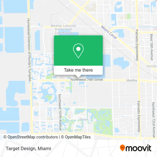
See Target Design, North Westside, on the map
Public Transit to Target Design in North Westside
Wondering how to get to Target Design in North Westside? Moovit helps you find the best way to get to Target Design with step-by-step directions from the nearest public transit station.
Moovit provides free maps and live directions to help you navigate through your city. View schedules, routes, timetables, and find out how long does it take to get to Target Design in real time.
Looking for the nearest stop or station to Target Design? Check out this list of stops closest to your destination: The Atlantic Doral; Palmetto Station Rail Southbound.
Bus: DLOOP2, DLOOP3, DLOOP4.Train: GREEN.
Want to see if there’s another route that gets you there at an earlier time? Moovit helps you find alternative routes or times. Get directions from and directions to Target Design easily from the Moovit App or Website.
We make riding to Target Design easy, which is why over 1.5 million users, including users in North Westside, trust Moovit as the best app for public transit. You don’t need to download an individual bus app or train app, Moovit is your all-in-one transit app that helps you find the best bus time or train time available.
For information on prices of bus and train, costs and ride fares to Target Design, please check the Moovit app.
Use the app to navigate to popular places including to the airport, hospital, stadium, grocery store, mall, coffee shop, school, college, and university.
Target Design Address: 7456 NW 99th Ave Doral, FL 33178 street in North Westside
- Munai,
- Xcellence Realty, Inc,
- E&Y Accounting Ser,
- Casimiro's Fast Food,
- 0q,
- Blade Barbershop,
- Eco-Blue,
- Gelatoalmamia,
- Cre Group,
- Fieldprint,
- VIP Electric Supply,
- Fidelis Opus,
- Sky Rental,
- Shell,
- Presto! ATM,
- La Parada del Sabor,
- LMV Grand Bay Holding Lt,
- Doral International Academy Of Math And Science,
- Puppy Buddy,
- IVX Health Infusion Center
Places Near Target Design (North Westside)
- Miami VA Hospital, Miami,
- Richard E. Gerstein Justice Building, Miami,
- Miami-Dade County Courthouse, Miami,
- Zoo Miami, Miami,
- Sawgrass Mall, Miami,
- Port of Miami Cruise Terminal, Miami,
- Aventura Mall, Miami Beach,
- Hard Rock Stadium, Miami Gardens,
- Little Havana, Miami,
- Aventura Mall, Miami,
- Brickell City Centre, Miami,
- Keiser University Flagship Campus, West Palm Beach,
- Dolphin Mall Bus, Miami,
- Wynwood, Miami,
- Miami Freedom Park, Miami,
- Marlins Park, Miami,
- Miami Design District, Miami,
- Dolphin Mall, Miami,
- Bayside Marketplace, Miami,
- Sawgrass mall ( FL ), Miami Beach
How to get to popular places in Miami with public transit
Get around North Westside by public transit!
Traveling around North Westside has never been so easy. See step by step directions as you travel to any attraction, street or major public transit station. View bus and train schedules, arrival times, service alerts and detailed routes on a map, so you know exactly how to get to anywhere in North Westside.
When traveling to any destination around North Westside use Moovit's Live Directions with Get Off Notifications to know exactly where and how far to walk, how long to wait for your line, and how many stops are left. Moovit will alert you when it's time to get off — no need to constantly re-check whether yours is the next stop.
Wondering how to use public transit in North Westside or how to pay for public transit in North Westside? Moovit public transit app can help you navigate your way with public transit easily, and at minimum cost. It includes public transit fees, ticket prices, and costs. Looking for a map of North Westside public transit lines? Moovit public transit app shows all public transit maps in North Westside with all Bus, Train, Light Rail and Ferry routes and stops on an interactive map.
Miami has 4 transit type(s), including: Bus, Train, Light Rail and Ferry, operated by several transit agencies, including Broward County Transit, Miami-Dade Transit, Metrorail, Palm Tran, Tri-Rail, Brightline, MARTY, City of Homestead Trolley, Key West Transit, Treasure Coast Connector, GoLine IRT, Amtrak, Greyhound-us, FlixBus-us and Aventura Express Shuttle Bus