How to get to Target Manhattan Herald Square by bus?
Click on the bus route to see step by step directions with maps, line arrival times and updated time schedules.
From 3030 Third Avenue
74 minFrom Randall's Island
75 minFrom 25 Beaver St (Beaver St,25)
46 minFrom Roosevelt Avenue
48 minFrom 89 South Street
45 minFrom 11 Greenwich Street
45 minFrom 851 Grand Concourse
58 minFrom Mall del Sol Guayaquil,Ecuador
49 minFrom 5 East 98th Street
24 minFrom MetLife Stadium
60 min
How to get to Target Manhattan Herald Square by train?
Click on the train route to see step by step directions with maps, line arrival times and updated time schedules.
How to get to Target Manhattan Herald Square by subway?
Click on the subway route to see step by step directions with maps, line arrival times and updated time schedules.
Bus stops near Target Manhattan Herald Square
Train stations near Target Manhattan Herald Square
Subway stations near Target Manhattan Herald Square
Bus lines to Target Manhattan Herald Square
- BXM2, West Midtown Penn Sta-34 St Via Kappock St,VIEW
- M34-SBS, Select Bus East Side Fdr Dr Crosstown,VIEW
- M34A-SBS, Select Bus Pa Bus Trm Via 34 St Via 8 Av,VIEW
- M5, Limited Washington Heights Gw Bridge,VIEW
- M7, Harlem 147 St Via 6 Av Via Amsterdam,VIEW
- M55, 44 St 6 Av,VIEW
- SIM23, Annadale Via Arden Av,VIEW
- SIM24, Princes Bay Via Huguenot Av,VIEW
- GREENWICH, Midtown / W 39th Street - Midtown / W 39th Street,VIEW
- 34TH ST, 34th St,VIEW
- QM10, Lefrak City - Midtown Express,VIEW
- QM12, Forest Hills - Midtown Express,VIEW
- QM24, Glendale - Midtown Express,VIEW
- Q32, Jackson Heights,VIEW
- QM2, Bay Terrace Bell Bl Via Whitestone Exy,VIEW
- QM20, Bay Terrace 211 St Via Willets Pt Bl,VIEW
- QM4, Electchester 164 St Via Jewel Av,VIEW
What are the closest stations to Target Manhattan Herald Square?
The closest stations to Target Manhattan Herald Square are:
- 7 Av/W 34 St is 23 yards away, 1 min walk.
- W 34 St/Broadway is 106 yards away, 2 min walk.
- 6 Av/W 34 St is 112 yards away, 2 min walk.
- W 34 St/6 Av is 115 yards away, 2 min walk.
- W 34th St & Broadway is 142 yards away, 2 min walk.
- 6 Av/W 35 St is 173 yards away, 3 min walk.
- W 32 St/7 Av is 195 yards away, 3 min walk.
- 6 Av/W 36 St is 260 yards away, 4 min walk.
- 33rd Street is 344 yards away, 5 min walk.
- 34 St-Herald Sq is 492 yards away, 6 min walk.
- 34 St-Penn Station is 540 yards away, 7 min walk.
Which bus lines stop near Target Manhattan Herald Square?
These bus lines stop near Target Manhattan Herald Square: 28, BXM4, M34-SBS, M34A-SBS, M55, QM10.
Which train lines stop near Target Manhattan Herald Square?
These train lines stop near Target Manhattan Herald Square: HARLEM, HUDSON, PATH.
Which subway lines stop near Target Manhattan Herald Square?
These subway lines stop near Target Manhattan Herald Square: 2, B, Q, R, W.
What’s the nearest subway station to Target Manhattan Herald Square?
The nearest subway station to Target Manhattan Herald Square is 34 St-Herald Sq. It’s a 6 min walk away.
What’s the nearest train station to Target Manhattan Herald Square?
The nearest train station to Target Manhattan Herald Square is 33rd Street. It’s a 5 min walk away.
What’s the nearest bus station to Target Manhattan Herald Square?
The nearest bus station to Target Manhattan Herald Square is 7 Av/W 34 St. It’s a 1 min walk away.
What time is the first subway to Target Manhattan Herald Square?
The A is the first subway that goes to Target Manhattan Herald Square. It stops nearby at 3:03 AM.
What time is the last subway to Target Manhattan Herald Square?
The N is the last subway that goes to Target Manhattan Herald Square. It stops nearby at 3:57 AM.
What time is the first train to Target Manhattan Herald Square?
The PORT JEFFERSON BRANCH is the first train that goes to Target Manhattan Herald Square. It stops nearby at 3:01 AM.
What time is the last train to Target Manhattan Herald Square?
The NORTHEAST REGIONAL is the last train that goes to Target Manhattan Herald Square. It stops nearby at 5:44 AM.
What time is the first bus to Target Manhattan Herald Square?
The SIM1C is the first bus that goes to Target Manhattan Herald Square. It stops nearby at 3:02 AM.
What time is the last bus to Target Manhattan Herald Square?
The M7 is the last bus that goes to Target Manhattan Herald Square. It stops nearby at 3:13 AM.
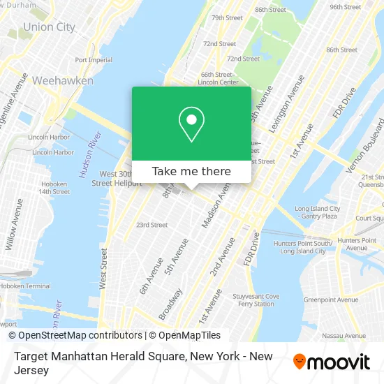
See Target Manhattan Herald Square on the map
Public Transportation to Target Manhattan Herald Square
Wondering how to get to Target Manhattan Herald Square? Moovit helps you find the best way to get to Target Manhattan Herald Square with step-by-step directions from the nearest public transit station.
Moovit provides free maps and live directions to help you navigate through your city. View schedules, routes, timetables, and find out how long does it take to get to Target Manhattan Herald Square in real time.
Looking for the nearest stop or station to Target Manhattan Herald Square? Check out this list of stops closest to your destination: 7 Av/W 34 St; W 34 St/Broadway; 6 Av/W 34 St; W 34 St/6 Av; W 34th St & Broadway; 6 Av/W 35 St; W 32 St/7 Av; 6 Av/W 36 St; 33rd Street; 34 St-Herald Sq; 34 St-Penn Station.
Bus: 28, BXM4, M34-SBS, M34A-SBS, M55, QM10, BXM2.Train: HARLEM, HUDSON, PATH, ATW, BLU, YEL, ACELA, ADIRONDACK, BERKSHIRE FLYER, CARDINAL, CAROLINIAN.Subway: 2, B, Q, R, W, D, F, FX, M, A, C, E.
Want to see if there’s another route that gets you there at an earlier time? Moovit helps you find alternative routes or times. Get directions from and directions to Target Manhattan Herald Square easily from the Moovit App or Website.
We make riding to Target Manhattan Herald Square easy, which is why over 1.5 million users, including users in Manhattan, trust Moovit as the best app for public transit. You don’t need to download an individual bus app or train app, Moovit is your all-in-one transit app that helps you find the best bus time or train time available.
For information on prices of subway, bus and train, costs and ride fares to Target Manhattan Herald Square, please check the Moovit app.
Use the app to navigate to popular places including to the airport, hospital, stadium, grocery store, mall, coffee shop, school, college, and university.
Target Manhattan Herald Square Address: 112 W 34th St street in Manhattan
- Target,
- MTA Bus - M34-SBS (W 34th St & Broadway),
- MTA Subway - 34th St / Herald Sq (B / D/F / M/N / Q/R / W),
- SAE New York,
- H&M,
- 112 W 34th St,
- Zaro's Family Bakery,
- Marc Jacobs Macy's Herald Square,
- SEPHORA,
- Bangladesh Embassy Consulate,
- Chinatown Bus to Albany,
- SEPHORA (Charlotte Tilbury - Sephora 34th Street),
- Macy's,
- Empire State Building 108th Floor Observation Deck,
- Macy's Herald Square,
- Macy's (Macy's Herald Square),
- Herald Sq (herald square 34th st),
- Herald Sq (34th herald square),
- 34th Street–Herald Square,
- Avenue of the Americas intersection 34th St
Places Near Target Manhattan Herald Square
- Hudson Yards, Manhattan,
- Rockefeller Center, Manhattan,
- Wall Street, Manhattan,
- Pier 83, Manhattan,
- Chinatown, Manhattan,
- qqqq, Manhattan,
- 66 John Street, Manhattan,
- 911 Memorial, Manhattan,
- Times Square, Manhattan,
- San Gennaro Feast, Manhattan,
- Queens Center Mall, Queens,
- SoHo, Manhattan,
- 1 Police Plaza, Manhattan,
- Bellevue Hospital, Manhattan,
- 111 Centre New York City Supreme Court, Manhattan,
- Katz's Deli, Manhattan,
- Mountainside Hospital, Glen Ridge,
- 3 Stone St, Manhattan,
- 26 Federal Plaza, Manhattan,
- 376 Hudson Street, Manhattan
How to get to popular places in New York - New Jersey with public transit
Get around Manhattan by public transit!
Traveling around Manhattan has never been so easy. See step by step directions as you travel to any attraction, street or major public transit station. View bus and train schedules, arrival times, service alerts and detailed routes on a map, so you know exactly how to get to anywhere in Manhattan.
When traveling to any destination around Manhattan use Moovit's Live Directions with Get Off Notifications to know exactly where and how far to walk, how long to wait for your line, and how many stops are left. Moovit will alert you when it's time to get off — no need to constantly re-check whether yours is the next stop.
Wondering how to use public transit in Manhattan or how to pay for public transit in Manhattan? Moovit public transit app can help you navigate your way with public transit easily, and at minimum cost. It includes public transit fees, ticket prices, and costs. Looking for a map of Manhattan public transit lines? Moovit public transit app shows all public transit maps in Manhattan with all Bus, Train, Subway, Light Rail, Ferry and Cable Car routes and stops on an interactive map.
New York - New Jersey has 6 transit type(s), including: Bus, Train, Subway, Light Rail, Ferry and Cable Car, operated by several transit agencies, including MTA Subway, Metro-North Railroad, LIRR, PATH, MTA New York City Transit - Express routes, MTA Bus, NJ Transit, NYC Ferry, NICE bus, Bee-Line Bus, NJ Transit Rail, Norwalk Transit District, Hartford Line, River Valley Transit and HART