How to get to Task Force Technical Institute by bus?
Click on the bus route to see step by step directions with maps, line arrival times and updated time schedules.
From E Sunset Rd / S Maryland Pkwy, Paradise
38 minFrom Sea Mountain Spa (Swinger Party One Love Temple Nude Resort and Swingers Retreat), Paradise
54 minFrom Absolute Dental - Sunset, Paradise
31 minFrom W Horizon Ridge Pkwy / S Eastern Ave, Henderson
54 minFrom Nevada State College, Henderson
46 minFrom Maryland Parkway & Windmill Lane, Paradise
52 minFrom Walmart Supercenter, Paradise
54 minFrom E Sahara Ave / S Nellis Blvd, Sunrise Manor
62 minFrom Desert Inn/ Lamb And Boulder Hwy, Sunrise Manor
52 min
Bus stops near Task Force Technical Institute in Henderson
Bus lines to Task Force Technical Institute in Henderson
What are the closest stations to Task Force Technical Institute?
The closest stations to Task Force Technical Institute are:
- Nb Gibson After Sunset is 529 yards away, 7 min walk.
- Eb Warm Springs After Gibson Sprngs is 778 yards away, 10 min walk.
Which bus lines stop near Task Force Technical Institute?
These bus lines stop near Task Force Technical Institute: 212, 217, BHX.
What’s the nearest bus station to Task Force Technical Institute in Henderson?
The nearest bus station to Task Force Technical Institute in Henderson is Nb Gibson After Sunset. It’s a 7 min walk away.
What time is the first bus to Task Force Technical Institute in Henderson?
The 212 is the first bus that goes to Task Force Technical Institute in Henderson. It stops nearby at 4:30 AM.
What time is the last bus to Task Force Technical Institute in Henderson?
The 212 is the last bus that goes to Task Force Technical Institute in Henderson. It stops nearby at 1:33 AM.
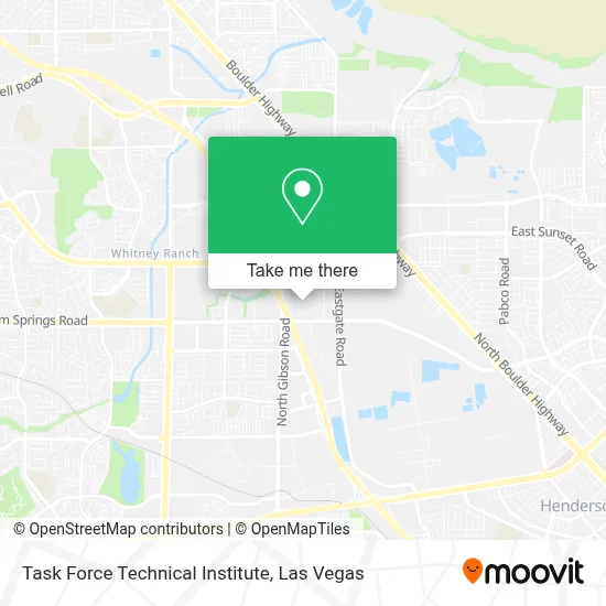
See Task Force Technical Institute, Henderson, on the map
Public Transit to Task Force Technical Institute in Henderson
Wondering how to get to Task Force Technical Institute in Henderson? Moovit helps you find the best way to get to Task Force Technical Institute with step-by-step directions from the nearest public transit station.
Moovit provides free maps and live directions to help you navigate through your city. View schedules, routes, timetables, and find out how long does it take to get to Task Force Technical Institute in real time.
Looking for the nearest stop or station to Task Force Technical Institute? Check out this list of stops closest to your destination: Nb Gibson After Sunset; Eb Warm Springs After Gibson Sprngs.
Bus: 212, 217, BHX.
Want to see if there’s another route that gets you there at an earlier time? Moovit helps you find alternative routes or times. Get directions from and directions to Task Force Technical Institute easily from the Moovit App or Website.
We make riding to Task Force Technical Institute easy, which is why over 1.7 million users, including users in Henderson, trust Moovit as the best app for public transit. You don’t need to download an individual bus app or train app, Moovit is your all-in-one transit app that helps you find the best bus time or train time available.
For information on prices of bus, costs and ride fares to Task Force Technical Institute, please check the Moovit app.
Use the app to navigate to popular places including to the airport, hospital, stadium, grocery store, mall, coffee shop, school, college, and university.
Task Force Technical Institute Address: 470 Mirror Ct street in Henderson
- Walmart Supercenter,
- CSN - Henderson,
- Sunset Station Hotel And Casino Valet Parking,
- Sunset Station Hotel & Casino,
- Seville Bar,
- Steinberg Diagnostic Medical Imaging,
- Sunset Station,
- Sunset Station Bingo Room,
- Regal Sunset Station,
- Cowabunga Bay Water Park,
- Galleria Mall Dr,
- Sunset Station Movie Theater,
- Coral Academy of Science Eastgate Campus,
- North Boulder Highway & Galleria Drive,
- Ssg Angelo Williams,
- Us Navy Recruiting Office,
- Ati Physical Therapy,
- La-Z-Boy Henderson,
- Horizon,
- Samsonite
Places Near Task Force Technical Institute (Henderson)
- Area15, Las Vegas,
- Koolsville Tattoos, Las Vegas,
- The Palms Casino Resort, Paradise,
- Allegiant Stadium, Paradise,
- Gold & Silver Pawn Shop, Las Vegas,
- The Deuce Bus Stop at Fremont St, Las Vegas,
- Trump International Hotel Las Vegas, Paradise,
- Omega Mart, Las Vegas,
- Welcome To Fabulous Las Vegas Sign, Paradise,
- Las Vegas South Premium Outlets, Enterprise,
- Walmart, Las Vegas,
- Arte Museum Las Vegas, Paradise,
- Walmart Supercenter, Las Vegas,
- Las Vegas North Premium Outlets, Las Vegas,
- Las Vegas Premium Outlets-North, Enterprise,
- Lee Canyon, Las Vegas,
- The Neon Museum, Las Vegas,
- Town Square, Enterprise,
- Zak Bagans Haunted Museum, Las Vegas,
- Meow Wolf - Las Vegas (Meow Wolf's Omega Mart), Las Vegas
How to get to popular places in Las Vegas with public transit
Get around Henderson by public transit!
Traveling around Henderson has never been so easy. See step by step directions as you travel to any attraction, street or major public transit station. View bus and train schedules, arrival times, service alerts and detailed routes on a map, so you know exactly how to get to anywhere in Henderson.
When traveling to any destination around Henderson use Moovit's Live Directions with Get Off Notifications to know exactly where and how far to walk, how long to wait for your line, and how many stops are left. Moovit will alert you when it's time to get off — no need to constantly re-check whether yours is the next stop.
Wondering how to use public transit in Henderson or how to pay for public transit in Henderson? Moovit public transit app can help you navigate your way with public transit easily, and at minimum cost. It includes public transit fees, ticket prices, and costs. Looking for a map of Henderson public transit lines? Moovit public transit app shows all public transit maps in Henderson with all Bus and Monorail routes and stops on an interactive map.
Las Vegas has 2 transit type(s), including: Bus and Monorail, operated by several transit agencies, including RTCSNV, City of Las Vegas, Alvand Transportation, Vegas Airporter, Las Vegas Monorail, FlixBus-us and Greyhound-us