Directions to Tasker Ave (Portland, ME) with public transportation
The following transit lines have routes that pass near Tasker Ave
 Bus: 81.
- Train: DOWNEASTER.
How to get to Tasker Ave by bus?
Click on the bus route to see step by step directions with maps, line arrival times and updated time schedules.
From University of Maine-Saco, Saco
114 minFrom Target, South Portland, ME, South Portland
140 minFrom CCCS or Maine, South Portland
93 minFrom Maine Medical Partners Mainehealth Cardiology, Scarborough
63 minFrom I-95 Maine Mall Exit, South Portland
76 minFrom Maine Mall-South, South Portland
73 minFrom South Portland Goodwill Store & Donation Center, South Portland
83 minFrom Mayflower Massage, South Portland
74 minFrom 54 Hemco Road, South Portland
109 min
Train station near Tasker Ave in Portland, ME
- Old Orchard Beach Amtrak, 43 min walk,VIEW
What are the closest stations to Tasker Ave?
The closest stations to Tasker Ave are:
- Old Orchard Beach Amtrak is 3615 yards away, 43 min walk.
Which bus line stops near Tasker Ave?
81 (Corner Imperial St And Milliken St→Corner Imperial St And Milliken St)
What time is the first train to Tasker Ave in Portland, ME?
The DOWNEASTER is the first train that goes to Tasker Ave in Portland, ME. It stops nearby at 7:33 AM.
What time is the last train to Tasker Ave in Portland, ME?
The DOWNEASTER is the last train that goes to Tasker Ave in Portland, ME. It stops nearby at 12:41 AM.
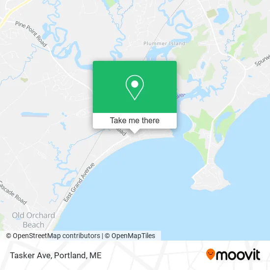
See Tasker Ave, Portland, ME, on the map
Public Transit to Tasker Ave in Portland, ME
Wondering how to get to Tasker Ave in Portland, ME? Moovit helps you find the best way to get to Tasker Ave with step-by-step directions from the nearest public transit station.
Moovit provides free maps and live directions to help you navigate through your city. View schedules, routes, timetables, and find out how long does it take to get to Tasker Ave in real time.
Looking for the nearest stop or station to Tasker Ave? Check out this list of stops closest to your destination: Old Orchard Beach Amtrak.
Bus: 81.Train: DOWNEASTER.
Want to see if there’s another route that gets you there at an earlier time? Moovit helps you find alternative routes or times. Get directions from and directions to Tasker Ave easily from the Moovit App or Website.
We make riding to Tasker Ave easy, which is why over 1.5 million users, including users in Portland, ME, trust Moovit as the best app for public transit. You don’t need to download an individual bus app or train app, Moovit is your all-in-one transit app that helps you find the best bus time or train time available.
For information on prices of bus, costs and ride fares to Tasker Ave, please check the Moovit app.
Use the app to navigate to popular places including to the airport, hospital, stadium, grocery store, mall, coffee shop, school, college, and university.
Tasker Ave Address: Scarborough, ME 04074 street in Portland, ME
- Clean for Me,
- Lily's,
- Dollar Inn-Scarborough,
- Avenue Two & Jones Creek Dr,
- 2 Avenue Two,
- Dog Days of Pine Point Gifts,
- 3 Avenue Three,
- Compass Room Events,
- 81 Avenue Four,
- Avenue Four & King St,
- Beach House Market and Deli,
- 14 Avenue Five,
- Pine Point Place,
- Dover St,
- Black Bear Landscaping Design,
- Shannon's Best Buds (Name Translated),
- A & T Seafood,
- Bay St,
- Scarborough River - Pine Point,
- Pine Point Beach
Places Near Tasker Ave (Portland, ME)
- Portland International Jetport (PWM) (Portland International Jetport),
- ZzZzZzZzZzZ, Westbrook,
- Exit 45 Park And Ride, South Portland,
- Cape Elizabeth, ME, Cape Elizabeth,
- L. L. Bean Outlet,
- Mercy Hospital - Fore River Campus,
- Portland Transportation Center,
- Fort Williams Park, Cape Elizabeth,
- The Old Port,
- Casco Bay Ferry Terminal,
- Southern Maine Community College, South Portland,
- Cross Insurance Arena,
- House Island,
- Fort Gorges,
- Jewell Island,
- Clarion Hotel Portland,
- Walmart Scarborough Supercenter,
- On a bus to Kennebunkport,
- Walmart,
- Maine Medical Center
How to get to popular places in Portland, ME with public transit
Get around Portland, ME by public transit!
Traveling around Portland, ME has never been so easy. See step by step directions as you travel to any attraction, street or major public transit station. View bus and train schedules, arrival times, service alerts and detailed routes on a map, so you know exactly how to get to anywhere in Portland, ME.
When traveling to any destination around Portland, ME use Moovit's Live Directions with Get Off Notifications to know exactly where and how far to walk, how long to wait for your line, and how many stops are left. Moovit will alert you when it's time to get off — no need to constantly re-check whether yours is the next stop.
Wondering how to use public transit in Portland, ME or how to pay for public transit in Portland, ME? Moovit public transit app can help you navigate your way with public transit easily, and at minimum cost. It includes public transit fees, ticket prices, and costs. Looking for a map of Portland, ME public transit lines? Moovit public transit app shows all public transit maps in Portland, ME with all Bus, Train and Ferry routes and stops on an interactive map.
Portland, ME has 3 transit type(s), including: Bus, Train and Ferry, operated by several transit agencies, including Greater Portland Metro, City of South Portland, Biddeford Saco Old Orchard Beach Transit, Casco Bay Lines, Amtrak, Greyhound-us and FlixBus-us