Directions to Tati Modas (São José Dos Pinhais) with public transportation
The following transit lines have routes that pass near Tati Modas
How to get to Tati Modas by bus?
Click on the bus route to see step by step directions with maps, line arrival times and updated time schedules.
From Rua Diogo Mugiatti, Boqueirão
54 minFrom Rua Gabriel Frecceiro de Miranda, Xaxim
81 minFrom Terminal do Pinheirinho, Pinheirinho
90 minFrom Rua José Hauer, Boqueirão
59 minFrom Portal do Porto, São José Dos Pinhais
56 minFrom Rua Waldemar Loureiro Campos, Boqueirão
62 minFrom Rua Conde de São João das Duas Barras, Boqueirão
71 minFrom Guatupê, São José Dos Pinhais
73 minFrom Rua Nicola Pellanda, Pinheirinho
86 minFrom Centro De Treinamento Clube Atlético Paranaense, Umbará
97 min
Bus stops near Tati Modas in São José Dos Pinhais
Bus lines to Tati Modas in São José Dos Pinhais
- 300 BAIRRO A BAIRRO - 4, Sentido Horário,VIEW
- E67 BRAGA / CURITIBA (VIA OURO FINO), Terminal Guadalupe ↺ Braga / Ouro Fino (via Conselheiro Laurindo) (Circular) ,VIEW
- 303 JARDIM ITÁLIA, Sentido Anti-horário,VIEW
- 302 ELDORADO, Sentido Anti-horário,VIEW
- 399 COLÔNIA RIO GRANDE / ELDORADO, Sentido Anti-horário (via Gestamp),VIEW
What are the closest stations to Tati Modas?
The closest stations to Tati Modas are:
- R. João Batista Carvalho de Oliveira, 139 is 188 meters away, 3 min walk.
- R. Quirino Zagonel, 1279 is 255 meters away, 4 min walk.
- R. Francisco Carvalho De Lima, 167 is 538 meters away, 8 min walk.
- R. Nestor Pereira da Rocha Júnior, 25 is 552 meters away, 8 min walk.
Which bus lines stop near Tati Modas?
These bus lines stop near Tati Modas: 300 BAIRRO A BAIRRO - 4, 303 JARDIM ITÁLIA.
What’s the nearest bus station to Tati Modas in São José Dos Pinhais?
The nearest bus station to Tati Modas in São José Dos Pinhais is R. João Batista Carvalho de Oliveira, 139. It’s a 3 min walk away.
What time is the first bus to Tati Modas in São José Dos Pinhais?
The 303 JARDIM ITÁLIA is the first bus that goes to Tati Modas in São José Dos Pinhais. It stops nearby at 4:54 AM.
What time is the last bus to Tati Modas in São José Dos Pinhais?
The 303 JARDIM ITÁLIA is the last bus that goes to Tati Modas in São José Dos Pinhais. It stops nearby at 12:20 AM.
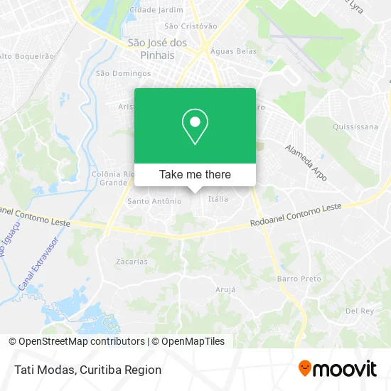
See Tati Modas, São José Dos Pinhais, on the map
Public Transit to Tati Modas in São José Dos Pinhais
Wondering how to get to Tati Modas in São José Dos Pinhais? Moovit helps you find the best way to get to Tati Modas with step-by-step directions from the nearest public transit station.
Moovit provides free maps and live directions to help you navigate through your city. View schedules, routes, timetables, and find out how long does it take to get to Tati Modas in real time.
Looking for the nearest stop or station to Tati Modas? Check out this list of stops closest to your destination: R. João Batista Carvalho de Oliveira; R. Quirino Zagonel; R. Francisco Carvalho De Lima; R. Nestor Pereira da Rocha Júnior.
Bus: 300 BAIRRO A BAIRRO - 4, 303 JARDIM ITÁLIA, E67 BRAGA / CURITIBA (VIA OURO FINO), 302 ELDORADO, 399 COLÔNIA RIO GRANDE / ELDORADO.
Want to see if there’s another route that gets you there at an earlier time? Moovit helps you find alternative routes or times. Get directions from and directions to Tati Modas easily from the Moovit App or Website.
We make riding to Tati Modas easy, which is why over 1.5 million users, including users in São José Dos Pinhais, trust Moovit as the best app for public transit. You don’t need to download an individual bus app or train app, Moovit is your all-in-one transit app that helps you find the best bus time or train time available.
For information on prices of bus, costs and ride fares to Tati Modas, please check the Moovit app.
Use the app to navigate to popular places including to the airport, hospital, stadium, grocery store, mall, coffee shop, school, college, and university.
Tati Modas Address: Rua Guilherme Otto Sell, 53 Itália São José dos Pinhais-PR 83020-286 street in São José Dos Pinhais
- Rua Rodolfo Scherner 184,
- Allan Transporte,
- Ouro Fino Transportes,
- Laisy Kaimi,
- Custodio Transportes,
- Divas de Luxo,
- Mendes,
- Xandeca Transportes,
- Entre Atos Producoes Artísticas,
- Jesus Reciclagem,
- Fernando Gonzaga de Oliveira,
- Black Cat Labs,
- Beleza a Domicilio,
- I a Costa Pinturas,
- mercado sol nascente,
- Kethlyn Mayara Garcia Antonio Mei,
- Cwb Pneus,
- Proteng,
- Wanderson dos Santos Benedito Prestação de Servicos,
- Mf Carnes
Places Near Tati Modas (São José Dos Pinhais)
- Hospital Universitário Evangélico de Curitiba, Bigorrilho,
- Shopping Palladium, Portão,
- Hospital de Clínicas (HC - UFPR), Centro,
- Hospital do Rocio, Campo,
- Hospital Angelina Caron, Campina Grande Do Sul,
- Park Shopping Barigüi, Mossunguê,
- Jockey Plaza Shopping Center, Tarumã,
- Rua General Mário Tourinho, Campina Do Siqueira,
- Hospital Madalena Sofia, Bairro Alto,
- Hospital Nossa Senhora Das Graças, Mercês,
- Pontifícia Universidade Católica do Paraná (PUCPR), Prado Velho,
- Rua Martim Afonso 558, Mercês,
- Campo Largo, Campo,
- Jardim Botânico de Curitiba PR, Centro,
- Shopping Estação, Rebouças,
- Parque Barigui, Mercês,
- Hhhhh, Fazendinha,
- Arena Da Baixada - Curitiba,
- Hospital Erasto Gaertner, Jardim Das Américas,
- Hospital Da Cruz Vermelha, Batel
How to get to popular places in Curitiba Region with public transit
Get around São José Dos Pinhais by public transit!
Traveling around São José Dos Pinhais has never been so easy. See step by step directions as you travel to any attraction, street or major public transit station. View bus and train schedules, arrival times, service alerts and detailed routes on a map, so you know exactly how to get to anywhere in São José Dos Pinhais.
When traveling to any destination around São José Dos Pinhais use Moovit's Live Directions with Get Off Notifications to know exactly where and how far to walk, how long to wait for your line, and how many stops are left. Moovit will alert you when it's time to get off — no need to constantly re-check whether yours is the next stop.
Wondering how to use public transit in São José Dos Pinhais or how to pay for public transit in São José Dos Pinhais? Moovit public transit app can help you navigate your way with public transit easily, and at minimum cost. It includes public transit fees, ticket prices, and costs. Looking for a map of São José Dos Pinhais public transit lines? Moovit public transit app shows all public transit maps in São José Dos Pinhais with all Bus and Cable Car routes and stops on an interactive map.
Curitiba Region has 2 transit type(s), including: Bus and Cable Car, operated by several transit agencies, including Sistema Integrado de Mobilidade (URBS), Sistema Integrado de Mobilidade (AMEP), URBS (Cartões bancários e Dinheiro), URBS (Cartões bancários / Cartão URBS), AMEP (Cartões bancários / Cartão MetroCard), AMEP (Cartões bancários / Cartão MetroCard / Dinheiro), Viação Colombo (Dinheiro), TRIAR (Cartão TRIAR / Dinheiro), Empresa Curitiba Cerro Azul (Dinheiro), Expresso Nossa Senhora da Penha (Dinheiro), Empresa Campo Alto Tijucas (Dinheiro), Auto Viação São José (Cartão VEM / Dinheiro), BRT S/A (Cartão VEM / Dinheiro), TransPiedade (Cartão Cidadão / Dinheiro) and Oceânica Sul (Cartão Transporte / Dinheiro)