Directions to Tati Modas (Camaragibe) with public transportation
The following transit lines have routes that pass near Tati Modas
How to get to Tati Modas by bus?
Click on the bus route to see step by step directions with maps, line arrival times and updated time schedules.
From San Martin, San Martin
77 minFrom Shopping Parnamirim, Parnamirim
57 minFrom Plaza Shopping Casa Forte, Parnamirim
53 minFrom Cemitério Parque das Flores, Sancho
60 minFrom Tejipio, Tejipió
59 minFrom Hospital Agamenon Magalhães, Tamarineira
44 minFrom Cavaleiro, Cavaleiro
68 minFrom Bairro do Cordeiro, Cordeiro
43 minFrom Apipucos, Apipucos
26 minFrom UFPE - Universidade Federal de Pernambuco, Cidade Universitária
45 min
How to get to Tati Modas by subway?
Click on the subway route to see step by step directions with maps, line arrival times and updated time schedules.
Bus stops near Tati Modas in Camaragibe
Subway station near Tati Modas in Camaragibe
- Estação Camaragibe - Metrorec, 31 min walk,VIEW
Bus lines to Tati Modas in Camaragibe
What are the closest stations to Tati Modas?
The closest stations to Tati Modas are:
- Rua Aníbal Falcão, 25 | Parada Municipal is 155 meters away, 3 min walk.
- Rua Domingos Martins, 36 is 166 meters away, 3 min walk.
- Rua Dos Programadores, 2a is 290 meters away, 4 min walk.
- Estação Camaragibe - Metrorec is 2357 meters away, 31 min walk.
Which bus lines stop near Tati Modas?
These bus lines stop near Tati Modas: 2470 CIRCULAR VILA DA FÁBRICA / SANTANA (VIA BAIRRO DOS ESTADOS), 2475 TIMBI / CENTRO CAMARAGIBE, 2503 CIRCULAR QUADRA 30 / BAIRRO NOVO VIA CELEIRO.
Which subway line stops near Tati Modas?
GIB (Camaragibe)
What’s the nearest bus station to Tati Modas in Camaragibe?
The nearest bus stations to Tati Modas in Camaragibe are Rua Aníbal Falcão, 25 | Parada Municipal and Rua Domingos Martins, 36. The closest one is a 3 min walk away.
What time is the first subway to Tati Modas in Camaragibe?
The GIB is the first subway that goes to Tati Modas in Camaragibe. It stops nearby at 5:08 AM.
What time is the last subway to Tati Modas in Camaragibe?
The GIB is the last subway that goes to Tati Modas in Camaragibe. It stops nearby at 11:42 PM.
What time is the first bus to Tati Modas in Camaragibe?
The 2475 TIMBI / CENTRO CAMARAGIBE is the first bus that goes to Tati Modas in Camaragibe. It stops nearby at 4:20 AM.
What time is the last bus to Tati Modas in Camaragibe?
The 2475 TIMBI / CENTRO CAMARAGIBE is the last bus that goes to Tati Modas in Camaragibe. It stops nearby at 11:47 PM.
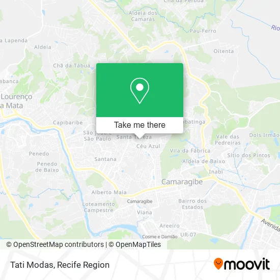
See Tati Modas, Camaragibe, on the map
Public Transit to Tati Modas in Camaragibe
Wondering how to get to Tati Modas in Camaragibe? Moovit helps you find the best way to get to Tati Modas with step-by-step directions from the nearest public transit station.
Moovit provides free maps and live directions to help you navigate through your city. View schedules, routes, timetables, and find out how long does it take to get to Tati Modas in real time.
Looking for the nearest stop or station to Tati Modas? Check out this list of stops closest to your destination: Rua Aníbal Falcão; Rua Domingos Martins; Rua Dos Programadores; Estação Camaragibe - Metrorec.
Bus: 2470 CIRCULAR VILA DA FÁBRICA / SANTANA (VIA BAIRRO DOS ESTADOS), 2475 TIMBI / CENTRO CAMARAGIBE, 2503 CIRCULAR QUADRA 30 / BAIRRO NOVO VIA CELEIRO.Subway: GIB.
Want to see if there’s another route that gets you there at an earlier time? Moovit helps you find alternative routes or times. Get directions from and directions to Tati Modas easily from the Moovit App or Website.
We make riding to Tati Modas easy, which is why over 1.5 million users, including users in Camaragibe, trust Moovit as the best app for public transit. You don’t need to download an individual bus app or train app, Moovit is your all-in-one transit app that helps you find the best bus time or train time available.
For information on prices of bus and subway, costs and ride fares to Tati Modas, please check the Moovit app.
Use the app to navigate to popular places including to the airport, hospital, stadium, grocery store, mall, coffee shop, school, college, and university.
Tati Modas Address: Rua Djalma Petit, 48 Camaragibe Camaragibe-PE 54774-450 street in Camaragibe
- Espetinho do Guga,
- Jorge Confecções,
- Escola Municipal Santa Tereza,
- Rua Carlos Vasconcelos,
- São Lourenço Da Mata 🗻,
- Leo Agua,
- Rua Ademar de Barros 68,
- Terminal de Ônibus do Timbi,
- Assembléia de Deus - Celeiro I,
- Adrianarobertatav,
- Comercial Produtos Limpesa,
- Colegio Dimensão-Me,
- Academia Meta camaragibe Pe,
- Mercadinho do Vando,
- Ifs Profissional de Visual,
- Rodrigo Silva,
- A N Z Construcoes e Reformas,
- A Graça de Deus,
- camaragibe/macaxeira,
- Céu Azul
Places Near Tati Modas (Camaragibe)
- Shopping RioMar Recife, Pina,
- Shopping Patteo Olinda, Olinda,
- Hospital Geral De Areias, Areias,
- Centro de Convenções de Pernambuco, Olinda,
- Hospital Maria Lucinda, Parnamirim,
- SHOPPING GUARARAPES, Jaboatão Dos Guararapes,
- Hospital Altino Ventura, Iputinga,
- Hospital Universitário Oswaldo Cruz, Santo Amaro,
- Arena de Pernambuco, São Lourenço Da Mata,
- llll, Fundão,
- SHOPPING TACARUNA, Santo Amaro,
- Marco Zero, Bairro Do Recife,
- hospital otavio de freitas - UTI, Tejipió,
- tuuuuu, Olinda,
- Hospital Agamenon Magalhães, Tamarineira,
- Shopping Recife, Boa Viagem,
- Parque da Jaqueira, Jaqueira,
- Imip (Instituto Materno-Infantil De Pernambuco), Coelhos,
- Hospital Eduardo Campus Da Pessoa Idosa, Areias,
- Imbiribeira, Imbiribeira
How to get to popular places in Recife Region with public transit
Get around Camaragibe by public transit!
Traveling around Camaragibe has never been so easy. See step by step directions as you travel to any attraction, street or major public transit station. View bus and train schedules, arrival times, service alerts and detailed routes on a map, so you know exactly how to get to anywhere in Camaragibe.
When traveling to any destination around Camaragibe use Moovit's Live Directions with Get Off Notifications to know exactly where and how far to walk, how long to wait for your line, and how many stops are left. Moovit will alert you when it's time to get off — no need to constantly re-check whether yours is the next stop.
Wondering how to use public transit in Camaragibe or how to pay for public transit in Camaragibe? Moovit public transit app can help you navigate your way with public transit easily, and at minimum cost. It includes public transit fees, ticket prices, and costs. Looking for a map of Camaragibe public transit lines? Moovit public transit app shows all public transit maps in Camaragibe with all Bus, Train, Subway and Ferry routes and stops on an interactive map.
Recife Region has 4 transit type(s), including: Bus, Train, Subway and Ferry, operated by several transit agencies, including CBTU (Metrorec), BRT (Via Livre), Grande Recife, BORBOREMA IMPERIAL (TIP), BORBOREMA IMPERIAL (B.V), RODOVIÁRIA POTENGY, EMPRESA METROPOLITANA, CONSÓRCIO RECIFE, SÃO JUDAS TADEU, Expresso 1002, Rodotur Turismo, Complementar Recife, Sistema Municipal - Jaboatão, Sistema Municipal - Cabo and Sistema Municipal - Ipojuca